I never thought I could visit ocean cliffs and abandoned places at the same time. It turns out I did, and you can too! Fort Wetherill State Park is built around Fort Wetherill. Early fortifications date back to 1776, but Fort Wetherill itself began operating in 1899 and became abandoned in 1946, and its stayed the same ever since.
 |
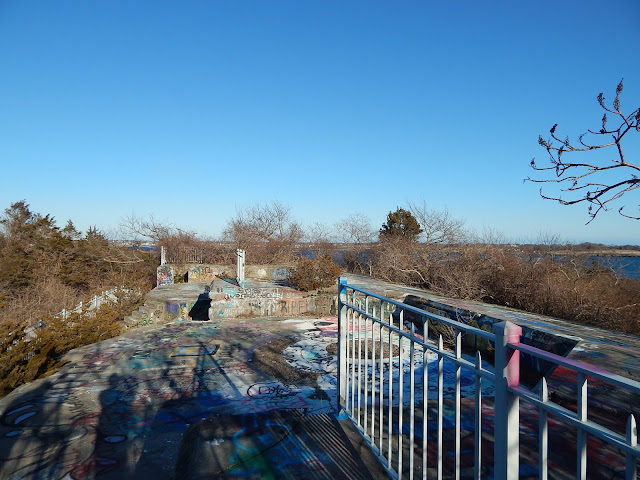
| The grand staircase between two batteries. |
We began at the southernmost portion of the fort. This area has been converted to a picnic area. Next to the entrance of the fort, there was a nice view looking into West Cove. The base had a lower passage leading to some rooms and hallways going to storage rooms.
 |
| Looking down a hallway in the lower passage. Notice the stalactites forming. |
After going over the base, we came to the cliffs on the ocean where there were some great views looking south into the Atlantic Ocean. We thought these cliffs were pretty cool, but they were just the beginning.
 |
| Looking over to Newport. |
 |
| Looking south with Castle Hill to the left. |
There was another parking lot up the street that we parked at. We headed up to the Dumplings, which is where some bases dating back to the Revolutionary War used to be. We took in more views and found a small building. I have no idea what it was but I know this particular building doesn't date back to the 1700s.
 |
| The small building atop the hill. |
 |
| Looking back to the original fort. |
Another trail at the parking lot lead to some taller cliffs. Very few signs of the fort remain in this location, but the cliffs were getting higher.
 |
| Another cove with a crevasse in the foreground. |
After following a sandy beach, we traversed more rocky cliffs and took a walk into the woods onto a wide, flat trail. The trail was a pleasant walk, and it occasionally opened up to a nice vista looking far out into the distance.
 |
| The last peninsula with the crevasse to the right. |
At the end of the cliff, there was a grouping of benches and clearings with great views. After this spot, we walked atop the cliffs and came to a steep and rocky bay. The trail lead to some high ledges and eventually brought us to the best place yet.
 |
| One of the benches in the scenic area. |
When I saw an outline of a building, I knew we had arrived at the larger section of the fort. There are a ton of bases in this section. Every time you get to one, you look past it and see even more. The first one we arrived at had a view of the next few portions of the base.
 |
| Looking down from atop the base. |
We entered a tunnel in the base. It went into the hillside for a good 20 feet and then zig-zagged around in there until we found are way out later. The main fort in this section is covered in graffiti and murals ranging from pleasant to horribly offensive. I've made and attempt to crop them out. Graffiti didn't distract too much from the main attraction.
 |
| A spot for a gun emplacement. |
Under the base was a ton of underground hallways and storage rooms.The doorways going down was right on the side of the old gun mounts. When I say there were a lot of these I mean there were a lot!
 |
| The setting sun in the distance. |
The batteries in this part of the fort all have distinct names. Going from east to west they're named Crittenden, Dickenson, Zook, Wheaton and Walbach. A battery is a fortified emplacement gun, which is usually found in these kinds of places. The two batteries on the first section of the base are called Cooke and Varnum.
GALLERY
 |
| One of many cliffs we traversed. |
 |
| Another crevasse in the cliff side. |
 |
| A large ledge atop one of the cliffs. |
 |
| A very steep cove. In the trees lies the base. |
 |
| A island-like peninsula. |
 |
| View from a large, bald rock. |
 |
| This is likely a watch building next to the first of many batteries. |
 |
| The tunnel we ended up following. |
 |
| Atop the first battery. |
 |
| Underground one of the batteries. |
 |
| A random part of the base. |
 |
| Looking over to Newport from the fort. |
 |
| Likely battery Walbach. |
 |
| A view from the lower deck. |
 |
| Another hidden room in the base. |
 |
| Yet another deep battery. |
 |
| Looking out of a dim cell. |
 |
| A staircase leading to the tunnels. |
 |
| Looking up at the lower deck from a path. |
 |
| A final shot of the infamous staircase. |
This day was incredible. I honestly don't know what was better, the cliffs or the fort. If you can identify any structures I wasn't able to name, please tell me what they are. I will definitely be returning again. If you find yourself in the Newport/Jamestown area and you have some spare time, I would recommend coming here and spending your time wisely.


Another interesting report, Evan!
ReplyDeleteOne of your photos is captioned “The small building atop the hill”. Although I’m not completely certain, this MIGHT be the remains of a gun emplacement that was used to defend the U.S. Eastern seaboard during WWII. I’ve seen similar-looking structures at other locations that were identified as such.
John
Thanks for reading my blog! It turns out that building was part of Battery Varnum and I just figured it was a random hut. Thanks for telling me, I always like it when people can identify some of the buildings, because I'm not too good at it myself. Thanks again!
DeleteI heard one of the tunnels is called “the hell tunnel” or something to that effect. Apparently satanic rituals were held there and it’s extremely haunted. Also, I’m not sure why that tunnel and many others are covered up with bars and not other ones? Supposedly some of the tunnels lead deeper under the fort than others?? Is there any truth to that?
ReplyDeleteI heard that one of the tunnels is called “the hell tunnel” or something to that effect. It looks like rituals were practiced there or something. Also, a lot of tunnels and hallways are covered up with bars. I don’t know if the tunnels lead deeper underground or what but I’m not too sure why those parts are sealed.
ReplyDelete