A Hike Up Burnt Rock Mountain

It's fall, and that means it's also Vermont season! In my opinion, this time of year is perfect for the Green Mountains. There are grand views to the Adirondacks and White Mountains from most areas on the Long Trail, and this time of year renders little haze. I figured the best peak to start the season off with was Burnt Rock Mountain, near Camel's Hump. The sky was clear, the temperature was cool, and the views were quite impressive.


Burnt Rock Mountain from a farmhouse.

My dad and I arrived at the trailhead very early, and the temperature was low enough to see our own breath. The trail immediately began with crossing Shepard Brook, even though it's called Hedgehog Brook Trail. The crossing is easy.


Looking down the brook.

The trail went in and out of logging cuts, and crosses a brook. Only then did it begin the incline, which wasn't bad at all. The steepest segment lied right before the Long Trail, and it included a few wooden steps.


Arriving at the Long Trail.

Once at the Long Trail, we followed it north toward Burnt Rock Mountain. The trail soon dropped into a crevasse, which was very cold. After that, the trail climbed steeply up to the first ledge.

The Long Trail through the crevasse.
Looking south toward Mt.Ellen.

The Long Trail here was skillfully constructed, as it cleverly utilized the rock notches and scrambles to create scenic switchbacks. Next, the trail pops up onto a ledge with a view up the bald summit ridge.


The view toward the Northeast Kingdom.

After some more scenery, we arrived at the summit. There is a pleasant view to the east and south, along with a small peek north toward the Worcester Range. Other peaks that can be seen include Burke Mountain, Signal Mountain, Mt.Lafayette, Killington Peak and Mt.Ellen.


The peaks of Groton State Forest. The White Mountains can be seen behind them.

When you get here, don't miss the herd path heading to the western ledge. This is quite the impressive viewpoint.The Adirondack are clearly visible, along with Lake Champlain. Peaks that can be seen include Lyon Mountain, Mt.Whiteface, Giant Mountain, Algonquin Peak, Dix Mountain, Gore Mountain, and Black Mountain.


The Adirondacks can be seen in the distance. Lake Champlain is peeking out from beneath the clouds.
A closer look at the high peaks. Mt.Whiteface is all the way to the right.

The views are probably some of the best in Vermont, and the range of peaks that can be seen are amazing. There's also a unique view of Camel's Hump from here. It was so clear I could make out people on top.


Camel's Hump, to the left of Mt.Ira Allen.

We met several thru-hikers who were also going over Camel's Hump that day. It is worth mentioning that on the way down there were a ton of people, so if you're going to do this mountain, get up there early.


Gallery
The three distant peaks to the left are Killington, Pico and Mendon.
Looking toward the summit, with Mt.Ira Allen and Mt.Ethan Allen visible.
The trail straddles this rock.
A closer look at Camel's Hump.
Mt.Ellen from the western ledge.
A closer look at Mt.Whiteface and Lake Champlain.
The Worcester Range can be seen behind the hill.
On the summit.
Burnt Rock Mountain is well worth a climb. It ended up being a tad over five miles, and the trail never got that difficult. The peak may be overshadowed by nearby Camel's Hump, but there are still a lot of people up there during the second half of the day. If you want an introduction to Vermont hiking, then Burnt Rock Mountain is a good place to start.

A Hike Up South Turner

When you hear of Roaring Brook Campground, you likely think of the multiple trails that ascend Katahdin, such as Helon-Taylor, Dudley, Cathedral, and maybe even Saddle Trail. When it comes to the campground, Katahdin isn't the only accessible peak. South Turner Mountain is an often forgotten peak that can be reached from Sandy Stream Pond. It's a steep climb, but the view is well worth the effort.


The primary view of Pamola Peak.

To get to the trail, you must first walk along Sandy Stream Pond, which has a few side trails leading to views of Pamola Peak and South Turner. The sky was a bit cloudy this early in the morning, but, later in the day, they did clear up. It's also worth mentioning that South Turner is named after Charles Turner Jr, who, along with Zackery Adley, were the first white men to climb Katahdin in 1804.


South Turner from Sandy Stream Pond.

After reaching the trail to South Turner and following it, the trail climbs over a few boulders and begans a steep ascent over hundreds of stairs. The maintenance and work that went into this trail is impressive. Once it passed a side trail to a spring, the trail began to flatten, and the trees were getting thinner. Then, the trail emerged onto the slide.


Looking up the slide.

The view is incredible, but there is still a climb ahead. The slide is covered in gravel, but it's not as bad as the slide on Mt.Coe or the ones on the Tripyramids. It's not that difficult, and the steepest section includes a small rocky spot immediately before the summit. Once up there, the view is even better, even though Katahdin was cloudy.


Looking back down the slide, with Katahdin and Pamola Peak in the clouds.

From here, North Turner, Deasey Mountain, Mt.Chase, Lunksoos Mountain, Pamola Peak, Katahdin, South Branch Mountain, and Mt.Fort can be seen. There is also a good view of Sandy Stream Pond, the Whidden Ponds, Katahdin Lake, Millinocket Lake, and the Togue Ponds. Only one other person came up to the summit, on Labor Day!


GALLERY

A bridge on Sandy Stream Pond.
Katahdin from the bottom of the slide.
Katahdin Lake from the summit.
Looking into Baxter State Park from the summit.
The summit area.
North Turner (right) also has an exposed summit.
Barnard Mountain and Deasey Mountain can be seen in the background.
One last picture from the slide. Mullen Mountain is popping up over the ridge.

Overall, South Turner is definitely worth the trek up. Sandy Stream Pond is quite scenic and peaceful. I would also like to mention, that it is my one year anniversary after completing the New England 67. I finished last year on Hamlin Peak when I was 14 years old. Baxter State Park is an important place for me, and there's still much more to do (like Black Cat Mtn)!

Big Moose Mountain, on Moosehead Lake

This mountain marks the first time I've been to Moosehead Lake, and the first time I've climbed a mountain north of Route 201, outside of Baxter State Park of course. We were in the area on our drive up to Millinocket, so I figured it would be a good hike. I would also like to mention that this peak is on my Views of Maine list, which now has a website (here).


One of the several vistas from the summit.

Our approach included the Big Moose Trail, the only one that ascends the mountain. Most of it utilized the old fire tower road, with a few sets of stairs and brook crossings. Bridges cross all the brooks, and the trail passes by the abandoned fire wardens cabin.

The cabin is a little over halfway up the mountain.

Once on the ridge, a side trail leads to a large rock outcropping, with great views of Greenville and the summit of Big Moose Mountain. Another rock has minor views over to Coburn Mountain, Granny Cap, and Heald Mountain.

The first lookout, looking toward Little Moose and the 100 Mile Wilderness.

The trail continues moderately up the summit ridge, until it reaches the bald summit. A radio repeater is on the summit, along with old footings, and views towards the 100 Mile Wilderness and Coburn Mountain. Peaks that can be seen include Baker Mountain, Whitecap Mountain, Elephant Mountain, Borestone Mountain and the Barren-Chairback Range. On a clearer day, Katahdin and Mt.OJI can be seen.

Looking toward Moosehead Lake, Baker, White Cap, Elephant, and more.

The views don't stop there! After talking to a nice couple on the summit, we continued down the trail to the next antennae. After passing the building, the trail winds into a large ledge with a helipad, which offers an even better view of the 100 Mile Wilderness.

The same view, but from the helipad ledge.

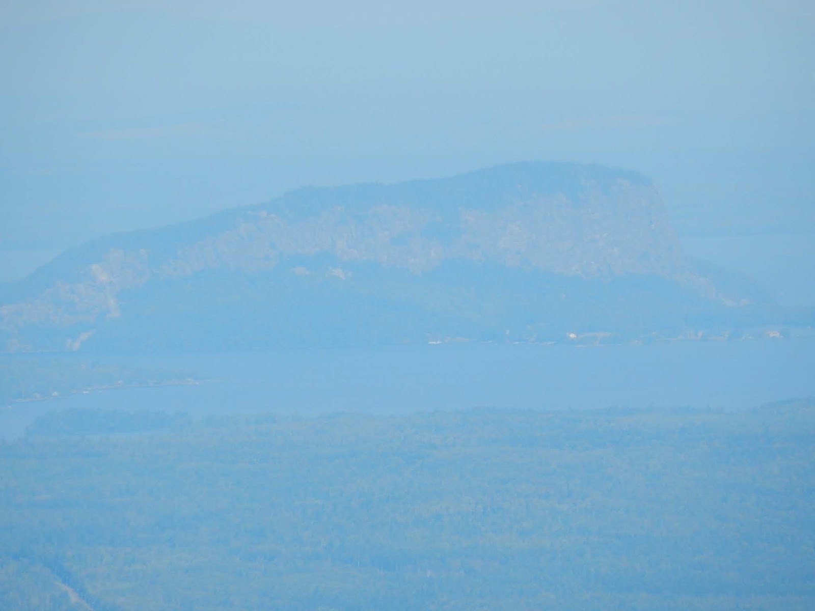
We stopped there for a bit, then continued a tiny bit farther to the final ledge, which overlooks Mirror Pond and Mountain View Pond. Almost all of Moosehead Lake can be seen from this ledge, as well as Big Spencer, Little Spencer, Boundary Bald Mountain, and the enormous cliff on Mt.Kineo. Eagle Rock can also be seen.

GALLERY
Looking up at the summit from the first view.
The view over to Coburn Mountain.
The summit of Big Moose Mountain.
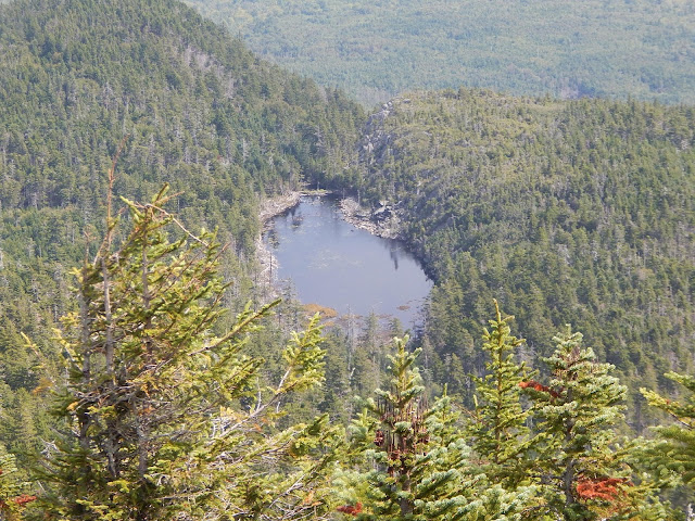
The view down to Mirror Pond.
The Spencers and Lobster Mountain across Moosehead Lake.
Mt.Kineo through the haze.

The mountain is gorgeous, and it sits in quite a unique area. I'll definitely be returning to the Moosehead Lake area to do The Spencers, Eagle Rock, and maybe Mt.Kineo. Hopefully, Greenville is far less crowded on a normal day. Remember to check out my new website on the Views of Maine, for a more in depth description of this peak and more.