 |
| Looking south from one of many meadows atop Black Cat Mountain. |
The peak is very unique, and this fact is evident just by looking at the trailhead, which immediately begins by crossing South Branch Brook. There is no bridge, and there are no rocks to hop across, which means you must ford the stream. After the crossing, the trail follows the shore for a short while, until reaching the junction with the remote campsites.
 |
| The trailhead for Black Cat Mountain. |
 |
| We're going right! |
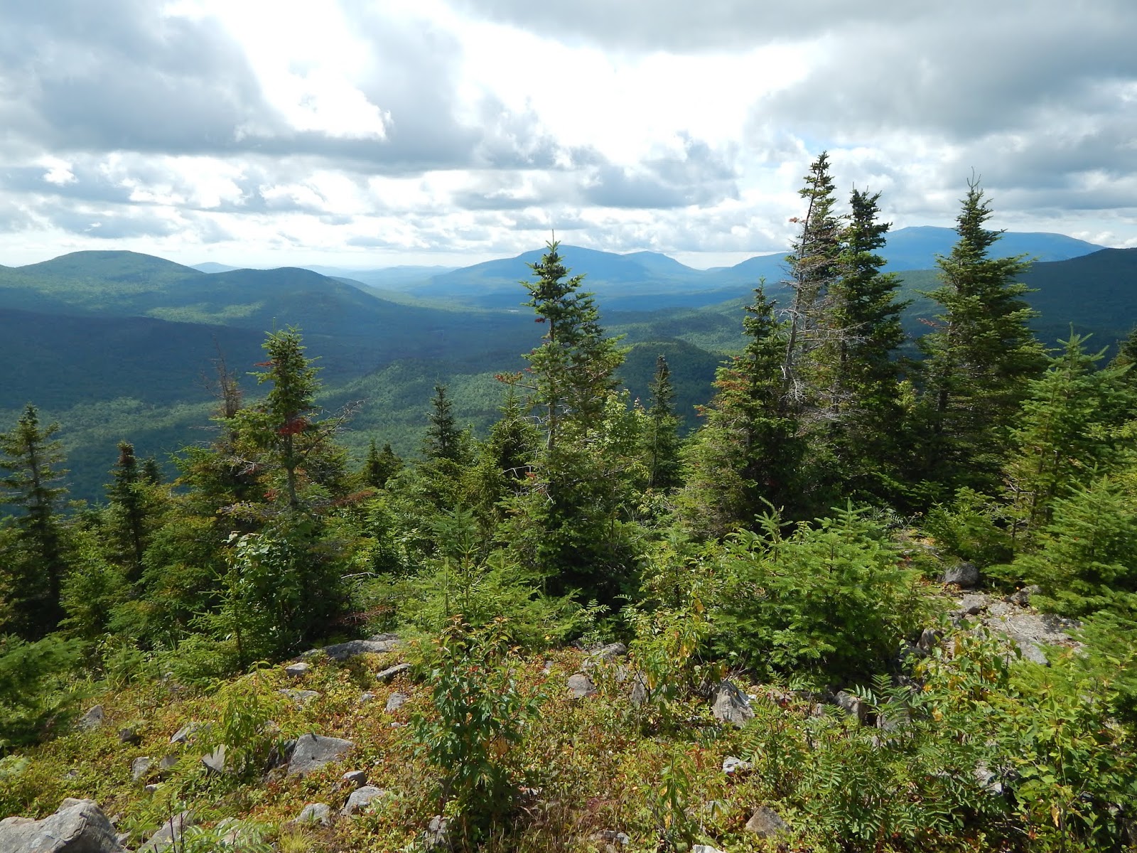
The path wound through the forest easily for a while, until reaching a rocky protuberance. It then climbed steeper until reaching a small rocky knob with a minor view directly north. It then climbed even steeper until reaching a second rocky knob just below the summit, with a great view looking toward The Traveler massif.
 |
| Looking north from the first knob. Peaks Visible: Willard Mountain, Norway Bluff, Mooseleuk Mountain, Peaked Mountain |
 |
| Looking up the steep trail. |
 |
| North Traveler, The Traveler, and Peak Of The Ridges from the second viewpoint. |
Once again, the trail climbed higher, at an easy grade this time. The forests were pleasant, and there was a ton of moose scat along the trail. I'm very surprised we didn't run into one while we were up there. Eventually we were lead to the summit of South Branch Mountain. The signs on both summits are a little short of the true elevation. There are no views from this summit.
 |
| The summit of South Branch Mountain. |
The trail descended easily until it began to climb yet again. The distance between the two summits is only half a mile, so it didn't take long to reach the summit of Black Cat Mountain. The trail started to open up into a meadow, that had a small rock outcropping in the center, with a sign sitting atop the peak. The views from the meadow were stunning. Almost every mountain in Baxter State Park can be seen from here, even some peaks around Moosehead Lake.
 |
| Emerging into the summit area. |
 |
| On the summit. |
 |
| The Traveler from the summit of Black Cat Mountain. |
 |
| The view from the summit toward North Turner Mountain. |
 |
| Mt.Fort and North Brother from the summit. |
 |
| Katahdin from the summit of Black Cat Mountain. |
It was evident that most people stop at the summit, then go back the same way, but that's a big mistake, as there are much better views beyond. The trail continued through the meadow, which lead down further and further, with the occasional cairn. It opened up more, with better views toward Katahdin and North Brother.
 |
| Leaving the summit. |
 |
| The view toward North Turner, Katahdin, and North Brother. |
 |
| Doubletop Mountain can be seen prominently in the center. North Brother and Mt.Fort sit high to the left. |
 |
| Center Mountain and Strickland Mountain, as seen from the meadows. Big Spencer Mountain can be seen just right of Center Mountain. |
 |
| Looking southeast toward North Turner Mountain. |
After the meadow, the trail descended through some large talus slopes, which offered incredible views looking west. The path continued to go in and out of trees until it reached a few wooded fields with no views. The path continued down the mountain steeply, with plenty of rocks. It can be hard to follow in some spots.
 |
| Looking east from the talus slopes. |
 |
| The view facing northwest. |
 |
| The overgrown trail heading down the mountain. |
Soon, the trail brought us down to Upper South Branch Pond, where we crossed the stream and enjoyed views up to Center Ridge from the water. After a few bog bridges, we ended up at Pogy Notch Trail, then the day use site, which offered a great view looking up to South Branch and Black Cat Mountains. The meadow was hidden from here, almost as if the mountain is trying to conceal it's beauty.
 |
| The stream crossing. |
 |
| An expansive view over Upper South Branch Pond. |
 |
| One of many bogs. |
 |
| Black Cat Mountain from the pond. |
Black Cat Mountain is a breathtaking summit, where almost all the peaks of Baxter State Park are visible. Just looking at the mountain doesn't show it's true beauty, unlike peaks like Katahdin and The Traveler. With those summits, you know what you're getting into for the most part, but with Black Cat, it's astonishing summit area is disguised by the endless forests along it's slopes, and maybe that's for the better.
Spectacular views! Excellent photos & write up...it all puts me right there in the wilderness with you!!
ReplyDeleteThat's what I'm hoping to do! Thank you for reading.
DeleteThank you for the great narrative and photos. Have not done this hike and would love to do so in the fall. How long did it take you to do this? Would you say the last section of the loop trial is easy to get lost on as you mentioned the path being hard to follow?
ReplyDeleteThank you so much for reading and commenting! The whole loop itself took about 7 hours, and that includes quite a bit of time taking in the views from the summit. The section of the trail you speak of was quite overgrown in some spots, but as long as you look for the blazes, you should be good. All the blazes are on the ground, so be careful!
DeleteOOOH! I can't wait to hike Black Cat! Awesome write up with super excellent descriptions! Keep up the great work!!!
ReplyDeleteThank you for reading! Black Cat certainly is an excellent mountain!
Delete