 |
| A viewpoint on Rounds Rock. |
I was alone today, and instead of taking the simple one mile loop from Rockwell Road, I started at the visitor center, and decided to take Northrup Trail. In order to get to the start of the trail, I had to walk along the Bradley Farm Trail, which was a real delight to walk so early in the morning.
 |
| The trailhead for Bradley Farm. |
 |
| Along Bradley Farm Trail. |
 |
| The place was teeming with chipmunks. |
I found Northrup Trail, and soon passed the road. The trail never got steep, and it barely lost or gained elevation. It was overgrown in many areas, and one of the bridges was broken beyond belief, making the brook crossing a little difficult.
 |
| Northrup Trail |
 |
| The bridge is in need of repair. |
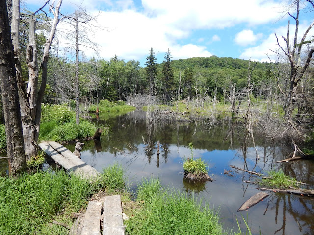
Eventually, the trail veered away from the road as it began to move to the west side of Rounds Rock. The sounds of cars and other people from the road disappeared, and it was finally silent. The trail came out to a scenic bog with bog bridges and a view up to the ledges of Rounds Rock.
 |
| Rounds Rock looming over the bog. |
 |
| On the bog bridges. |
 |
| Crossing on some sticks. |
After crossing the bog, the trail lead me to the junction for Rounds Rock. From here, I finally started gaining some elevation, as it began to climb up some steep rocks. I followed the trail until it flattened out, and reached the junction after a while.
 |
| Finally reached the trail. |
 |
| The steeper slopes of the trail. |
I went left at the junction for a couple hundred feet in order to find the 1948 wreckage of a Cessna Twin Engine. This short path lead through a grouping of ledges that were completely covered in blueberries. Eventually I reentered the woods and found the wreckage and memorial.
 |
| One of the blueberry fields. |
 |
| The rusted frame of the plane. |
 |
| I can't even begin to guess what part this is supposed to be. |
 |
| The memorial. |
 |
| The haunting story of the plane crash. |
I continued back to the junction and went the other way. There were many large open blueberry fields along the top of the mountain, and they were in season. A short spur lead to the first real viewpoint, which offered a vista toward some of the Taconics.
 |
| The first viewpoint from Rounds Rock. Potter Mountain is to the left, while Brodie Mountain is to the right. |
 |
| A closer look at Brodie Mountain and the wind farm. |
After heading through more ledges, the trail brought me to the second ledge; the better of the two. From here there is a grand view sweeping all the way down to Mt.Everett. After taking in the views here, I began to head back down, which was very easy.
 |
| A beautiful meadow atop Rounds Rock. |
 |
| More of the trail. |
 |
| The second viewpoint. |
 |
| Looking over to the Taconics and Potter Mountain. |
 |
| Looking south. Mt.Everett can be seen behind the prominent mountain to the far left. That mountain is Lenox Mountain. |
 |
| Looking as far east as possible. Tallest to the left is Judges Hill, tallest to the right is French Hill. |
I'm surprised peaks like this don't get more attention. On a beautiful warm Saturday afternoon, I only saw one other person, and nobody on the entire Northrup Trail. The views were incredible, the forest was quiet, and the trails were well put together. I would highly recommend this peak for anyone.
Congrats on your #2 solo hike (or is it #1?...total solo...no pooch...). Well done!!!
ReplyDeleteChipmunk had its eye on you.
Thank you for reading. This one was no where near as difficult as Burke Mtn, but it is a solo hike!
Delete