 |
| Mt.Crawford from the lower ledges. |
Davis Path, one of the oldest trails in the Presidential Range, served as our route of ascent, as it follows the ridgeline just below each summit. The path is very easy to follow, and starts gradually, until it becomes quite strenuous as it continues to pass over a large rocky area and many steep rocky steps. The path eventually flattened out and arrived at the first ledge, which offer a great view towards many iconic peaks in the White Mountains.
 |
| Frankenstein Cliff from the bridge over the Saco River. |
 |
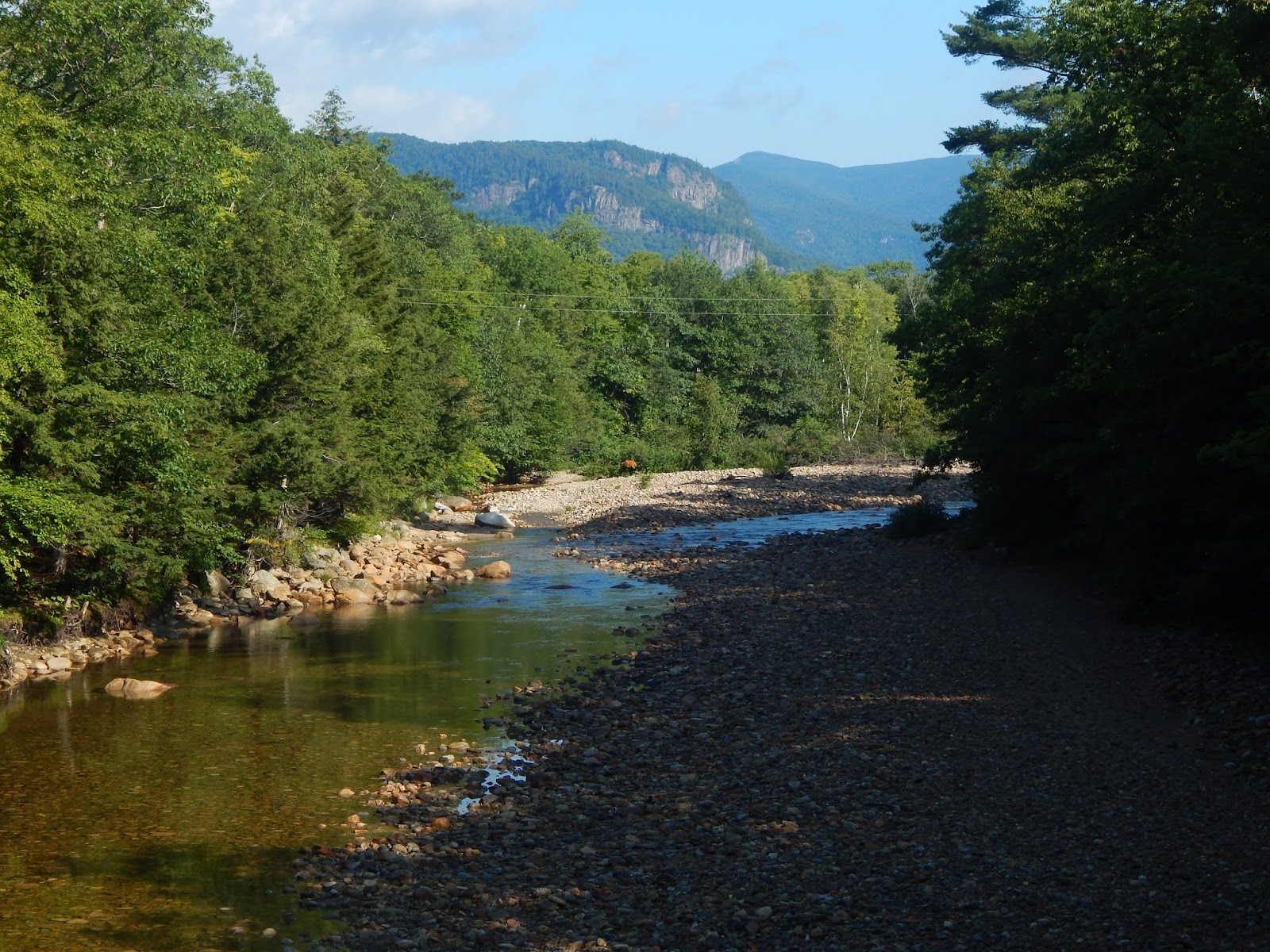
| The rocky, never ending trail. |
 |
| The view toward Mt.Hope and the Sandwich Range. |
From there, the path continued up the mountainside, in and out of the trees along open ledges. It's worth mentioning that there is a short side trail which leads to a large gravelly ledge with a great view looking into Crawford Notch, and the Presidentials on a clear day. Sadly, the only summits in the range that were visible were Mt.Webster and Mt.Jackson, but we knew the skies had to clear up at some point.
 |
| Looking back towards the Sandwich Range. Peaks visible include: Mt.Tremont, Bartlett Haystack, and Bear Mountain |
The path soon found the trail junction, with a spur trail leading up to the beautiful summit of Mt.Crawford. We followed the path, which brought us to the expansive ledges of the sharp peak. There were incredible views from this spot out to many peaks in the Whites, most notably Stairs Mountain and Mt.Resolution, our next destination. There are views in every direction, just not from one spot.
 |
| The junction with Mt.Crawford trail. |
 |
| Approaching the summit with a clear and distinct view toward Stairs Mountain. |
 |
| Crawford Notch (Mt.Willey and Mt.Webster) as seen from the summit. |
 |
| The massive summit of Mt.Resolution as seen from the true summit. |
 |
| Mt.Carrigain as seen from another ledge. |
After descending from the summit, we began to make our way out to Mt.Resolution, the only peak I had left to do in the area. We stayed in the woods for a while until emerging onto some ledges that had minor views toward the surrounding peaks. There were very good views back toward the summit of Mt.Crawford. The path then reentered the trees for a while. I can't express how beautiful this area truly is!
 |
| The path atop the ledges. |
 |
| Crawford Notch from the ledges. |
 |
| Is this a hiking trail or a sidewalk? |
The forests were nice and open, and unlike the way up, the trail was flat and not rocky at all. Eventually we were brought to the junction with the Mt.Parker Trail, which when followed to it's end, leads to the bald summit of Mt.Parker, a mountain I've climbed previously. We were only going to follow it about half way, to the summit of Mt.Resolution. The path got steeper, and more overgrown, but was still easy to follow.
 |
| The path to the junction. |
It took no time for the trail to find it's way to the first ledge, where we enjoyed great views over Mt.Crawford and Crawford Dome. The trees slightly obscured the view back towards Stairs Mountain. We entered the trees yet again, and the path stayed there for a while. The path started gaining elevation again, until we emerged onto the open summit, which had great views in almost every direction. Some of the Presidentials even cleared up!
 |
| This is the trail! |
 |
| The Crawfords can be seen below, with Mt.Carrigain towering above all other peaks. |
 |
| Stairs Mountain from the summit of Mt.Resolution. |
 |
| The Sandwich Range, with Mt.Tremont and Greens Cliff visible. Mt.Passaconaway can be seen to the far left. |
 |
| Crawford Notch, and the Twin Range in the backgrounds, lost in the clouds. |
Being on the summit showed us just how extensive the ledges were on Mt.Resolution. This peak is definitely worth coming back to, as there were more views to be had further down the trail. We enjoyed a clearer view of the Sandwich Range from here, and an excellent view toward Mt.Carrigain. There were paths running all throughout the ledges of the summit, and I'd like to find out some day where they lead. On our way down, Mt.Washington even cleared up.
 |
| Mt.Willey and Mt.Field cleared up to the left. Mt.Webster and Mt.Jackson are also visible now. |
 |
| Mt.Washington and Boott Spur through the trees. |
After following the trail all the way back to the junction with Mt.Crawford, we continued over all the ledges, which offered even better views than before, as most of the peaks were clear now, especially Mt.Chocorua and Mt.Willey. The Bonds and Twins never cleared up, but everything else did, and that's all that matters. We soon found our way back down the trail.
 |
| The now clear peaks of the Sandwich Range. |
 |
| Mt.Chocorua with Bear Mountain blocking most of it. |
This area of the White Mountains is truly beautiful, and one of the most scenic locations in the region, outside of the 4,000-footers. Any of the four peaks are worth climbing, Mt.Crawford, Mt.Resolution, Stairs Mountain, and Mt.Parker. This is a great area, so next time you can fit in an extra hike when in the White Mountains, keep this place in mind. Just be sure to do it on a good day, because you don't want to miss out on the incredible views.
Evan, thanks for sharing another truly wonderful adventure! Two-thumbs up!!
ReplyDeleteThe Crawford Notch area ranks highly among my favorite places to hike.
And just as a side note, regarding Mt. Resolution, you stated “This peak is definitely worth coming back to, as there were more views to be had further down the trail.” I’m uncertain if you were referring to the views from an unnamed knob located about 0.6 mile south of Resolution’s summit. Regardless, as you might already know, this viewpoint is described on page 65 of the 30th edition of the White Mountain Guide. It’s a terrific spot that’s worth visiting.
John
Thank you for commenting John. Our goal that day was to make it out to that knob, but the mileage was stacking up and we had gotten to the trailhead late, so I decided to save it for another day. I also notice a herd path going into the trees on the summit, which can be seen on satellite, and it appears the path could possibly lead to some ledges with easterly views. Either way, definitely a spot worth returning to. Once again, thank you for the kind words!
DeleteGreat write up & pics! I'll take the wide open treeless ledges any/every day...
ReplyDeleteI like how part of your blog is set up by hiking list, i.e. Terrifying 25, 52 WAV, etc. (maybe it's always been that way and I am always so mesmerized by your photos & write up i never noticed it... either way i see it now!)
Thank you for commenting, and thank you for taking note of the setup of my blog, it means a lot!
Delete