The Long Trail
The Long Trail of Vermont has always stood out to me as the finest example of what a "long distance" trail should be. It runs for a total of 273-miles through the backwoods of Vermont, winding it's way through large boreal forests, over quartzite ledges, and atop the state's tallest peaks, such as Mt.Mansfield and Camel's Hump.
Originally conceived in 1909, the Long Trail's construction lasted from 1910 to 1930, making it the oldest long-distance trail in the United States (the Appalachian Trail wouldn't be finished until 1937). It was built by the Green Mountain Club, who continue to maintain the path to this day. The southern-terminus can be found on the border with Massachusetts, while the northern-terminus can be found along the international border with Quebec.
While I've never thru-hiked the trail, I have been to both ends (almost). A few years ago I ventured out to Pine Cobble in Williamstown, where I came within close proximity to the southern-terminus. Sadly, the temperature that day was an unforgiving 96 degrees, which deterred me from making the brief walk from the cobble to the border.
Mount Carleton
It was a very comfortable summer morning in northern Vermont when my dad and I decided to tackle Mt.Carleton, with a promise of a view at the Quebec border. The air was cool, the roads were quiet, and the fog still lingered above the lowlands. Northern Vermont (specifically the Northeast Kingdom) is such a beautiful area, with sweeping views around every corner.
 |
| One of many views from VT-105. |
While parked at the trailhead on route 105, I couldn't help but think about all the thru-hikers who have crossed the highway, knowing it's the last road they'll be crossing on their journey.
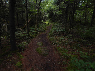
This particular piece of the Long Trail is very pleasant, meandering over bumpy landscape and through pleasant stands of pine. We made it to the summit in no time.
 |
| Through a picturesque pine forest. |
I'd looked into Mt.Carleton before, and heard rumors of a pleasant vista from it's piney summit. However, as the years have gone by, the trees have finally started taking the summit back, leaving us with little to no view.
 |
| One of two summit signs, marking the elevation. |
 |
| The "view" from Carleton, long after it's glory. |
From here, the trail got very rugged, with large tree roots and rocky terrain disrupting the flow of the trail. It's important that I bring up the latitude 45 degrees sign on this segment of the trail, the half way point between the equator and north pole.
 |
| Brand new signs all along the trail! |
Journey's End
After a long descent over rocky terrain, I could finally see it, the Quebec border, the northern-terminus of the Long Trail! While it is man-made, the border swath is still able to provide an outstanding view into Canada, specifically to the neighboring peak of Carleton, known as Mont Brock.
 |
| Benchmark in the foreground, with Mont Brock far in the distance. |
 |
| Commemorative sign discussing the Long Trail. |
The Long Trail ends here, but the hike does not. For any thru-hiker who makes it to this point, they must either go back up what they just came down from Mt.Carleton, or take the shorter Journey's End Trail, which leaves to the right of the border.
Even though Mt.Carleton itself lacks a view, the hike is well worth the effort. It's a unique spot, to be able to see where so many hikers celebrate their journey's end. If I ever return here, it won't just be a day hike, that's for sure.
Interesting write-up, I should check this blog more often...
ReplyDelete