 |
| The White Mountains from North Percy Peak. |
My dad and I began the hike at the southern trailhead, where we followed the trail easily through a beautiful forest. The fall colors were everywhere, adding more beauty to the area. The path was gradual at first, but eventually began to climb up the mountainside, passing over and around numerous slides, yet never getting too steep. There were faint views back through the trees from the slides, but they're nothing compared to the views ahead.
 |
| The Percy Peaks Trail. |
 |
| Lucy crossing a bridge along the trail. |
 |
| The view from one of the slides. |
The path flatten out as it entered the col, which is the gap between the two peaks. We were soon brought to the junction with the Cohos Trail, which we followed a few hundred feet south to a faint herd path. This trail is seldom used, despite the very obvious sign stating that it leads to the summit of South Percy. The path is obscure, as it maneuvers up the steep slope, and very slowly opens up onto the summit. This peak is rarely visited, yet it offers one of the most iconic views north of the White Mountain.
 |
| The trail junction. |
 |
| The spur trail to South Percy Peak. |
 |
| Still climbing South Percy. |
 |
| The ledges of North Percy as seen from South Percy. |
 |
| Goback Mountain and Savage Mountain |
After taking in the views for a while, we decided to head over to North Percy. We descended from the south peak and eventually made our way over to the junction with the spur trail up the ledges and to the summit of North Percy. Something I don't understand is how over exaggerated the trail up the ledges is. The trail climbs up the ledges, but never results in climbing, it's easily walk-able the whole way up. If anything, the trail up South Percy is more difficult, but not as beautiful.
 |
| The beginning of the ledges. |
 |
| Lucy climbing up the rocks. |
 |
| Looking toward Long Mountain and the Mahoosuc Range. |
We knew we were approaching the summit as the slope began to flatten, and the sign came into view. This peak offers the best views north of the White Mountains in New Hampshire, offering views into three states. Numerous peaks in Vermont can be seen, including Mt.Mansfield, Burke Mountain, Bald Mountain, Jay Peak, Seneca Mountain, and even East Mountain and it's many radar towers can be seen.
 |
| The summit of North Percy Peak. |
 |
| Burke Mountain, East Mountain, Seneca Mountain, Bald Mountain, and Jay Peak. |
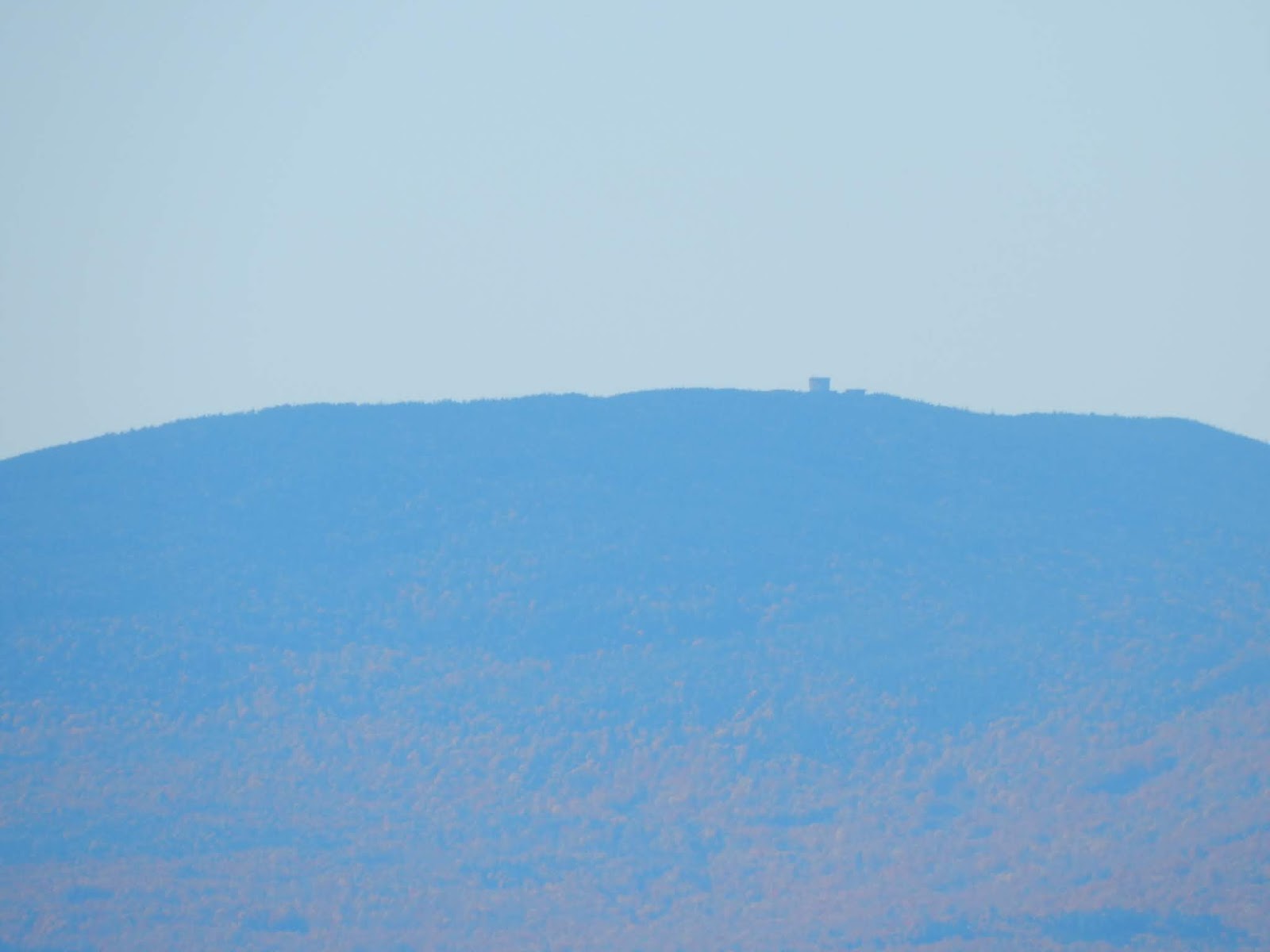 |
| The radar towers atop East Mountain. |
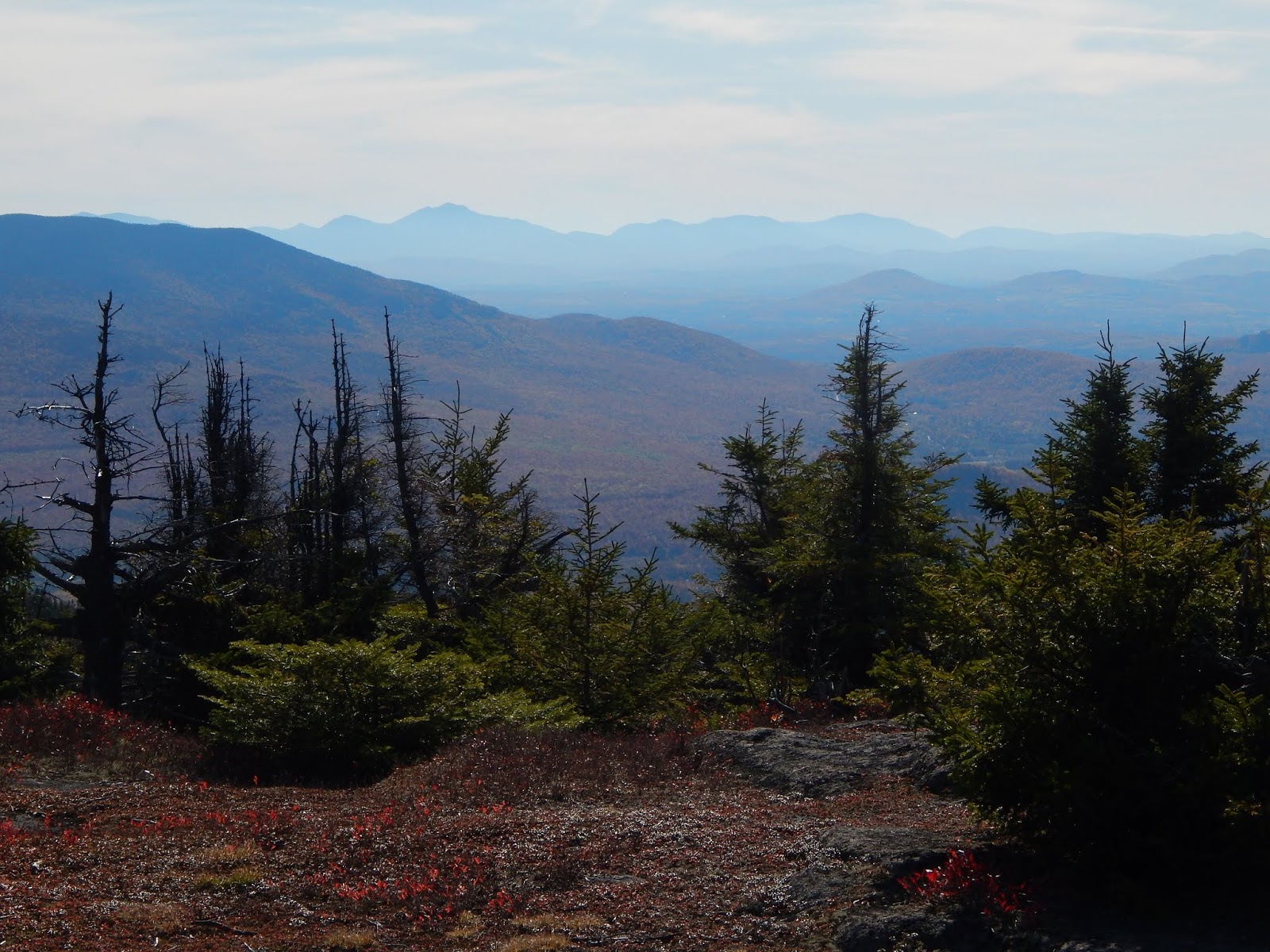
Many more peaks can be seen in New Hampshire, both to the north and south, including Mt.Moriah, Mt.Washington, Rogers Ledge, The Horn, Mt.Cabot, Mt.Garfield, the Franconia Ridge, Mt.Cannon, and Mt.Moosilauke. The Mahoosuc Range can be seen continuing into Maine, and many more mountains throughout Nash Stream Forest can be spotted from the summit.
 |
| Looking north from the summit. |
 |
| The Mahoosuc Range from North Percy, including Baldpate Mountain, Old Speck, Mahoosuc Arm, Goose Eye Mountain, Mt.Carlo, and Mt.Success. |
 |
| The Presidential Range rising above the Pilot-Pliny Range. |
 |
| Mt.Garfield and the Franconia Range, alongside the Kinsman Range, as seen from North Percy Peak. |
We set up camp just below the summit, and away from the winds. We stuck around the summit, as the sun began to set over the horizon of Vermont. There were still people arriving at the summit, even after the sun had set. After watching the sunset, and taking in the star-filled skies, we went to bed, awaiting the sunrise the next morning.
 |
| The colors of sunset over the Mahoosuc Range. |
 |
| South Percy and the White Mountains. |
 |
| Watching the sunset over Vermont. |
The sunrise was a beautiful sight, as it rose just over the Mahoosuc Range, shining all over the valley and nearby mountain slopes. We admired it for a while, but we also wanted to get down early, so we hastily packed up camp and began to make our way down, enjoying the views over Lake Christine and toward the White Mountains all the way down.
 |
| The sun rising over the undercast clouds. |
 |
| The sun slowly rising. |
 |
| Lake Christine and the White Mountains |
 |
| Looking into Vermont from the ledges. Cape Horn can be seen to the left. |
Once we entered the trees, we continued down the north side. This trail is beautiful, and not steep at all. It begins by passing through a moss-covered forest, which slowly transitions into hardwood. The Cohos Trail is well marked here, and it eventually brings you to the camping spot, where the Cohos Trail diverges, and we continued on the Percy Loop Trail, which follows an old woods road for the rest of the way.
 |
| The junction with the campsite. |
 |
| Lucy roaming the campsite. |
 |
| The old woods road through the forest. |
 |
| Sugarloaf Mountain through the fall-colored trees. |
Overall, it was enjoyable hike with great views, making a great second to last sunrise for the year. If you don't know what I'm talking about, it's that my dad and I have been doing a sunrise hike every month since November to celebrate my dad's 50th birthday. We've already done twelve months, but we will officially finish the endeavor next month, completing the year. It's been an exciting experience so far, so hopefully we can finish strong!
Very nice job! that 1st pic of North Percy Peak was pulling me right into the computer screen; love that ledge!!!
ReplyDeleteInteresting names - Goback & Savage mountains...I'll be asking you about those...
The pics of the under clouds as well as the "colors of sunset..." are more of my favorite photos! So beautiful!
ONE MORE MONTH/SUNRISE TO THE BIG FIVE ZERO...
GREAT job keeps getting GREATER by the hike!!!...
Thank you so much for reading, as always! I'll be sure to answer all those questions soon. Only one more!
DeleteExcellent report, as always, Evan! I especially like the sunrise photo that is captioned “Lake Christine and the White Mountains”.
ReplyDeleteJohn
Thank you for reading John, and thank you for mentioning my photos as well!
DeleteSuperb Blog Thanks For Sharing Such an Amazing Post.
ReplyDeleteTaj Mahal Tours
Same Day Taj Mahal Tour
Sunrise Taj Mahal Tour From Delhi
Same Day Taj Mahal Tour By Train
Overnight Taj Mahal Tour
Golden Triangle Tour 3 Days
Golden Triangle Tour 4 Days
Golden Triangle Tour 5 Days
Wow that’s great. This are those facts which I don’t know before reading. That’s amazing its not easy to write this type of blog thanks for sharing this type of information with us. Please also write on kailash parvat because kailash parvat facts
ReplyDeleteis still the mysterious one.