Showing posts with label Sunrise/Sunset. Show all posts

The Last Sunrise: Bromley Mountain

The time has finally arrived, and our full year of sunrises has come to an end. Last November, my dad and I climbed Mt.Alander for sunrise. Since then, we've been able to get a sunrise from atop a different mountain in the northeast, doing so at least once every month. That first sunrise was only the beginning. Now that a full year has gone by, we've done sunrises just about everywhere, from Camel's Hump in Vermont's Green Mountains, to Mt.Wittenberg in the Catskills, and even two peaks in the Adirondacks. Usually you'd treat an event like this with great respect; making sure the weather will be perfect, and choosing an important mountain. Instead, I made sure to treat our last sunrise like any other hike. We decided to do our last one from atop Bromley Mountain, which is in southern Vermont. While it doesn't rank as our most beautiful sunrise, it definitely wins most unique.


The sunrise behind the ski-lift.

We got to the trailhead a few hours after midnight, with the forest silent and the stars out and shining above us. The path was easy to follow, even with the darkness all around us. We were able to keep track of the blazes, which were everywhere (this section of the path is the Long Trail and Appalachian Trail, after all). It never got steep, and it made for a great, relaxed ending to all the other hikes we've done so far. We passed the lean-to, then emerged onto one of the ski slopes, lit up by the stars above. The lights of Manchester could be seen behind us, with Equinox Mountain visible. We made it up to the summit, where we wandered around the ski-lifts for a while, awaiting the sunrise.


The ski-lift in silhouette over the rising sun.
Peru Peak from Bromley Mountain.
One of many ski-slopes.

As we waited for the sun to appear, I began to take notice of all the early signs of winter. Not only did a fine layer of frost cover most of the equipment, but all the water on the summit was frozen as well. While we were waiting for the break of day, I found many of the huts doors being unlocked, which provided momentary warmth from the freezing winds outside. From the summit could be seen the Coolidge Range to the north, Glebe Mountain to the east, and Stratton Mountain and Glastenbury Mountain to the south.


The ski-lift as the clouds began to move in.

As the wind began to howl, the sun started rising, which lead to the clouds moving in. Usually, an event like this would lead to poor visibility, and in this situation, a lousy sunrise. However, the clouds elevated the experience. As they filled the sky, it appeared the sun was sitting high above a raging fire on the mountain side. Words can barely describe the sight, as it perfectly sat behind one of the ski lifts, putting everything in silhouette. After we watched the sunrise for a while, we tucked away inside the ranger cabin.


The sunrise can be seen through the clouds.
Another view of the sunrise behind the lift.
Some of the chairs in silhouette.

Once the sun had fully risen, we realized the clouds wouldn't leave us, so we began to head down as dawn was breaking. Despite the lack of views from the ski slope, it still made for a beautiful descent. A while after entering the trees, we passed a vista, which offered a decent view toward eastern Vermont. On the way down we were able to admire the trail more. There were many portions that were flooded, but they were pretty easy to avoid.


The Ranger Cabin
The Appalachian/Long Trail north.
The long and winding trail down the slope.
One of the partially flooded sections of trail.

Overall, Bromley Mountain wasn't anything special (despite the truly unique sunrise), and I'm okay with that. Not all things need to finish big, as long as I enjoyed it, I'm fine with it. When it comes to what the future holds for hiking and this blog, I'm unsure of it. I might change the blog slightly, or I might take a break for a while. From Mt.Alander to Bromley Mountain, all I can say is that this wasn't only a great year for sunrises, but it was a fantastic year for hiking in general.

Overnight on the Cohos Trail: the Percy Peaks

The third times the charm, especially with hiking. Our most recent hike described below happens to be our third time doing the Percy Peaks. It took three attempts to finally get it right, this time completing the loop and ascending both peaks. This hike is one of the best loops north of the White Mountains in New Hampshire. This is also the first Columbus Day weekend we've had good hiking weather, which is an added bonus.


The White Mountains from North Percy Peak.

My dad and I began the hike at the southern trailhead, where we followed the trail easily through a beautiful forest. The fall colors were everywhere, adding more beauty to the area. The path was gradual at first, but eventually began to climb up the mountainside, passing over and around numerous slides, yet never getting too steep. There were faint views back through the trees from the slides, but they're nothing compared to the views ahead.


The Percy Peaks Trail.
Lucy crossing a bridge along the trail.
The view from one of the slides.

The path flatten out as it entered the col, which is the gap between the two peaks. We were soon brought to the junction with the Cohos Trail, which we followed a few hundred feet south to a faint herd path. This trail is seldom used, despite the very obvious sign stating that it leads to the summit of South Percy. The path is obscure, as it maneuvers up the steep slope, and very slowly opens up onto the summit. This peak is rarely visited, yet it offers one of the most iconic views north of the White Mountain.


The trail junction.
The spur trail to South Percy Peak.
Still climbing South Percy.
The ledges of North Percy as seen from South Percy.
Goback Mountain and Savage Mountain

After taking in the views for a while, we decided to head over to North Percy. We descended from the south peak and eventually made our way over to the junction with the spur trail up the ledges and to the summit of North Percy. Something I don't understand is how over exaggerated the trail up the ledges is. The trail climbs up the ledges, but never results in climbing, it's easily walk-able the whole way up. If anything, the trail up South Percy is more difficult, but not as beautiful.


The beginning of the ledges.
Lucy climbing up the rocks.
Looking toward Long Mountain and the Mahoosuc Range.

We knew we were approaching the summit as the slope began to flatten, and the sign came into view. This peak offers the best views north of the White Mountains in New Hampshire, offering views into three states. Numerous peaks in Vermont can be seen, including Mt.Mansfield, Burke Mountain, Bald Mountain, Jay Peak, Seneca Mountain, and even East Mountain and it's many radar towers can be seen.


The summit of North Percy Peak.
Burke Mountain, East Mountain, Seneca Mountain, Bald Mountain, and Jay Peak.
The radar towers atop East Mountain.

Many more peaks can be seen in New Hampshire, both to the north and south, including Mt.Moriah, Mt.Washington, Rogers Ledge, The Horn, Mt.Cabot, Mt.Garfield, the Franconia Ridge, Mt.Cannon, and Mt.Moosilauke. The Mahoosuc Range can be seen continuing into Maine, and many more mountains throughout Nash Stream Forest can be spotted from the summit.


Looking north from the summit.
The Mahoosuc Range from North Percy, including Baldpate Mountain,
Old Speck, Mahoosuc Arm, Goose Eye Mountain, Mt.Carlo, and Mt.Success.
The Presidential Range rising above the Pilot-Pliny Range.
Mt.Garfield and the Franconia Range, alongside the Kinsman Range,
as seen from North Percy Peak.

We set up camp just below the summit, and away from the winds. We stuck around the summit, as the sun began to set over the horizon of Vermont. There were still people arriving at the summit, even after the sun had set. After watching the sunset, and taking in the star-filled skies, we went to bed, awaiting the sunrise the next morning.


The colors of sunset over the Mahoosuc Range.
South Percy and the White Mountains.
Watching the sunset over Vermont.

The sunrise was a beautiful sight, as it rose just over the Mahoosuc Range, shining all over the valley and nearby mountain slopes. We admired it for a while, but we also wanted to get down early, so we hastily packed up camp and began to make our way down, enjoying the views over Lake Christine and toward the White Mountains all the way down.

The sun rising over the undercast clouds.
The sun slowly rising.
Lake Christine and the White Mountains
Looking into Vermont from the ledges. Cape Horn can be seen to the left.

Once we entered the trees, we continued down the north side. This trail is beautiful, and not steep at all. It begins by passing through a moss-covered forest, which slowly transitions into hardwood. The Cohos Trail is well marked here, and it eventually brings you to the camping spot, where the Cohos Trail diverges, and we continued on the Percy Loop Trail, which follows an old woods road for the rest of the way.

The junction with the campsite.
Lucy roaming the campsite.
The old woods road through the forest.
Sugarloaf Mountain through the fall-colored trees.

Overall, it was enjoyable hike with great views, making a great second to last sunrise for the year. If you don't know what I'm talking about, it's that my dad and I have been doing a sunrise hike every month since November to celebrate my dad's 50th birthday. We've already done twelve months, but we will officially finish the endeavor next month, completing the year. It's been an exciting experience so far, so hopefully we can finish strong!

A Night in the Adirondacks: Hurricane Mountain

On our ongoing quest for new sunrises from atop the mountains of the northeast, we saw it appropriate to return to the Adirondack High Peaks. We had already experienced a sunrise from a peak in the Adirondacks back in May, from Pharaoh Mountain. While we were going to leave it there, I thought it would be a good idea to return to the range, as the Adirondacks are a large range. I chose Hurricane Mountain (3,694') for it's open summit and fine views in all directions. This was definitely going to be a unique sunrise.


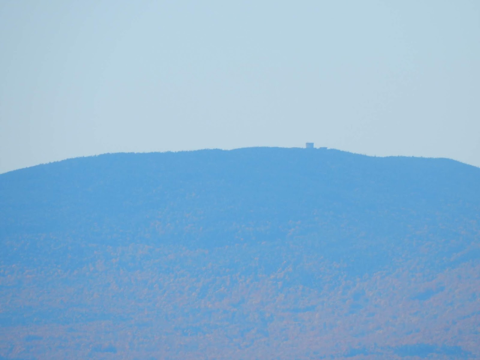
The fire tower atop Hurricane Mountain.

Even though Hurricane Mountain is in the High Peaks region, it isn't a 4,000-footer, but it does provide one of the best views in the  area. The most popular trail on the mountain climbs from Route 9N, but I chose to start the hike from the Crow Clearing trailhead to the north. My dad and I arrived at the trailhead early, where we eagerly started the hike. The first mile of the hike was smooth, following what was likely an old logging road.

The beginning of the trail.
Perhaps an old logging road?

Once at the junction with the Soda Range Trail, we continued on the Hurricane Mountain Trail, which crossed a small brook, then began at a steady grade. It brought us through an open forest, which was followed by a smooth trail over a brook. At this point, the path got rockier, and continued to climb through boreal forests. Soon it flattened out at the junction below the summit. Overall, an easy trail!

At the junction.
Some rockier portions of the trail.

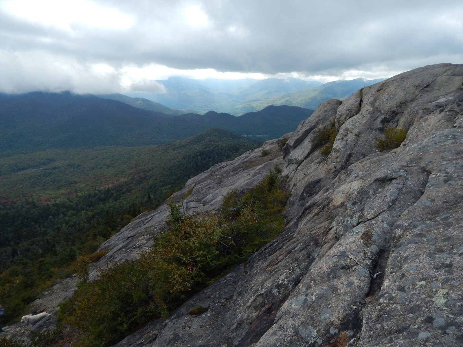
After a bit of flat trail, we were brought to a steep rocky area, that when ascended, brings you to the first ledge on the summit. Upon our first time on the peak, there were no views, as the summit was completely socked in. Despite this, we still continued along the ledge all the way to the fire tower. We didn't spend too much time up there, as there was a very strong wind passing over the summit. We went back into the trees below the summit and set up camp, occasionally returning to the ledges.

The technical climb just before the ledges.
Looking up toward the summit while in the clouds.
The restored fire tower, and some remains of the former in the foreground.

Upon our last climb to the summit that day, we waited for the sun to set. We knew we weren't going to see a great one, but it was worth watching. The skies had cleared up a lot, mostly to the north. To the north could be seen the Soda Range and Jay Mountain. Since the winds had eased up, I climbed the fire tower, which doesn't offer that much more to the view. Fire towers are a better gimmick then they are practical, but none the less, it's nice to have.

Through the clouds can be seen the Sentinel Range.
Looking past the ledges toward Baxter Mountain.
Jay Mountain and the Soda Range from Hurricane Mountain.
From the fire tower, looking toward Lake Champlain.

The western horizon turned orange beneath the clouds, and it was evident the sun would be setting soon. It wasn't the best sunset, but it was something. While there were still clouds around many of the high peaks, we trusted that the skies would clear up enough for the next morning in order to see the sunrise. We carefully made our way down the peak into the woods and off the trail back to our tent, where we awaited the sunrise.


Jay Mountain and the Soda Range before sunset.
The sun shining through the clouds.
Even though this is all we got, it's still beautiful.

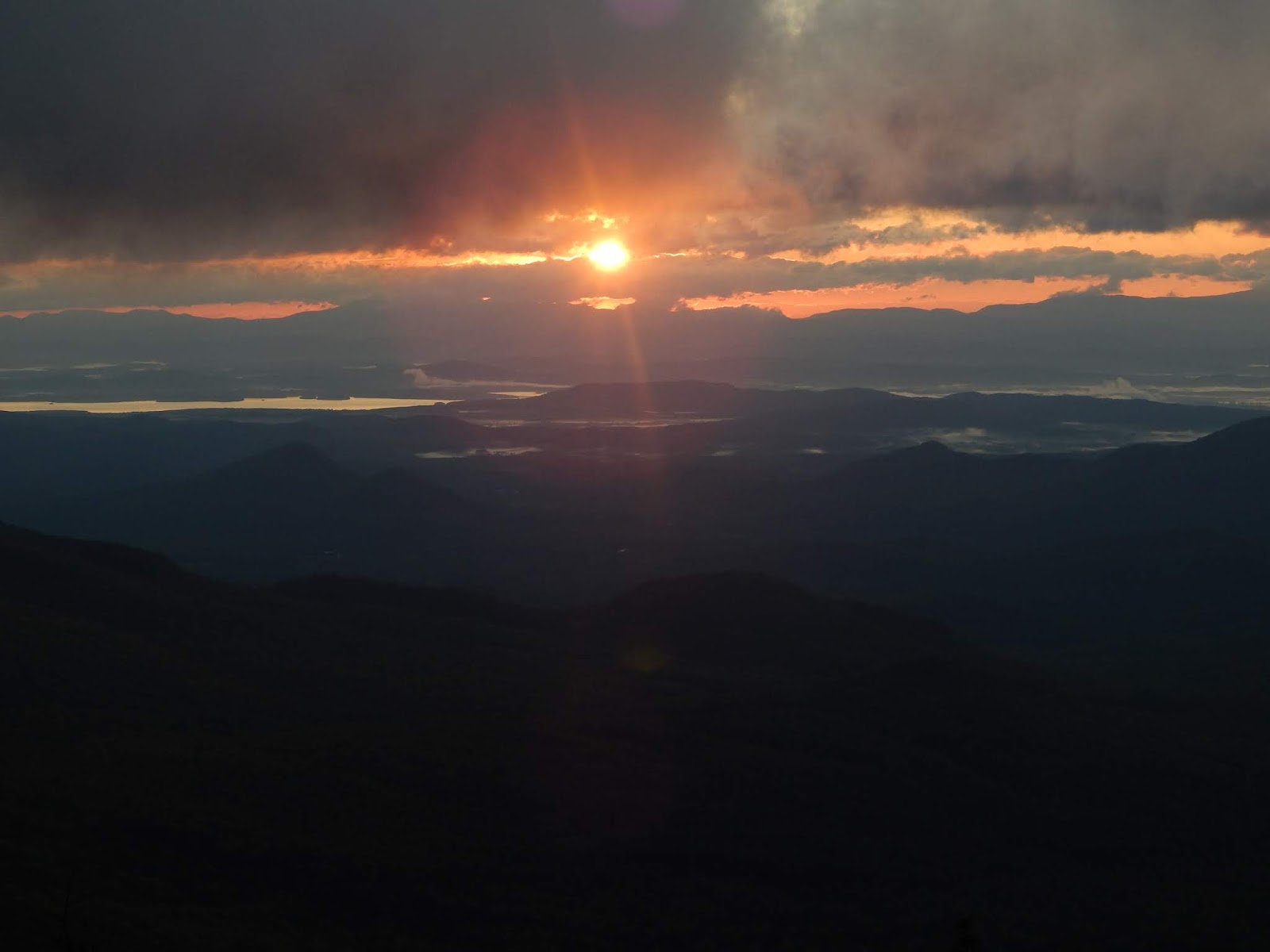
The sky began to brighten as we made our way back to the summit the next morning. We didn't have to wait long until the sun began to rise just over the Green Mountains and Lake Champlain, which both cleared up overnight. While clouds are usually a nuisance on hikes, they can occasionally add to the scenery, which is what I felt of them during the sunrise. There were just enough as not to block the sun, but make it more unique.


The sky before sunrise.
The sun rising over Lake Champlain and Split Rock Mountain.
A rough outline of the Green Mountains can be seen just below the sun.

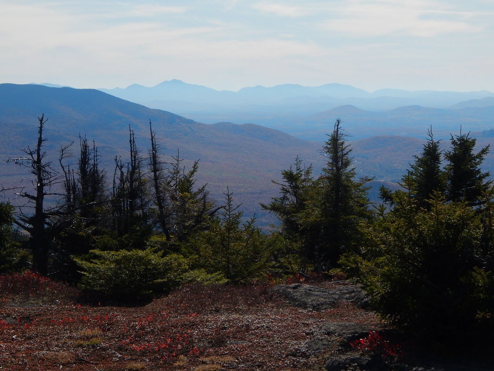
The skies were much wider now that the clouds eased up overnight. Some of the high peaks were visible, including Cascade and Porter, Giant Mountain, and Rocky Peak Ridge. Dix Mountain could be seen in the distance, with Nippletop Mountain nearby. The serrated ridge of Sawteeth Mountain was plainly visible. The Sentinel Range was in and out of the clouds all morning, and Whiteface Mountain never showed through.


The fire tower in silhouette.
Giant Mtn, Macomb Mtn, Hough Mtn, Dix Mtn, Nippletop Mtn, Mt.Colvin, and Sawteeth
The serrated ridge of Sawteeth Mountain.
Mt.Whiteface and Esther Mountain from the ledges.

We made our way down to camp and packed up, then continued our way back to the trailhead. Hurricane Mountain made for an excellent spot to see the sunrise. It was one of the best ones yet, with all the clouds and fall scenery adding to it. During our descent back to Crow Clearing, we noticed how quickly fall would be approaching. Seasons change much faster in the mountains, and it was evident, with the leaves turning yellow, and the autumn breeze beginning to roll in. I can't wait for fall!