Napatree Point in Westerly, Rhode Island is now contained in conservation land. The peninsula is plentiful in history, with it's grassy dunes and rocky coasts, along with the hidden gem of Fort Mansfield. The name "Napatree" is derived from the words "neck of trees", as before the Great September Gale of 1815 struck, the entire peninsula was forested. Today, the beach is bare of trees, but covered in history.
 |
| The southern side of Napatree Point. |
The beach is sandy in the beginning, but it's also covered in shells and ducks. At least fifty ducks were swimming along the coastline. There was also several bricks and concrete chunks in the sand. This is due to Fort Mansfield, but I'll explain this later.
 |
| Ducks! |
Long strings of yellow rope are there to gate off portions of the dunes. As I said, this is conservation area, and it's there to help let the dunes grow back. Once the trail reaches the western end of the cape, it rises off of the coast onto rocks.
 |
| The western end of Napatree Point. |
This area is covered in old pieces of brick and hardened clay. Large chunks of concrete also lay on the water. We also found a fishing rod and rusted knife on the rocks. All of the debris is from Fort Mansfield, which is deep within the bushes from here.
 |
| Battery Wooster from Battery Crawford. |
Fort Mansfield was built in 1899, but it only lasted until 1917 when they realized that there was a major blind spot in the area that the guns couldn't shoot at. Battery Wooster and Battery Crawford are all that remain. All government buildings were demolished in 1928, and this is the source of all the bricks and concrete. Battery Connell wasn't demolished either, but due to the coastline of Napatree Point shrinking by 200 feet from then, the battery has been consumed by the tides.
 |
| Looking at Connecticut from Battery Crawford. |
Unlike Fort Wetherill, this fort is very hard to access. There is a very tall fence surrounding the walls and large metal sheets covering the ladders. We were still able to access it. While Fort Wetherill is higher up and set for drainage, Fort Mansfield is neither of these things, and the lower halls and rooms are flooded. Also, the fort is named after Joseph K. Mansfield, an officer in the Mexican War who died in the Civil War.
 |
| Looking into a dank room under Battery Crawford. |
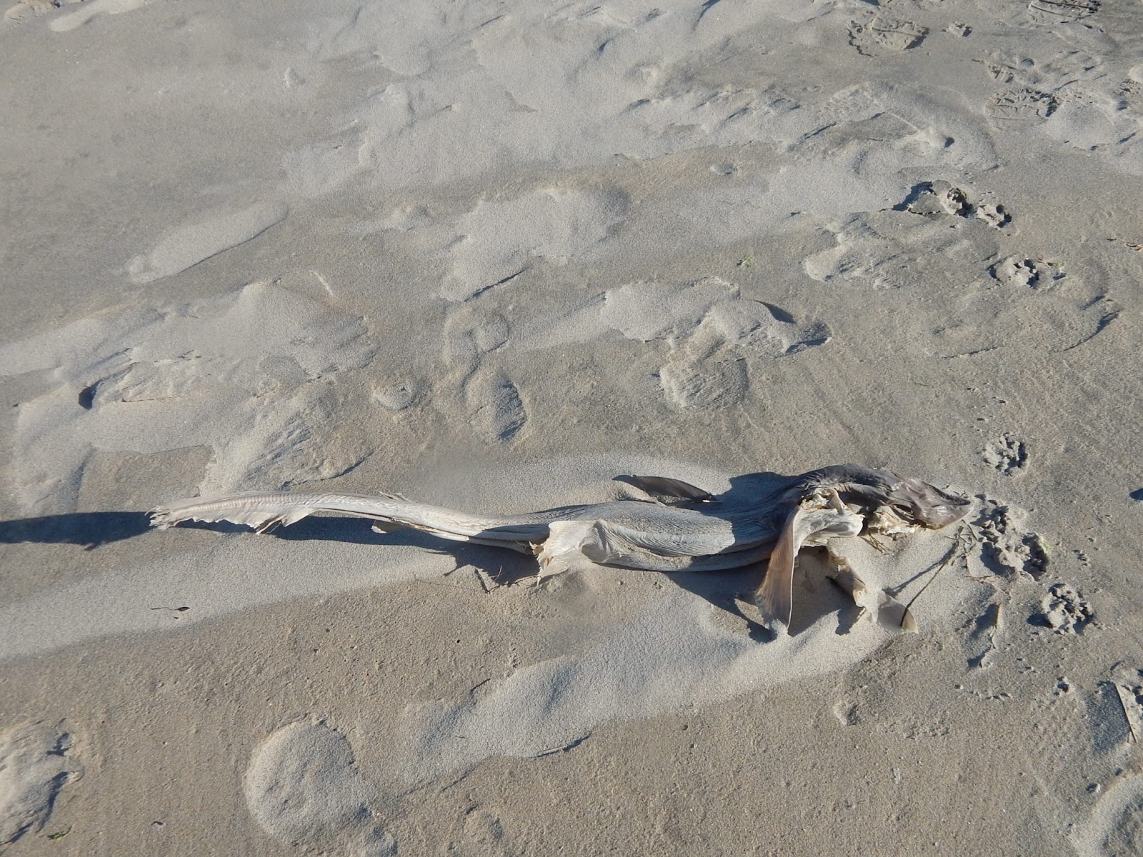
After exploring, we trampled through the undergrowth and found ourselves back on the beach where we could see old wooden posts in the water at the site of Battery Connell. My sister also found a dead fish in the sand. It looks like a small shark, so if anyone knows what it is please identify it.
GALLERY
 |
| The northern side of Napatree Point with Watch Hill Cove to the right. |
 |
| The coastline at Napatree Point. |
 |
| Another portion of the north side. |
 |
| Likely seagull footprints. |
 |
| Debris of the government buildings. |
 |
| The fishing rod and rusty knife. |
 |
| Mind the glare in this photo of Battery Crawford. |
 |
| Battery Wooster in the background. |
 |
| A hallway in Battery Crawford. |
 |
| Looking down Battery Wooster. |
 |
| A worn staircase entering Battery Wooster. |
 |
| Looking off of Battery Wooster. |
 |
| Looking down on Battery Wooster. |
 |
| All that remains of Battery Connell. |
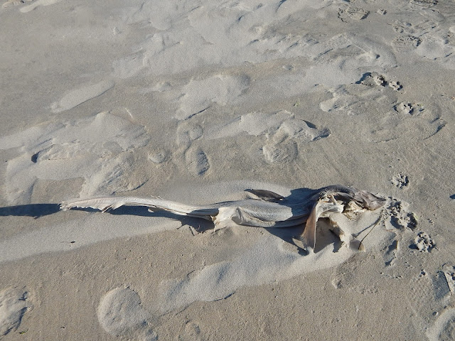 |
| What kind of fish is it? If you know what it is then tell me. |
 |
| One last photo of Napatree Point. |
The walk back was calming and windy. Many people were walking alongside the monstrous waves. Kites were in the sky and surfers were in the ocean. This destination is just yet another remnant of coastal bases on the east coast. These types of places run from Texas to Maine, and many can be found in New England. Fort Wetherill was the first of many forts and batteries I will be visiting.


No comments:
Post a Comment