The Northeast Kingdom of Vermont is full of great hikes and rugged bike trails, places you can explore at your leisure, and have the experience being deep within nature. Trails such as those don't compare in the slightest to East Mountain, in fact nothing does. By far, it is the most unique climb you can experience in the entirety of the Appalachian Mountains. What gives it such a title, probably the fact that the mountain was once the site of the now defunct Lyndonville Air Force Station.
 |
| Lyndonville Air Force Station |
The base was operational from 1955 to 1963, and during those eight years, they were able to build up quite the base. Radar road climbs to the top of the mountain, and is blocked by a large oil tank about halfway up. Right before the road block is the Quonset Village, the location where the people stationed there would live out there lives. Now, it is crumbling, day after day...
 |
| The Quonset Village |
Most of the buildings are still standing, only one has begun to collapse, and that's the barn. Other sites to be seen include the garage/motor pool, the dining hall, the gym, and even a bowling ally. While this base may sound luxurious, just imagine living here with ten feet of snow on the ground, and being stuck here with the same people for an entire winter.
 |
| Inside the dining hall. |
 |
| The dining hall is completely gutted. |
 |
| The outside of the gym. |
 |
| The gymnasium. |
Near the gym were a few other structures that nature was reclaiming. The nearby tennis court has started to become overgrown with weeds and small trees. Even though everything is falling apart, it's surprising how well the place has held up over the years.
 |
| Inside the bathroom. |
 |
| Looking through the barracks. |
 |
| Likely the bowling alley. |
 |
| The barn, which has completely collapsed on the inside. |
 |
| Just a walk in the woods... |
 |
| The tennis court. |
Clouds flew overhead, and the time came to begin our ascent. Immediately after the Quonset Village, the road drops in quality. It continues straight as an arrow toward a marsh, which is the location of a tank that has been used to block the road. From here, there is an eerie view looking up toward a few of the radar towers, standing tall above the treeline, looking down at us.
 |
| A shack along Radar Road. |
 |
| Radar Road |
 |
| The radar towers sitting atop the mountain. |
The road is in much better condition after the tank. If you can drive around the blockade, you can certainly drive the rest of the way up, but it is far to risky to attempt going around the tank. The road winds up the mountain side consistently, bringing us further and deeper into the untamed forest. Snow still lays on the sides of the overgrown road, even in June.
 |
| Looking up Radar Road. |
 |
| More of Radar Road. |
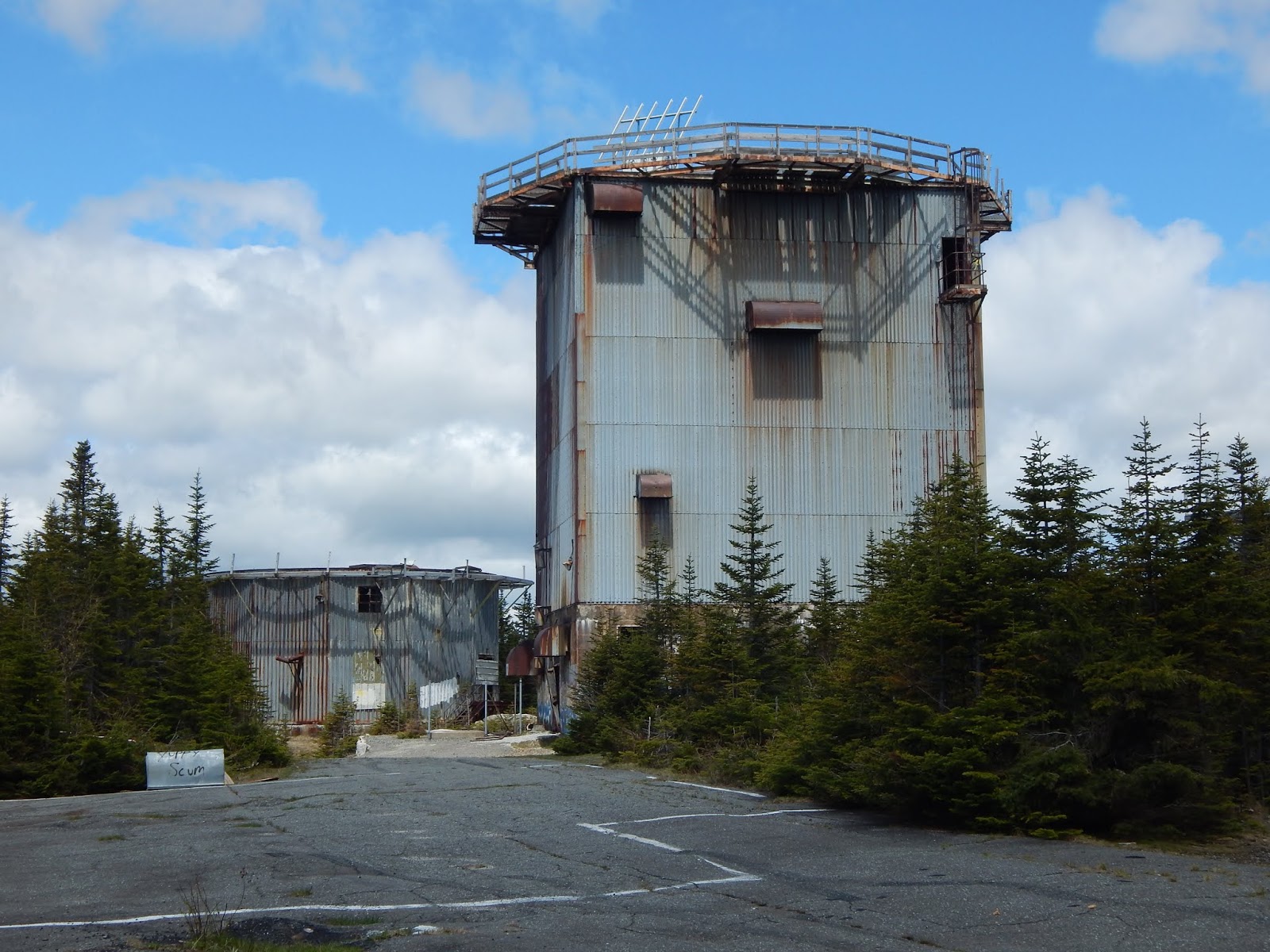
After seemingly endless walking up the old road, it went around one more bend, then straightened. Suddenly, the giant towers appeared over the trees, and we knew we had made it. Surprisingly, the towers have held up quite well the last few years, but not the other surrounding structures.
 |
| Atop East Mountain. |
There are five towers total, the tallest being five stories tall. Seeing these structures stand high above you is a sight to behold, the area is truly haunting. There was a constant dull noise, that of the wind creeping throughout the towers, and occasionally moving large pieces of metal at times, making the fearful sound of distant movement, even though we always knew we were alone.
 |
| The tallest radar tower. |
 |
| One of the shorter towers. |
One of the first things we did was attempt to climb the highest tower, which we were able to do quite easily. You must climb up a rusted staircase for five levels, then climb straight up a rickety ladder which will bring you to the very top. This tower gave us one of the best views in all of New England.
 |
| The base of the tallest tower. |
 |
| The entrance. |
 |
| The rickety staircase. |
 |
| Looking out from the top floor. |
 |
| The view from the tower. |
From here, one can have themselves a grand view of the Northeast Kingdom, and even more mountains, far beyond. Notable peaks include North and South Percy, Mt.Cabot, Mt.Waumbek, Mt.Adams, Mt.Washington, the Twins, Mt.Garfield, Mt.Lafayette, and Cannon Mountain in New Hampshire.
 |
| Looking toward New Hampshire, primarily the White Mountains. |
 |
| Another view, toward Burke Mountain. |
Over in Vermont can be seen Burke Mountain, Signal Mountain, Mt.Ellen, Camels Hump, Mt.Mansfield, the Sterling Range, Mt.Hor, Wheeler Mountain, Mt.Pisgah, Bald Mountain, and even Jay Peak, which sits almost in Canada.
 |
| Looking into Vermont. |
 |
| The Northeast Kingdom. |
Being given the view you have from the top of the tower distracts you from just how high above the ground you are. It's a serious drop, all the way back to the ground, so with the winds picking up, we carefully made our way back to the bottom. We walked over to the northernmost tower, which was very short, but also safe enough to climb.
 |
| The stairs leading atop the tower. |
 |
| Through the window... |
From this tower could be seen the same views as the other, but not as good. That's not to say the view wasn't great, because many of the same peaks can still be seen, including a view of the tallest tower. This building was by far the safest to climb, but it's still very much worth it to climb the tallest one as well.
 |
| The tallest tower as seen from another. |
 |
| Vermont from the lower tower. |
 |
| What an incredible view... |
 |
| Camels Hump and Mt.Mansfield can be seen in the distance. |
Down the slope a ways was a white brick building, which was slowly being engulfed in dense pines. This structure has stood the test of time the best out of all the other buildings up there, excluding the towers. There was another building of the same type on the other side of the summit.
 |
| Notice how nature is taking it back. |
 |
| Again, haunting... |
We climbed back up to the summit, only to find the other three towers either blocked off, or too dangerous to climb up. I'm sure it can be attempted, but we're not going to be the ones to test it. There were a few more buildings hiding away within the trees, all of which had been gutted and are now rusting, empty husks.
 |
| One of the buildings. |
 |
| All that remains is the frame and roof. |
 |
| There were bullet holes everywhere, including some on the wall above. |
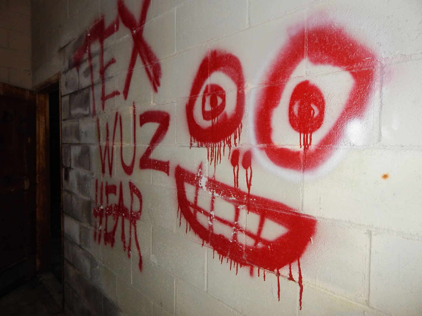
While the atmosphere of the place is very eerie, and the silence is deafening, that is not the only reason the base is creepy. It is said that on a September day in 1961, the base was able to track an unidentified flying object for 18 minutes straight. Moments later, the Barney and Betty Hill incident took place, the first widely reported alien abduction in United States history. This event certainly adds another level of fear and mystery to the place.
 |
| Emerging from the trees. |
 |
| The towers through the window. |
 |
| Looking down the staircase. |
 |
| Wouldn't we all like to know? |
 |
| Hi-Voltage |
 |
| One of the towers. |
 |
| From atop the tower. |
 |
| The shortest tower. |
 |
| Looking toward New Hampshire. The Percy Peaks can be seen to the far left. |
 |
| Mt.Pisgah is on the far left, with Bald Mountain to the right. Jay Peak is in the far distance. |
 |
| Inside one of the summit buildings. |
 |
| It's all falling apart. |
 |
| What a site... |
Who really knows what the future holds for Lyndonville Air Force Station. It has stood for over 60 years now, and let's hope it won't fall now, whether that's from vandalism, the land owners, or severe weather. The haunting atmosphere can't be duplicated, it's a chilling experience to go alone, on a windy day. Even if we don't know it's future, we can continue to discuss it's past without any ramifications.
This is the third entry in a series of blogs:


Amazing write up!!! Where is Maura Murray??????
ReplyDeleteThank you for the kind words. I'm sure everyone would like to know where she is. It's one of the biggest mysteries in the area...
DeleteFascinating place! Excellent write up & awesome pics! Very much looking forward to visiting... on my long to do list for sure... Thanks for sharing another amazing entry!
ReplyDeleteThis is definitely a place I would love to camp at...
ReplyDelete"The engine on my snow blower is strong, but I wish it had better fuel efficiency." 3 stage snowblower
ReplyDeleteI’m impressed with their professionalism. air conditioning repair
ReplyDeleteReplacement added so much comfort. hvac replacement near me
ReplyDelete