Mt.Wachusett & the Crow Hills

Mt.Wachusett towers high above Worcester County, Massachusetts, and it is well known for it's popular ski area. The mountain also supports a good system of trails, the fastest route being the Pine Hill Trail, which happens to be the trail we took up.


Mt.Wachusett and Pine Hill from the Crow Hills.

To access the trail, we had to follow the Bicentennial Trail for a short time until we reached the Pine Hill Trail. It's less of a trail and more of a granite staircase all the way up. It took some serious trail work to build this trail. Going this way, it only takes about half a mile to reach the summit. We reached it quite quickly, and we were greeted with  a view of the fire tower.


The fire tower from the upper portion of the Pine Hill Trail.

The summit itself is flat and very developed, but it offers views in all directions. We could see Mt.Monadnock, the Wapack Range, and what is likely Stratton Mountain. The Boston and Worcester skylines could also be seen. I was also able to make out Asnebumskit Hill to the south, which is the highest source of the Blackstone River.


Looking into New Hampshire with Mt.Monadnock and Gap Mountain in the center.

The bottom of the fire tower is open to the public for better views, but the tower itself is still in use. To the north, there were a few buildings for the ski area. Many antennae pepper the mountain, and one happened to get in the way looking north at the Wapack Range and Mt.Monadnock.


The Boston skyline.

Mt.Wachusett was quick and easy, so we headed over to the Crow Hills in Leominster State Forest for a different view. Much like Mt.Wachusett, the 92 mile Midstate Trail passes over these peaks. There are two peaks, but the south has the best views. This peak is also popular among rock climbers. Looking at the cliffs of the south hill, I can see why.


The towering cliffs above the trail

The trail is actually a dirt road until you reach a flat spot beneath the cliffs. The trail then splits, but we chose the trail that passes under the cliffs. It twists around the rocks and then connects to the Midstate Trail. The views from the north hill are lacking, but the views from the south include Mt.Wachusett, Pine Hill, and Crow Hills Pond.


Mt.Wachusett from a bigger ledge on the Crow Hills.

The Midstate Trail is blazed in yellow triangles, much like the Wapack Trail. The Midstate Trail in Massachusetts, Wapack Trail in New Hampshire, and North-South Trail in Rhode Island all connect, and form a 191 mile greenway.


GALLERY
The Bicentennial Trail
The Wapack Range from Mt.Wachusett.
The Wapack Range, with Mt.Cardigan in the distance, at 80 miles away.
The Uncanoonucs and Crow Hills from the summit.
Looking at Mt.Monadnock.

I would've liked to take more photos, but even on a Monday evening their were a lot of people who were getting in the way of photos. It was a nice trip for the time we had, but there's better hikes in the area than Mt.Wachusett. The Crow Hills had less people, and they had more of a natural view. We saw an Eastern Milk Snake on one of the ledges. It wasn't poisonous, but I means there are snakes here, so be careful if you go.

Mt.Liberty, In the Spring

Since I've completed the New England 67, and I missed out on views from certain 4,000 footers, I though it would be a good idea to start redoing these summits to achieve the best experience on each. When I did Mt.Liberty and Mt.Flume years ago, the summits were socked in. Luckily, this trip offered some of the best views I had ever seen.


Franconia Notch and Mt.Lincoln from Mt.Liberty.

This time, my dad and I hiked with four other people, but I found myself alone, ahead of everyone for most of the hike, so I'll be telling this from just my perspective. As a group, we headed up Liberty Springs Trail, until we came to the bike path, and I went ahead.

The Liberty Springs Trail is part of the Appalachian Trail, and the path itself is tame. There are a few water crossings, but nothing that bad. The last brook crossing was wide, but it still wasn't that bad. The brook has no name, but it flows down to "The Pool" on the Pemigewasset River near the Flume Gorge.


The unnamed brook that flows to the Pemi.

The trail soon enters pines and an icy spine of snow formed on the trail. It was still easy to go around, and it didn't take away from the hike at all. I arrived at Liberty Springs Tentsite, and the water was flowing well. Franconia Ridge Trail was just ahead, and I soon found myself below the empty summit.


The bare summit of Mt.Liberty.

The approach to the summit was excellent, and I immediately noticed the Kinsman Ridge and Camels Hump in Vermont. Mt.Lincoln was towering behind me as Mt.Lafayette hid behind it.


Camels Hump behind North Kinsman.

The views from the summit itself was even better, as it offered views in every direction. The mountain towered above the town of Lincoln, and I saw Mt.Moosilauke to the southwest. I waited for an hour on the summit for the rest of the group to get there. Some hikers from Virginia told us that the snow in between Flume and Liberty was about waist height, so we decided not to head over.


Mt.Flume in front of the southern White Mountains.

Mt.Liberty is one of three 4,000 footers in New England that has a name with an unknown origin. The other two include Spaulding Mountain and Mt.Abraham, both in Maine.


Mt.Washington rises behind the Twin Range.

The entirety of the White Mountains could be seen looking east, and a lot of the Green Mountains could be seen behind the Kinsman Range to the west. I also saw Mt.Cardigan and Mt.Kearsarge to the south.


Looking south from Mt.Liberty with Lincoln below.

Below are some panoramas that we took from the summit. I had them labeled, and I took about two hours to label them, but when put on here they couldn't be read. I still left them labeled if you want to look hard enough to read them.

A closer look at Franconia Notch. Willoughby Gap can be seen in the background to the right.

GALLERY
The cliffs of Cannon Mountain.
Looking down Franconia ridge with the ledges of Mt.Liberty below.
Mt.Moosilauke and the Kinsmans.
The Presidentials over Mt.Guyot and Mt.Bond.
Mt.Flume
A wider shot of Mt.Flume.
Bondcliff with more summits in the background.

The descent was easy, and I stuck around them as we headed down. I'm glad to be bringing my readers more mountains, and this happens to be my first blog on a report up a 4,000 footer. I have made my blog on the New England 67 (link here), but this is a single report, and I hope you enjoyed it! Happy trails!

Sweeping Views from Lyndeborough Mountain

Lyndeborough Mountain doesn't get enough credit. When researching the mountain, I barely found anything on it. The mountain itself is referred to as Lyndeborough Mountain, but the two peaks are called The Pinnacle (1,640') and Rose Mountain (1,720'). Both peaks together offer quite an enjoyable hike.


Mt.Monadnock from The Pinnacle.

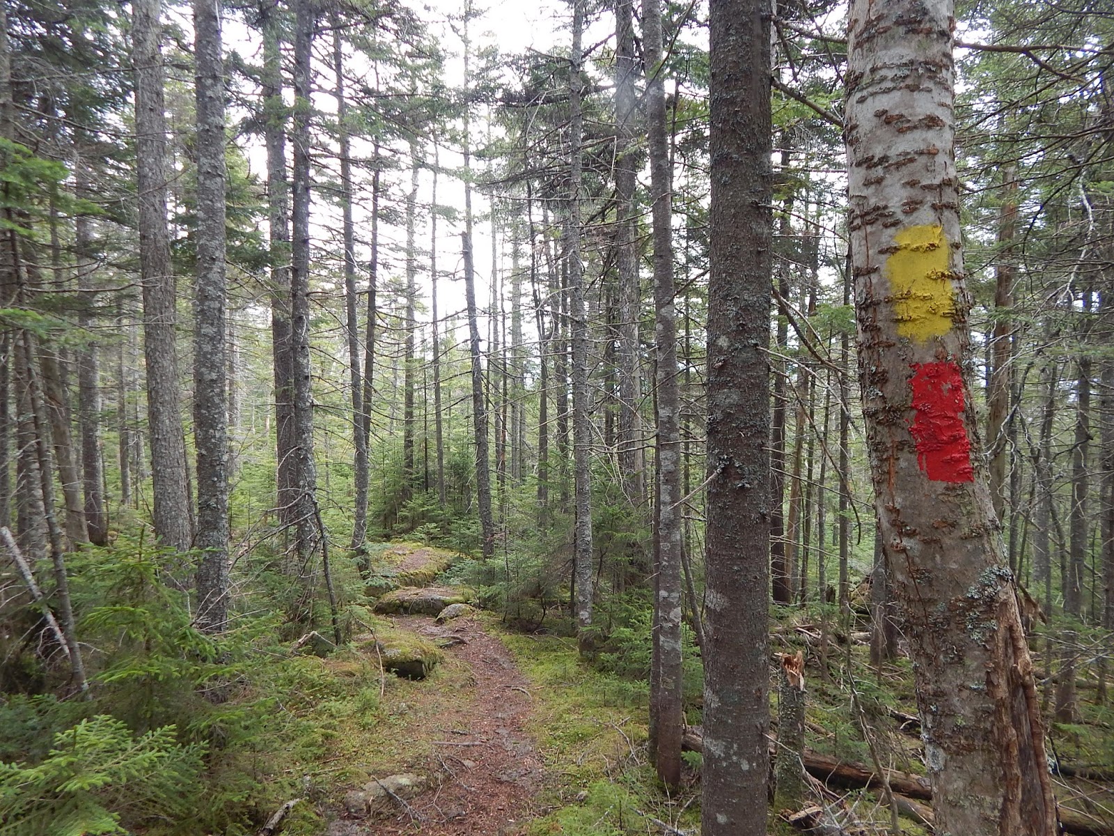
The trailhead is hard to find, and there's barely any sign of it being there. You can find parking on Mountain Road, and the trail is wide as it follows a stonewall. You'll know you're at the right spot when you see a sign restricting motorized vehicles. There's sparse yellow-blazing. We soon came to a sign saying Helen's Trail, and it had a map of the trails.

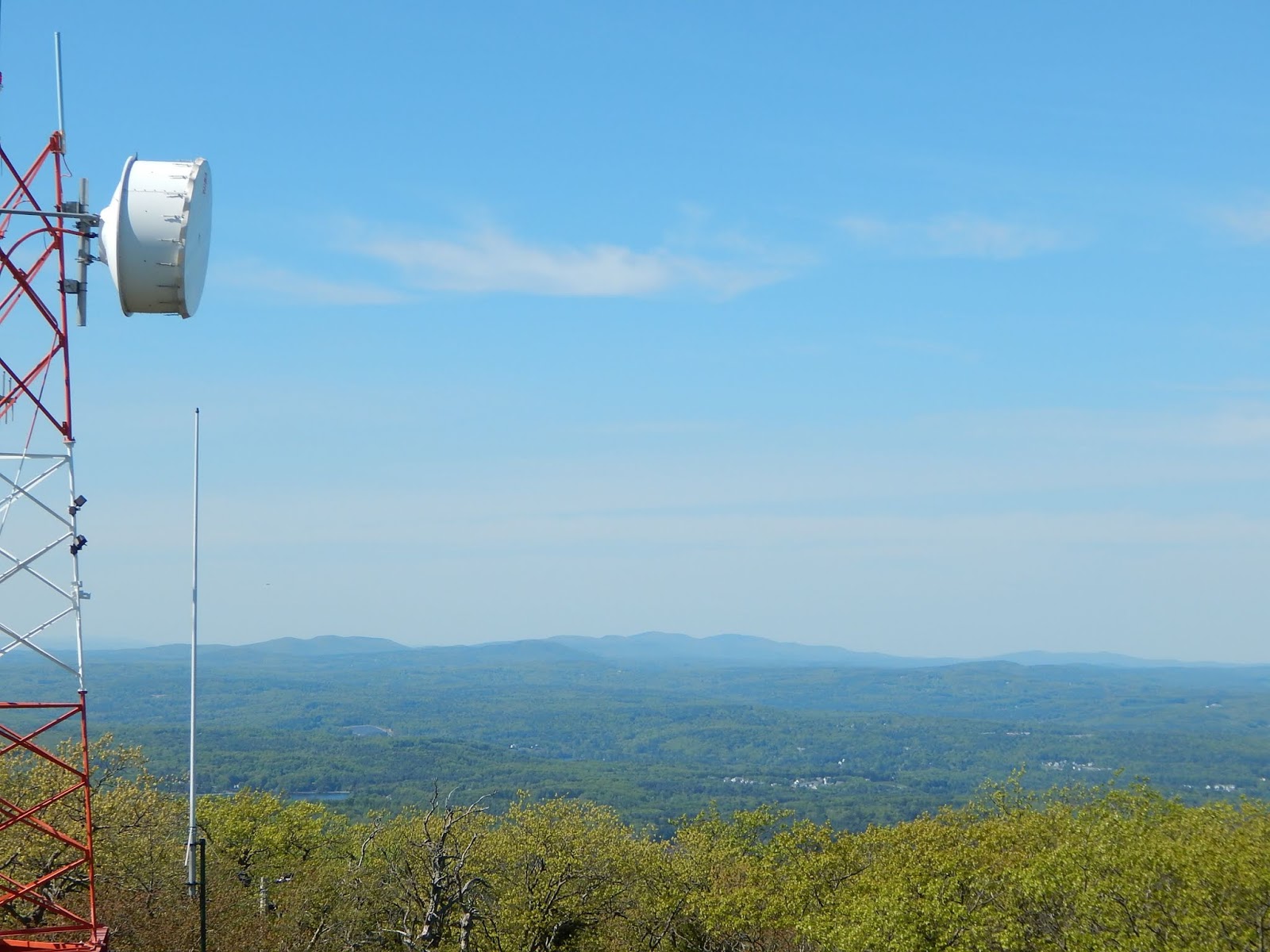
The trail climbs shortly to the summit area of The Pinnacle. The forest is open and plentiful in underbrush. There are sparse views looking south from here. The view looking north is better, and Mt.Monadnock, Rose Mountain, and Mt.Kearsarge in the north.


Mt.Kearsarge from The Pinnacle. The minor summit over the flat hill to the left is Smarts Mountain, which is 63 miles away.

The trail between Rose Mountain and The Pinnacle isn't blazed, but it's very easy to follow, as it's a solitary ski mobile trail. The trail crosses few brooks and ledges, and it's a pleasant hike. On the ascent to Rose Mountain, we passed an old rusty car and other remnants.


Remnants of a rusty car alongside the trail.

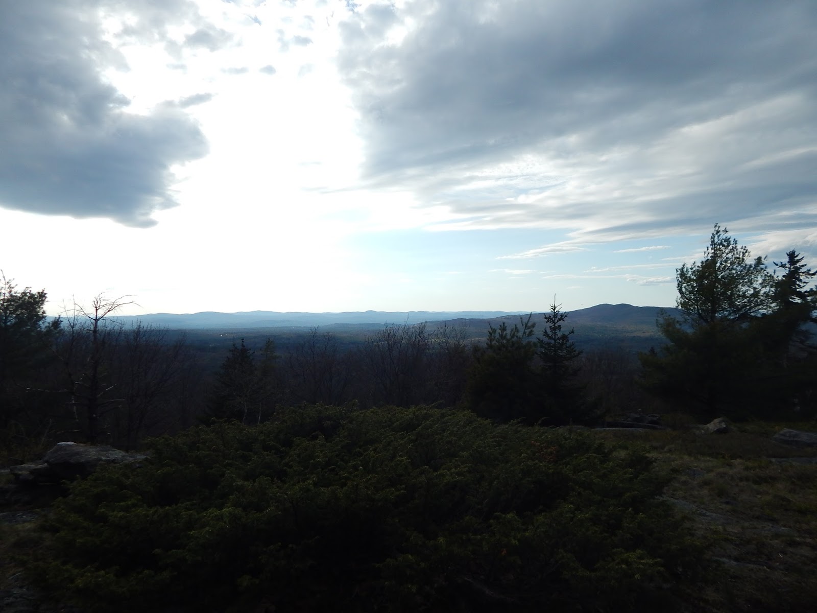
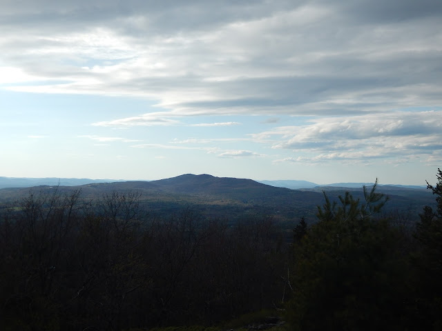
More and more ledges appeared as we neared the summit. The summit began to open up as we saw a large cairn atop the mountain. Looking back down the trail gave us a view of the Wapack Range and Mt.Wachusett.


Looking back down the trail. Bella is having a good time.

We headed over to an open ledge with chairs made of rocks! A large cairn also sat atop this ledge. From here we saw Mt.Monadnock, in center shot. This mountain would be a great place for sunset!


Mt.Monadnock from Rose Mountain.

After spending some time laying in the stone chairs (which were quite comfortable), I headed down to a lower ledge with a grand view looking north. I was able to locate Osgood Hill, Skatutakee Mountain, Bald Mountain, and Crotched Mountain. A nearby ledge also offered a view looking all the way out to Belknap Mountain.


The view from Rose Mountain with Crotched Mountain to the right.

The entire summit area is open and covered in shrubs and ledge. Many stone chairs and large cairns pepper the summit area. The hike back was pleasant and calming. We took the opposite side of Helen's Trail on the way back (the trail loops around The Pinnacle).


GALLERY
The true summit of The Pinnacle.
Looking south from The Pinnacle.
The forest atop The Pinnacle.
The Pack Monadnocks from The Pinnacle.
A view from The Pinnacle. Rose Mountain is to the left while Crotched Mountain is in center shot.
Bella ascending Rose Mountain.
The highpoint of Rose Mountain. Mind the bugs!
A wider shot of Mt.Monadnock from Rose Mountain.
Temple Mountain in the Wapack Range.
The large cairn with chairs to the left.
Crotched Mountain from the second ledge.
Crotched Mountain
The skyline of distant peaks from Rose Mountain.
Belknap Mountain from Rose Mountain.
Mt.Chocorua, at 75 miles away!

The hike was good, and obscure, as there's very little info on it. The views are incredible, and many notable peaks can be seen such as Mt.Monadnock, Mt.Kearsarge, Belknap Mountain, and Mt.Chocorua. Lyndeborough Mountain is worth a trip, and it's rather calming on a weekday. I don't know how the mountain is on a weekend, but I doubt it gets that busy. If you're looking for a easy and quiet experience with great views, I would highly recommend this one.

Spring Time on North Percy Peak

The Percy Loop is a popular hike contained within Nash Stream Forest, and it's no question on why it's so popular. North Percy Peak is a bald dome, towering above South Percy and Nash Stream. It's on the 52 With A View list, and it's likely one of the best ones on it.


The summit sign with elevation.

Nash Stream Road was closed, and a gate blocked it off about 2 miles away from the closer trailhead. The gravel road is easy to follow. We began up the closer segment of the loop and we followed it up, occasionally passing Slide Brook. The trail also passes many slides with fair views.


A view from the first slide.

The trail climbs steeply from the slides and it began to flatten as it reached the col. There was more and more snow in the col, but not enough to need snowshoes or any other equipment. We came to a junction with the Cohos Trail, a long distance trail that goes from the Presidential Range to the Connecticut Lakes.


A portion of the Cohos Trail.

We reached the side trail that lead up to North Percy Peak. This portion of trail was narrow and filled with ice and snow, but it still wasn't that bad. The first portion of ledges are very steep, and luckily, none of the rock was wet or slippery. The first view we got was looking out to South Percy and the Pilot Range.


Looking south. Notice the snow in the col.

The summit is so unique. The entire steep, bald summit of the mountain offers views in all directions. We could see Burke and East Mountain in Vermont, the Mahoosuc Range in New Hampshire and Maine, and the Northern Presidentials.


The Mahoosuc Range from North Percy Peak.

Below is a zoomed shot of East Mountain in Vermont and it's abandoned radar station. I like to photograph this peak due to the abandoned fort atop it. I've also photographed East Mountain in my Burke Mountain blog (blog here).


Lyndonville Air Force Base atop East Mountain.

We had a great view looking north as well, and we could see Long Mountain, Whitcomb Mountain, Mt.Blue, Savage Mountain and Sugarloaf Mountain, another 52 With A View.


Looking north with Savage Mountain to the left and Mt.Blue to the right.

We started to head back down the peak, but the great thing about North Percy Peak is that you get views all the way up and down after the junction with the spur trail. The main view from here includes South Percy Peak, Christine Lake, and Victor Head. The village of Percy surrounds Christine Lake, and the town is the namesake of the mountain.


Looking down the trail towards Christine Lake and Victor Head.

The Cohos Trail leads north, and we followed it. The snow on this side of the mountain got pretty nasty, but we still didn't need any extra equipment. We passed the Trio Trail and Percy Camp, where the Cohos Trail continues north. The Percy Loop trail lead back to the road and we followed it back.


GALLERY
Another limited view from a slide.
North Percy Peak from below.
Looking southwest with Cape Horn in the middle.
South Percy Peak and it's slide.
Bella heading up the trail.
Another picture of Bella.
A better photo of Long Mountain.
The summit with Whitcomb Mountain in the background.
Bella on the summit.
The Pilot Range in center shot.
The Mahoosuc Range in the distance.
East Mountain in the distance.
The northern Presidentials.
Savage Mountain in the north.
Looking at the White Mountains.
The incline of North Percy Peak.
Bella on the road with North Percy Peak in the background.

Overall, it was a great day, and much better than the first time we came here. The first time, we didn't achieve a single view from either summit. We also decided not to do South Percy Peak, as it was steeper and mostly in the trees, so the snow and ice would have been tricky in some places. Luckily all this snow is melting. Looks like spring has finally sprung!