Napatree Point and Fort Mansfield

Napatree Point in Westerly, Rhode Island is now contained in conservation land. The peninsula is plentiful in history, with it's grassy dunes and rocky coasts, along with the hidden gem of Fort Mansfield. The name "Napatree" is derived from the words "neck of trees", as before the Great September Gale of 1815 struck, the entire peninsula was forested. Today, the beach is bare of trees, but covered in history.


The southern side of Napatree Point.

The beach is sandy in the beginning, but it's also covered in shells and ducks. At least fifty ducks were swimming along the coastline. There was also several bricks and concrete chunks in the sand. This is due to Fort Mansfield, but I'll explain this later.


Ducks!

Long strings of yellow rope are there to gate off portions of the dunes. As I said, this is conservation area, and it's there to help let the dunes grow back. Once the trail reaches the western end of the cape, it rises off of the coast onto rocks.


The western end of Napatree Point.

This area is covered in old pieces of brick and hardened clay. Large chunks of concrete also lay on the water. We also found a fishing rod and rusted knife on the rocks. All of the debris is from Fort Mansfield, which is deep within the bushes from here.


Battery Wooster from Battery Crawford.

Fort Mansfield was built in 1899, but it only lasted until 1917 when they realized that there was a major blind spot in the area that the guns couldn't shoot at. Battery Wooster and Battery Crawford are all that remain. All government buildings were demolished in 1928, and this is the source of all the bricks and concrete. Battery Connell wasn't demolished either, but due to the coastline of Napatree Point shrinking by 200 feet from then, the battery has been consumed by the tides.


Looking at Connecticut from Battery Crawford.

Unlike Fort Wetherill, this fort is very hard to access. There is a very tall fence surrounding the walls and large metal sheets covering the ladders. We were still able to access it. While Fort Wetherill is higher up and set for drainage, Fort Mansfield is neither of these things, and the lower halls and rooms are flooded. Also, the fort is named after Joseph K. Mansfield, an officer in the Mexican War who died in the Civil War.


Looking into a dank room under Battery Crawford.

After exploring, we trampled through the undergrowth and found ourselves back on the beach where we could see old wooden posts in the water at the site of Battery Connell. My sister also found a dead fish in the sand. It looks like a small shark, so if anyone knows what it is please identify it.

GALLERY
The northern side of Napatree Point with Watch Hill Cove to the right.
The coastline at Napatree Point.
Another portion of the north side.
Likely seagull footprints.
Debris of the government buildings.
The fishing rod and rusty knife.
Mind the glare in this photo of Battery Crawford.
Battery Wooster in the background.
A hallway in Battery Crawford.
Looking down Battery Wooster.
A worn staircase entering Battery Wooster.
Looking off of Battery Wooster.
Looking down on Battery Wooster.
All that remains of Battery Connell.
What kind of fish is it? If you know what it is then tell me.
One last photo of Napatree Point.

The walk back was calming and windy. Many people were walking alongside the monstrous waves. Kites were in the sky and surfers were in the ocean. This destination is just yet another remnant of coastal bases on the east coast. These types of places run from Texas to Maine, and many can be found in New England. Fort Wetherill was the first of many forts and batteries I will be visiting.

Kidder Mountain

Being a fan of the Wapack Range, I've been wanting to do Kidder Mountain for a while. The mountain, at 1,804 feet, lies just over the border in New Hampshire. The entire mountain was covered in pasture back in the day, but today, the forest is making an attempt to reclaim the fields and ledges that pepper the summit.


Mt.Monadnock from the field on Kidder Mountain.

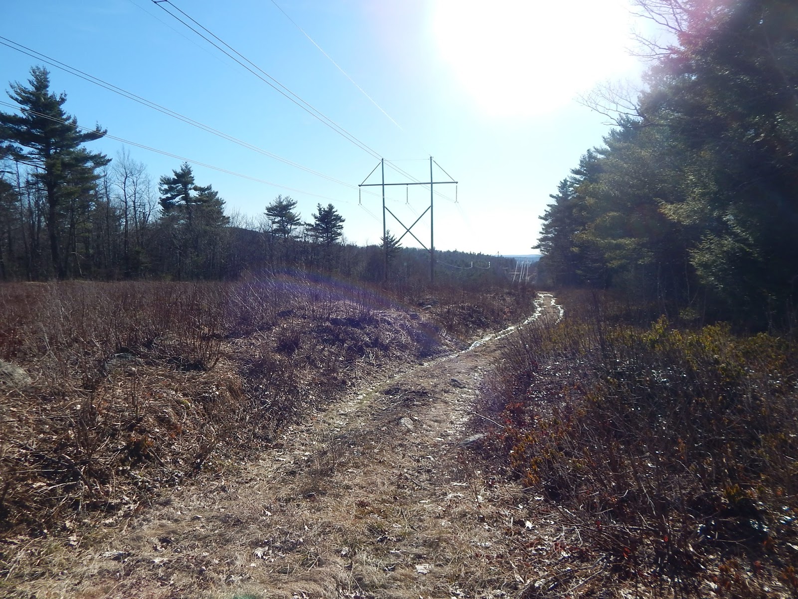
After parking on Chapman Road, we began down the Wapack Trail heading south. The left side of the trail has several "No Trespassing" signs posted on trees. The trail comes out to a line of power lines which we needed to follow for a bit after we left the Wapack Trail. It soon reentered the trees.


A portion of trail on the power lines.

The trail was swampy in some places and there were a few patches of snow aside the trail. Through the trees, we could see large ledges with grassy spots. Strangely, the trail came up to a side trail with large metal plant pots. There are many logging roads on the mountain, but there was no good reason for these to be here.


The pots on the trail make it appear as a grand entrance.

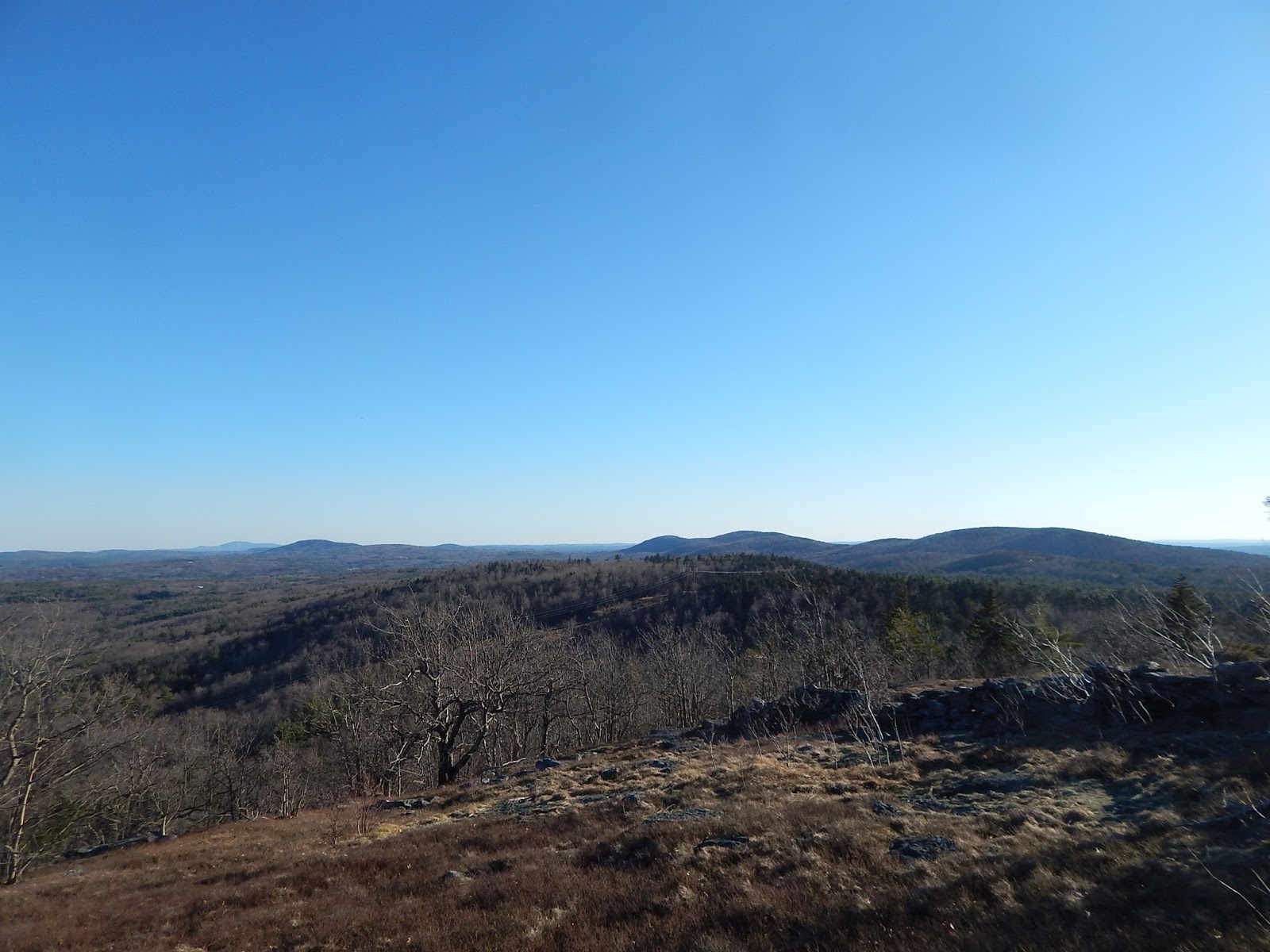
After taking a rocky trail from the pots, the trail enters the border of a field with a side trail leading to the other side of the field. This spot offered a great view looking over to the northern portion of the Wapack Range. I was able to name Temple Mountain, the Pack Monadnocks and Lyndeborough Mountain.


The Wapack Range from the first viewpoint.

This isn't the only viewpoint on the mountain. After rejoining the trail, we followed it up for a hundred more feet and arrived at the main view. This spot is also grassy, but it also has ledges and a stonewall. The stonewall is just a remnant of the times when this summit was covered in farmland.


A cairn with the stonewall to the right.

A large cairn marks the summit, and from it we could see the southern Wapack Range and Mt.Wachusett. We could also see the old slopes of an incomplete ski area on the backside of Mt.Watatic (blog here).


Mt.Wachusett is the one in the background to the left, and Mt.Watatic is in front of it.

Knowing that you can see the Boston skyline from Mt.Monadnock and Mt.Watatic, I figured we could see it from where we were. I attempted to take some photos of the city.


A hazy photo of the John Hancock Tower and Prudential Tower.

After trying to get to the highest point, we found a herd path lead to what was likely a geochache. The last person to find it probably didn't know what it was due to them leaving it open and causing the log to get wet. I sealed it back up and put it back in the right location.


GALLERY
The trail as it runs through a field.
Temple Mountain and the Pack Monadnocks through the trees.
Mt.Monadnock through the trees.
Looking into Massachusetts.
Mt.Wachusett behind Mt.Watatic.
Barrett Mountain passed the stonewall.
The summit area.
Looking towards Boston.
The best photo I captured of Boston.
The stonewall on the summit with Mt.Watatic on the other side.

Kidder Mountain is not too different from Mt.Watatic. Both have the same terrain and history surrounding them. I would recommend both hikes. If you want to get away from crowds that gather atop Mt.Watatic, I would choose Kidder Mountain. The biggest bonus about Kidder Mountain, is that it has the same views as Mt.Watatic, but also views looking north at Mt.Monadnock. Both are great, so head out there and get hiking!

Alone on Burke Mountain

Burke Mountain stands tall above the nearby villages in the Northeast Kingdom of Vermont. The mountain, at 3,260 feet, is an active ski area today, but I climbed it off season. This hike is important to me, as my dad was taking part in a bike race in the area at the time, and Burke Mountain is the first mountain I've ever climbed alone. It was just me and my dad's friend's dog, Owen, who climbed the mountain.


The snow-dusted summit of Burke Mountain.

Me and Owen took the Red Trail to the summit. The deepest the snow got was about 3 to 4 inches deep. Most of the Red Trail was easy to follow, except for the very beginning after I left the snowmobile trail. The path turns up the mountain until it reaches a CCC Road. This road leads from the ski slopes to a shelter behind the mountain. The Red Trail continues past this road and ends at a shelter.


The shelter atop the Red Trail.

This shelter marks the sight of where the trail splits into two blue-blazed trails. I took the longer West Summit Trail for the views. This portion is steeper and icier, and most of the blazes are faded, which makes it hard to follow. When I lost the trail in some spots, Owen was able to guide me back to the trail. Soon, the trail began to rise above the trees where it reached a ledge looking over to Mt.Mansfield.


Looking over to the Green Mountains with Mt.Mansfield in the background.

The trail wraps around the West Peak and soon reaches another view looking south at Kirby Mountain and Franconia Notch. Mountains that I could see from here included Mt.Garfield, Mt.Lafayette, Cannon Mountain and Miles Mountain.


Looking at the White Mountains with Cannon Mountain to the right.

The trail reaches the Upper Willoughby slope where Willoughby Gap can be seen. Willoughby Gap includes Mt.Hor to the left and Mt.Pisgah to the right, with Bald Mountain towering over both.


Willoughby Gap to the right with Bald Mountain to the left.

Me and Owen climbed the slope to the Ski Lift and the rest of the trail which leads to the fire tower. I decided not to climb it due to all the large chunks of ice falling off the tower. I didn't need to climb it to still achieve some great views.


The icy fire tower.

The Profile Trail leads to the open summit with views looking out to the White Mountains and East Mountain in Vermont. From here, I got the best views from in between the trees. Franconia Notch, The Twins, Cannon Mountain and the Presidential Range can be seen. It was actually warmer on the summit than it was at the base lodge.


The Presidential Range through the trees.

After taking more photos and exploring the summit, I decided to head down the Willoughby slope due to the trees starting to drop large chunks of ice. I feared one could fall on me or Owen. Down this trail, I got a great view of Willoughby Gap and East Mountain, with the abandoned Lyndonville Air Force Station atop it. 


East Mountain with the air force station on the summit.

We reached the base lodge where the bike race started to end. Let's just say that Owen was very tired once we reached the lodge!


GALLERY
The profile of Mt.Mansfield, with The Chin to the right.
Owen on the open trail.
Looking at the White Mountains with Kirby Mountain in the foreground.
Lyndonville Air Force Station atop East Mountain.
The top of the Ski Lift.
The White Mountains from the summit of Burke Mountain.
The Lowell Mountains with Jay Peak and Big Jay in the background.
Willoughby Gap with the Green Mountains in the back.
The Ski Patrol hut with Bald Mountain in the background.
More distant peaks.
Burke Mountain from the base.

Burke Mountain was a great hike for me. Being my first hike to do alone completely, I felt pride and confidence at the end. Me and Owen helped each other equally. I lost the trail and he helped me find it, and I helped him up steep icy slopes where he needed to be pushed up. It must be fun to ski Burke Mountain, but it's a different story when you climb it!