March is a perfect month to go to the beach. Not to swim, of course, but rather to have some quiet time, really meditate to the sounds of the waves crashing, relax. You'd be hard-pressed to find your typical, obnoxious summer crowd on the beach during this time, due to the remnants of winter still blowing-cold along the coast. If you can put the temperature aside, it truly is a great time to be out.
Fisherman's Memorial State Park
Former military fort turned campground, Fisherman's Memorial is a place rich in history. This area was once known as Fort Greene, named after Nathanael Greene, a Revolutionary War general, who served under George Washington during the Siege of Boston.
The base was built in 1943 during World War II, as the first line of defense to any would-be invaders of Narragansett Bay. The site grew to include a few 16"/50 caliber Mark 2 guns (can't say I know what any of those numbers mean, but it sounds menacing). These guns had a range of 45,000 yards, in all directions! Also on base was a plotting room, military bunkers, and a fire control tower disguised as a barn silo.
 |
| Looking over Point Judith from atop the old fort. |
 |
| Another section of the base. Likely to be where one of the Mark 2 guns were housed. |
Certain sections of the base were abandoned after World War II, leading to the state purchasing the property in 1953 with the hopes of turning it into a state park. They were successful in their efforts, and ended up naming it Fisherman's Memorial, to thank all local sport and commercial fisherman who keep Rhode Island's economy alive.
Battle of Point Judith
I can't go any further without acknowledging one of the few battles during World War II which took place off the coast of the United States. As the name implies, the battle transpired right off the rocky cape of Point Judith, in May of 1945.
Several German ships were surveying the American coastline that month, one of which was U-853, a German submarine stationed in Block Island Sound. In the same area was the SS Black Point, a collier ship (designed to transport coal) which was heading for Boston. Without being provoked, the German U-boat fired upon the ship, sinking it immediately.
It took a day of searching, but finally, the German U-boat was located, and bombarded by two blimps and the USS Moberly. The ship had been sunk, everyone on board drowned, succumbing to the cold waters surrounding them. By the end of the battle, 12 Americans had died, along with all 55 passengers of the U-boat. Germany would surrender only two days later.
 |
| Some folks say you can see the ghostly apparition of the USS Black Point, still in the midst of it's final voyage. |
Sunset From Point Judith
The Point Judith area is beyond words, it's one of those "legendary" New England locales that you hear about from tourists. This is with good reason, whether it be a warm summer day or a breezy Saturday night in March, it's surefire way to make memories you'll never forget.
I was with my family that March night, and the sky was beautiful. Bands of color laid across the sky, the bushes were beginning to bud as well, with the ever-present light atop the Point Judith Lighthouse visible for miles. All around, a great experience.
 |
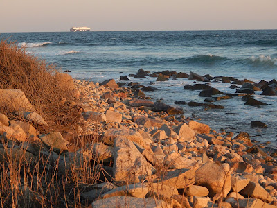
| The rocky shore of Point Judith, a cargo ship passing in the distance. |
 |
| The sun setting over one of the jetties, which was covered with people. |
 |
| Me, hoisting a piece of driftwood to the sky! |
It really doesn't matter what time of year it is, or what kind of person you are. Almost everybody can find beauty in places like this. And unlike a mountain, which can only be reached by a long, strenuous trail, it's accessible to everybody. Not only does Point Judith have history, but it has plenty of beauty to go along with it.


