Showing posts with label Monadnock Area. Show all posts

Mt.Monadnock for Sunset

You may be privy to the fact that I had climbed Mt.Monadnock about two months ago in order to watch the sunrise. The mountain was a superb choice, with it's close proximity to us, it's easy to see such sites as we don't waste hours just getting to the trailhead. If it's good for a sunrise, then it's good for a sunset, at least that was the idea. Judging by what we saw, it's safe to say it's a perfect spot.


There's nothing else like a beautiful sunset...

Besides my dad and I, we had another hiker with us today, Chris, an excellent photographer from New Haven. We took the most expected route, White Dot Trail, and because we were climbing it in hopes to see the sunset, we began our hike late, whilst everyone else was heading down. Luckily, all the snow had melted, and the trail offered the same spectacular views and exciting climbs as usual.


The Wapack Range, from the Pack Monadnocks to Mt.Watatic.
Showing the loneliness of Mt.Wachusett.
Looking down White Dot Trail.
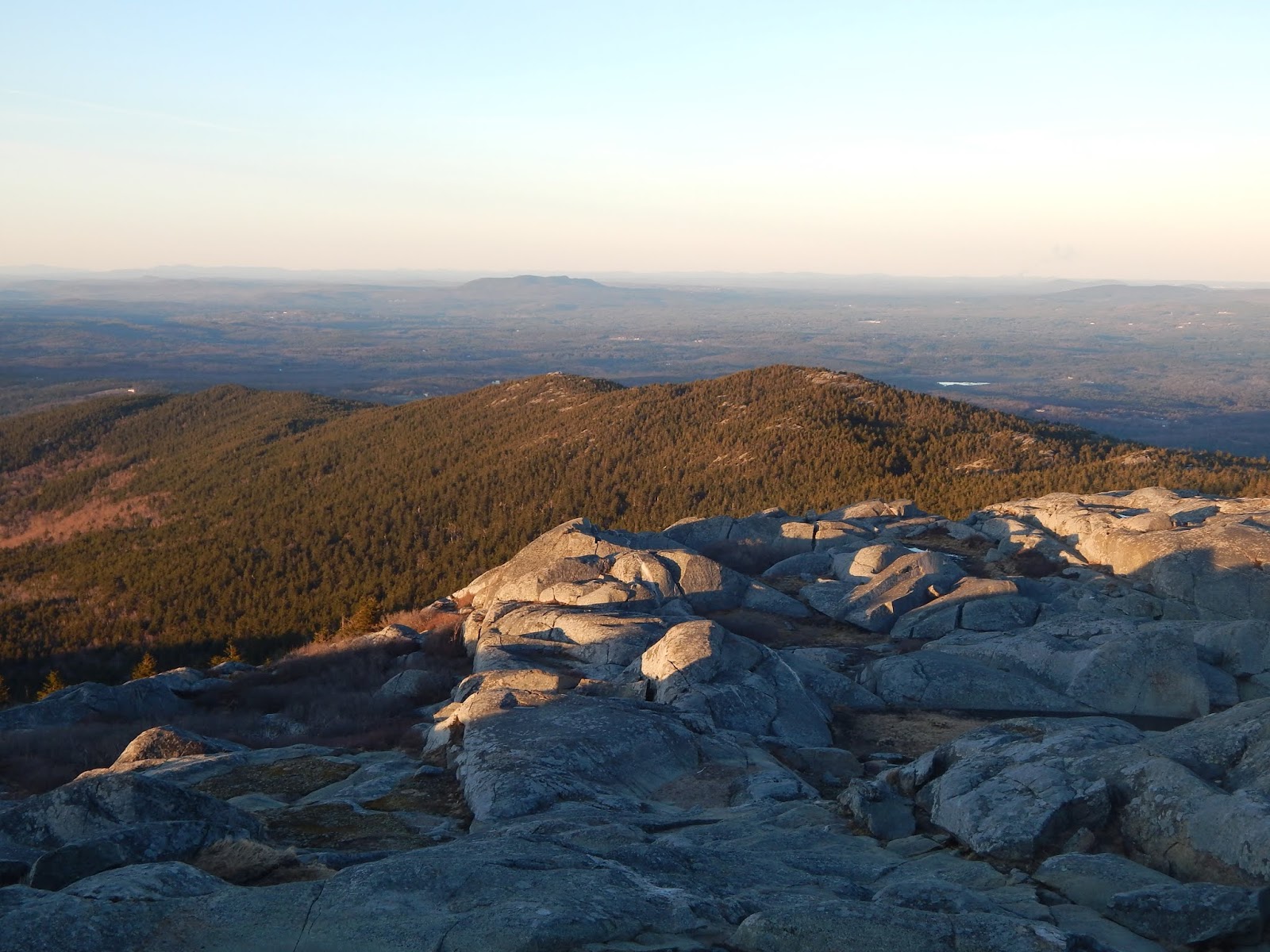
Town Line Peak (left) with Crotched Mountain alone in the distance.
The upper portions of White Dot Trail.
White Dot and White Cross.
Only a bit of ice here...

Once we were close to the top, we thoroughly explored all the ledges and folds in the rock, as we had plenty of time to spare. With it being spring, there was no haze, meaning we had some of the clearest views you could achieve from Mt.Monadnock. The entire Wapack Range was visible, along with Crotched Mountain and Mt.Wachusett. Did I mention there was nobody else up there with us?


White Dot Trail sign with Kiasticuticus Peak below.
Gap Mountain and Little Monadnock far down below.
Crotched Mountain

The sky began to fill with the early signs of sunset, soft yellows and dull oranges, so we scrambled up the rest of the way, all the way up to the summit, still with an hour to spare. The horizon was so clear, and the air was crisp, and many mountains could be made out. In Vermont, you could see Mt.Haystack and Mt.Snow, Stratton Mountain, Bromley Mountain, Salt Ash Mountain, and the numerous peaks of Mt.Killington (Killington, Mendon, Pico, Shrewsbury).


Stratton Mountain (left) with Bromley Mountain (right)
Looking toward Killington Peak and Mt.Ascutney.
The Coolidge Range with Salt Ash Mountain and Killington Peak.

The temperature was comfortable, and the weak wispy breeze was soft and soothing. Other peaks that could be seen to the west included Gap Mountain and Little Monadnock in the foreground, along with Mt.Ascutney to the northwest and even Mt.Greylock to the southwest.


A plane in the sky.


The soft outline of Mt.Greylock.

Looking into New Hampshire could be seen Dublin Lake, Croydon Peak, Mt.Sunapee, Mt.Kearsarge, the Belknap Range, Mt.Chocorua, and, the still lightly snow-capped Mt.Washington. The sky began to get more and more vivid as time went on.


Looking into New Hampshire.
Looking northeast. The Belknap Range is in the distance to the far left.
Mt.Kearsarge
The best I could capture Mt.Washington.

As oranges filled the sky and clouds darkened, the sun began to set just south of Stratton Mountain, with beautiful colors and soft light. The east side of Mt.Monadnock began to darken as the west side was lit up one last time for the day. It was truly a one of a kind sunset, and I enjoyed every single second of the site.
Sunset from Mt.Monadnock
The sun setting over Vermont.
A few more seconds and it's gone...
The colors of sunset over Stratton Mountain and Keene.

With the sun now fully tucked away beneath the Green Mountains, the lights of nearby Keene and Jaffrey turned on, signaling to us we should begin our way down. We took White Cross Trail, and much like White Dot Trail, it was calm and easy, with occasional glimpses through leafless trees to the illuminated streets of Jaffrey.

Was this brief climb worth the effort, certainly, and I'm happy to know I was able to witness it. The best times of year are when the haze is gone and the air is crisp, like spring and fall. These are the times of year you should be making memories in the mountains, these are the times when you can fully enjoy yourself without the chilling cold of winter or stunning heat of summer. This is the time of year to be outside.

Sunrise from Mt.Monadnock

A new month, a new sunrise! It's finally time to strap on the snow boots and climb up Mt.Monadnock, a classic hike known for it's scenery and convenient proximity to cities like Boston and Manchester. While the mountain easily gets crowded on a pleasant summer day, less hikers can be found around the mountain on an early morning in the midst of winter. The sunrise from here is delightful, along with all other sites along the slopes of the mountain.


The sunrise from the cairn below the summit.

This is our second attempt of achieving a sunrise from Mt.Monadnock this month. Last weekend, we awoke very early in hopes of being rewarded with a pleasant sunrise, but clouds limited our visibility, and the sun stuck around for about a minute. While some people may take this as a failed hike, we took it as an invitation to come back for another.


The sunrise from our first attempt.

Early in the morning, my dad and I found ourselves at the Mt.Monadnock Headquarters, the trailhead for White Dot Trail, the most well trodden route to the summit. The lower reaches of the trail lacked in snow and ice. Almost the entire trail was bare of snow, only on the uppermost bald slopes of the mountain there were some hefty patches of ice.

Eventually, we arrived at the large cairn just below the summit, which made for our viewpoint of the sunrise. The sky began to light up, as several others continued up to the windy summit. Minutes went by, then the sun began to rise.


The sun rising above Temple Mountain.
The sunrise, with the Pack Monadnocks in the center of the photo.

While the sun made for a pleasant sight, it didn't stop the chilling breeze hitting our backs. We didn't stay around too long, but at the same time, it was very difficult to simply walk away from the gorgeous sight. From here, we started our way up to the summit.


Another photo of the sun.
Gap Mountain and Little Monadnock (to the left) during sunrise.
Sunlight...

The wind was hidden behind the summit as we climbed higher and higher up the craggy slopes of the peak. Immediately after arriving at the summit, we were struck with a strong wind gust blowing us from the north. The summit was desolate, and the winds and temperature were the source of this.


Slopes of the summit during sunrise.
Taken from the summit.
Looking toward Town Line Peak.

After trying to enjoy the views from the summit, we headed a few hundred feet down the Dublin Trail until we found the White Arrow Trail, our primary way of getting down. I snapped a few more photos while on the ridge, then ducked down onto the trail to escape the wind.


The last photo of the sunrise.
The White Arrow Trail leaving the ridge.
Looking to Crotched Mountain, with Mt.Kearsarge in the distance to the left.
Mt.Ascutney in the center, with Killington Peak to the far left.

The White Arrow Trail wound down a steep ravine heading straight down through rough terrain. It winded below the summit, with beautiful scenery. There were several small patches of ice and snow here, some treacherous, especially without spikes. There are several good views here looking out to Gap Mountain, Little Monadnock, and even Stratton Mountain and Haystack Mountain in Vermont.


Looking down White Arrow Trail.
White Arrow Trail
Looking to Vermont, with Haystack Snow, and Stratton Mountains visible.

The path slowly morphed from rocky flats to a snowy forest. The trail from here became completely frozen over with ice. Not an inch of the trail from here wasn't covered in at least two inches of ice. Spikes are needed here. From flat spots to steep slopes, the entire White Arrow Trail was an enormous ice waterfall.


The large frozen falls on the trail.
More ice.

After the slippery, strenuous descent of White Arrow Trail, we came out to the ruins of the Halfway House, a former hotel built in 1858 that, at it's peak, could accommodate 100 guests. The building burnt down in 1954, but artifacts can still be found here to this day, along with a view looking southwest toward Troy.


The site of the Halfway House.
Some ruins of the buildings.
The old site of the Halfway House.
The view from the Halfway House.

We found our way to Hello Rock Trail, a footpath mixed with all the other random trails that squirm through the forest in this area. The trail had little ice, and clearly receives virtually no use in the winter. The trail winded up to the Cliff Walk Trail, where we laid ours eyes on Hello Rock, a large prominence along the trail that's made up of a large mossy rock with views over to the Wapack Range.


The top of Hello Rock.
Looking to the Wapack Range from Hello Rock.

After continuing down the steep, craggy slopes of the Cliff Walk Trail, which had more icy falls on it, we made our way to Parker Trail, which walked along the outermost reaches of the mountain. We crossed a bridge at one point which brought us to Hunter Rock, a large boulder used by hunters as a lookout for wildlife.


My dad standing in front of Hunter Rock.

Finally, we walked the rest of the icy trail until we reached Poole Reservoir, which offered a final view looking back up at the immense, bald slopes of Mt.Monadnock. We stopped for a few photos at the dam, then continued through the picnic area to the base.


The dam at Poole Reservoir.
Mt.Monadnock from Poole Reservoir.

As generic as it may be, Mt.Monadnock still made for an impressive sunrise. Ice and snow won't stop us from achieving yet another amazing journey. All the different trails of Mt.Monadnock are worth exploring, and many sites can be found that open a new page in the history of the mountain. Remember to comment, and thanks for reading!