Showing posts with label Baxter State Park. Show all posts

An Overlooked Summit: Black Cat Mountain

Climbing a mountain and observing a mountain are two different stories. A summit may appear different from the ground than it does if climbed. There is no better example of this than Black Cat Mountain, a summit on South Branch Mountain in northern Baxter State Park. The mountain as a whole is often overlooked. When seen from below, it appears as a big forested peak, but in reality, the summit area is like a meadow in the sky.


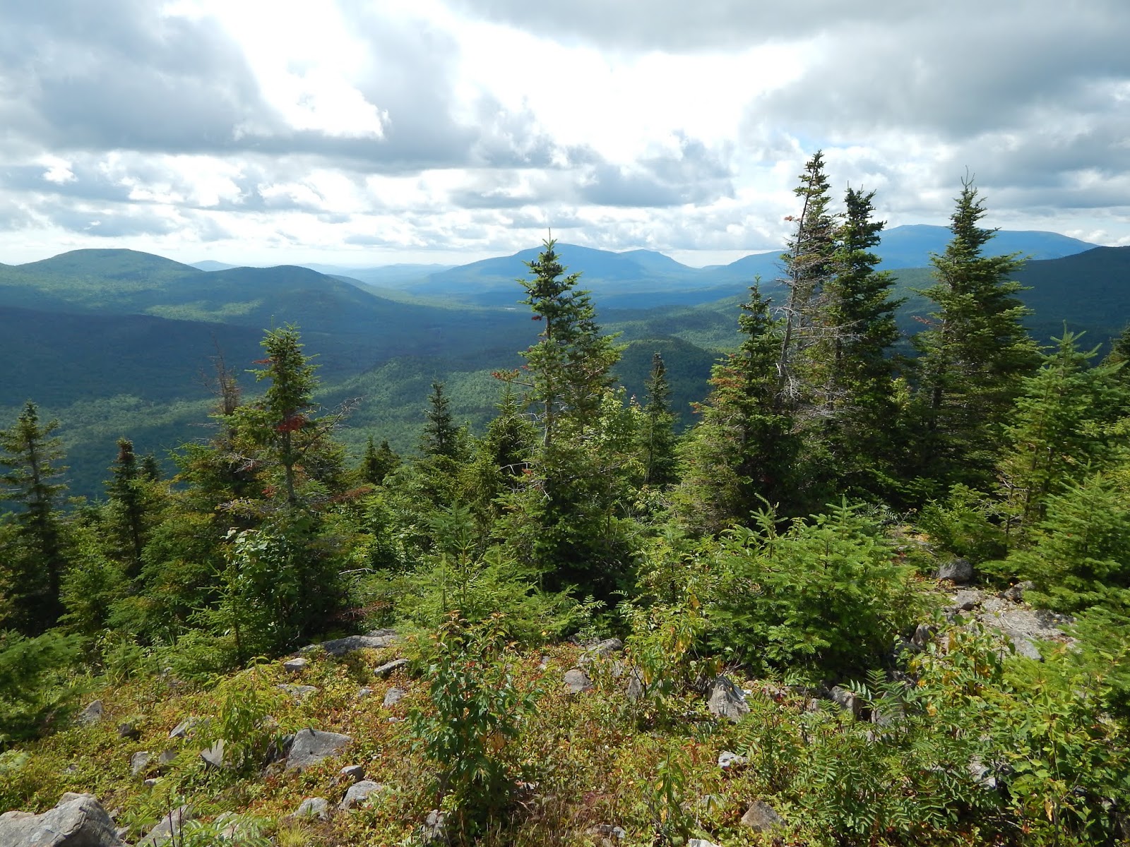
Looking south from one of many meadows atop Black Cat Mountain.

The peak is very unique, and this fact is evident just by looking at the trailhead, which immediately begins by crossing South Branch Brook. There is no bridge, and there are no rocks to hop across, which means you must ford the stream. After the crossing, the trail follows the shore for a short while, until reaching the junction with the remote campsites.


The trailhead for Black Cat Mountain.
We're going right!

The path wound through the forest easily for a while, until reaching a rocky protuberance. It then climbed steeper until reaching a small rocky knob with a minor view directly north. It then climbed even steeper until reaching a second rocky knob just below the summit, with  a great view looking toward The Traveler massif.


Looking north from the first knob.
Peaks Visible: Willard Mountain, Norway Bluff, Mooseleuk Mountain, Peaked Mountain
Looking up the steep trail.
North Traveler, The Traveler, and Peak Of The Ridges
from the second viewpoint.

Once again, the trail climbed higher, at an easy grade this time. The forests were pleasant, and there was a ton of moose scat along the trail. I'm very surprised we didn't run into one while we were up there. Eventually we were lead to the summit of South Branch Mountain. The signs on both summits are a little short of the true elevation. There are no views from this summit.


The summit of South Branch Mountain.

The trail descended easily until it began to climb yet again. The distance between the two summits is only half a mile, so it didn't take long to reach the summit of Black Cat Mountain. The trail started to open up into a meadow, that had a small rock outcropping in the center, with a sign sitting atop the peak. The views from the meadow were stunning. Almost every mountain in Baxter State Park can be seen from here, even some peaks around Moosehead Lake.


Emerging into the summit area.
On the summit.
The Traveler from the summit of Black Cat Mountain.
The view from the summit toward North Turner Mountain.
Mt.Fort and North Brother from the summit.
Katahdin from the summit of Black Cat Mountain.

It was evident that most people stop at the summit, then go back the same way, but that's a big mistake, as there are much better views beyond. The trail continued through the meadow, which lead down further and further, with the occasional cairn. It opened up more, with better views toward Katahdin and North Brother.


Leaving the summit.
The view toward North Turner, Katahdin, and North Brother.
Doubletop Mountain can be seen prominently in the center.
North Brother and Mt.Fort sit high to the left.
Center Mountain and Strickland Mountain, as seen from the meadows.
Big Spencer Mountain can be seen just right of Center Mountain.
Looking southeast toward North Turner Mountain.

After the meadow, the trail descended through some large talus slopes, which offered incredible views looking west. The path continued to go in and out of trees until it reached a few wooded fields with no views. The path continued down the mountain steeply, with plenty of rocks. It can be hard to follow in some spots.


Looking east from the talus slopes.
The view facing northwest.
The overgrown trail heading down the mountain.

Soon, the trail brought us down to Upper South Branch Pond, where we crossed the stream and enjoyed views up to Center Ridge from the water. After a few bog bridges, we ended up at Pogy Notch Trail, then the day use site, which offered a great view looking up to South Branch and Black Cat Mountains. The meadow was hidden from here, almost as if the mountain is trying to conceal it's beauty.


The stream crossing.
An expansive view over Upper South Branch Pond.
One of many bogs.
Black Cat Mountain from the pond.

Black Cat Mountain is a breathtaking summit, where almost all the peaks of Baxter State Park are visible. Just looking at the mountain doesn't show it's true beauty, unlike peaks like Katahdin and The Traveler. With those summits, you know what you're getting into for the most part, but with Black Cat, it's astonishing summit area is disguised by the endless forests along it's slopes, and maybe that's for the better.

Barrell Ridge: A Hidden Gem

Tucked away in the wilderness of Baxter State Park can be found many hidden gems. It's difficult enough to get into the park, and even harder to find the best kept secrets there. One such sight is Barrell Ridge, which lies just north of The Traveler. Most people staying at South Branch Campground go canoeing, or hike The Traveler. It's as if nobody knows this place exists, even though the views are truly remarkable.

Bald Mountain from Barrell Ridge.

To access Barrell Ridge, we had to walk down Ledges Trail for a while. The trail was beautiful as it wound through yellow flowers and tall grass. We eventually reached the junction, and continued down Middle Fowler Trail, which when followed to it's end, reaches Middle Fowler Pond.

Ledges Trail
Looking up the path.
Continuing down Middle Fowler Pond Trail.

The trail climbed higher and higher until it reached the col between Little and Big Peaked Mountains. The path became rockier. Here, the trail opened up onto a few ledges, with views looking north to Norway Bluff and Willard Mountain. From here, the path continued back into the trees.

Looking north from the first few ledges.

We started going down for a while, but the trail passed several ledges looking up to Barrell Ridge, our destination. The trail came across a brook with a few waterfalls. The area was very beautiful, and the forests were thick and wild. Clearly, this trail doesn't get much use. We eventually arrived at the junction for Barrell Ridge.

The view up to Barrell Ridge.
One of the waterfalls.
Barrell Ridge
What an accurate sign!

After a few steep sections of trail, we reached the first few ledges, which had excellent views looking out to Bald Mountain and North Traveler. We went in and out of trees until we reached the summit, which was marked with a sign. There were great views looking out to other nearby peaks, like Trout Brook Mountain, Horse Mountain, and Bald Mountain.

Bald Mountain from Barrell Ridge. Mt.Chase with Sugarloaf Mountain
directly in front of it can be seen beyond to the left.
Looking northeast toward Trout Brook Mountain
and Billfish Mountain to the right.
Bald Mountain, with Lunksoos and Deasey Mountains visible in the distance.
The summit of Barrell Ridge.

Even though we had reached the summit, our hike wasn't over. We bushwhacked westward along the ledges until we came to a large rocky area with incredible views looking south and west. There was an especially good view looking over to Little Peaked Mountain from here.

Looking down Barrell Ridge.
North Traveler from Barrell Ridge.
Looking toward Little Peaked Mountain.
South Branch Mountain can be seen above the ridge to the left.
Looking back toward Bald Mountain.

It always feels great to explore new areas. While Barrell Ridge isn't too far from The Traveler, a mountain I've climbed before, I still got that sense, something reminding me that this is the most northern mountain I've climbed, and the farthest north I've been in general. It's far away from any signs of civilization, and very remote. I'm happy to know there are still places like this is New England.

Views From the Ponds: Daicey Pond and Grassy Pond

The state of Maine encompasses more than 6,000 bodies of water, some in rural flat lands, and others high atop mountains. These lakes and ponds play an important part in Maine's ecosystem. No where else is this fact better shown than in Baxter State Park. There are many ponds within the southern expanses of the park, two of them being Grassy Pond and Daicey Pond.

Dissipating clouds around Doubletop Mountain from Daicey Pond.

Both ponds are crossed by the Appalachian Trail, meaning this is one of the last sections of trail thru-hikers see when going north, as Katahdin sits just north of the Tote Road. We started from Katahdin Stream Campground, as the trail brought us over a pleasant brook and through some beautiful forests.

Looking down the Appalachian Trail.
Crossing Katahdin Stream.

Eventually the Appalachian Trail began to approach Grassy Pond. There were a few side trails leading down to a sandy bank along Katahdin Stream. From here there was a view of Moose Bosom Mountain and Doubletop Mountain. The Tablelands of Katahdin could even be seen poking out from behind the trees.

Moose Bosom and Doubletop Mountains
Looking up to Katahdin.

The trail wrapped around Grassy Pond until we came across a small open portion of the trail. There was a great view looking across the water out to Mt.OJI, a mountain named due to the three slides that can be seen along it's southern slopes, each one looking like the letters O-J-I. The letters have faded since, but it's still visible to an extent.

The view from Grassy Pond.
Mt.OJI with it's three iconic slides.
The peaks in the background to the right are Mt.Coe and South Brother.

The trail crossed a brook, then came to a junction, where we left the Appalachian Trail in order to follow the southern shore of Daicey Pond. I was surprised to see that this trail was overgrown, due to the fact that it offers great views across Daicey Pond over to Mt.OJI and Mt.Coe. There is an exceptional view of Doubletop Mountain from here.

Katahdin and The Owl from Daicey Pond.
Doubletop Mountain

After arriving at Daicey Pond Campground, we took the Appalachian Trail along the northern side of the pond where there were views over to Sentinel Mountain, one of the most southern peaks in the park, and one of the shortest. After enjoying the views on the way, we soon found our way back to Katahdin Stream Campground.

Doubletop Mountain from Daicey Pond Campground.
Appalachian Trail crossing.
Looking across Daicey Pond to the campground.
Sentinel Mountain is seen above the trees.

There are few hikes I write about that don't include mountains, and rarely do I make an exception. I'd like to change this, so if you would like more write ups like this, please comment below. A hike is a hike, whether there's elevation gain or not. As long as you get to enjoy nature, that's all that matters.