|
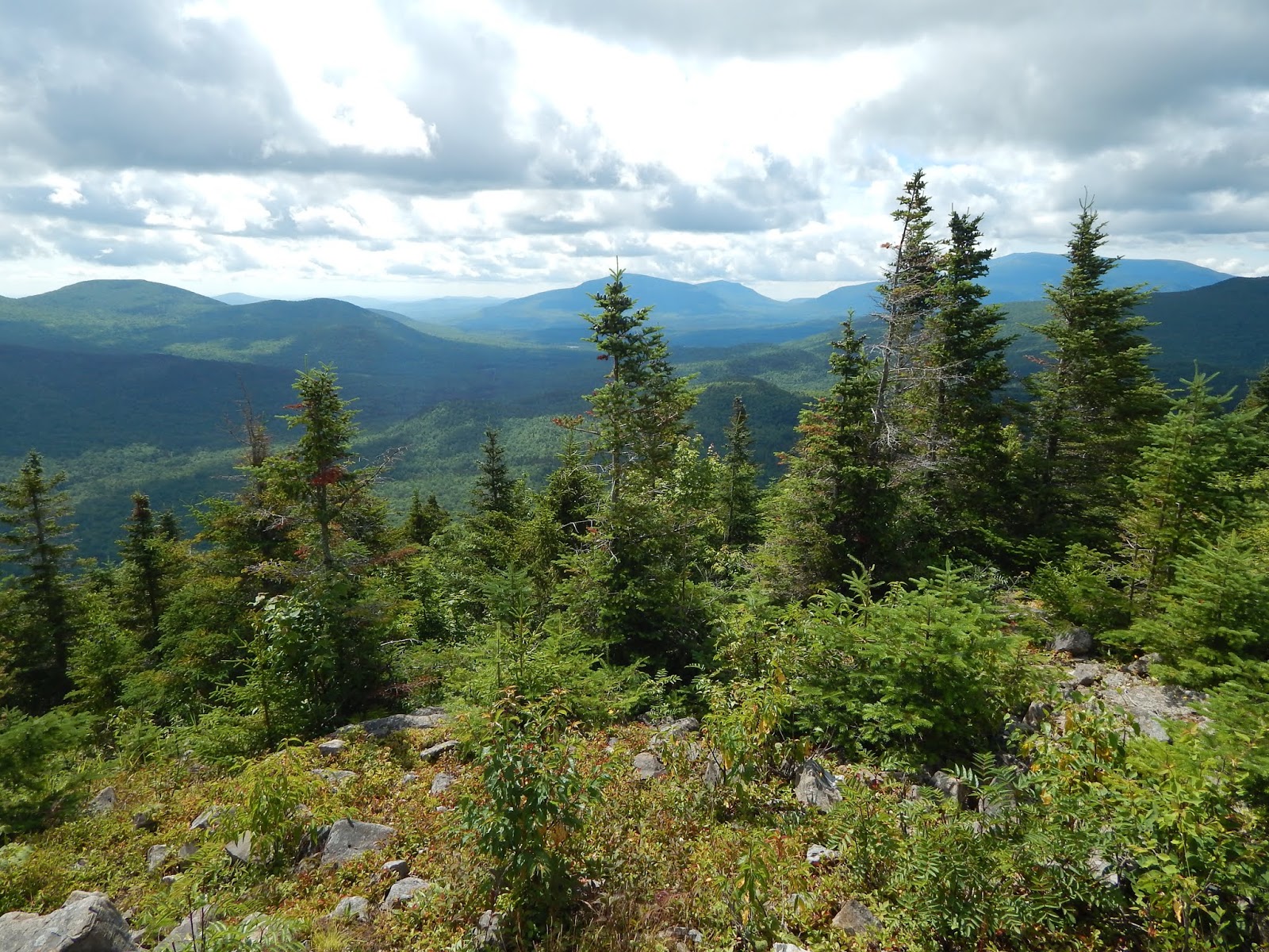
| Many of the 4,000-footers as seen from Jennings Peak. |
Most people take the easy route from Waterville Valley in order to bag the summits, but I made the decision to start the hike from Sandwich Notch Road, using the Algonquin Trail as our way of ascending the mountain. This is the longest, and most technical route up the mountain. The trail was pleasant as it went through some nice forests, with plenty of evident moose activity. The trail soon passed over some ledges with views up to the mountain ahead.
 |
| Even the trailhead is in the middle of no where! |
 |
| Lucy waiting ahead. |
 |
| Some of the lower ledges with the slope of the mountain visible. |
 |
| A closer look at the ledges ahead. |
We began to climb the slopes until we reached the base of Black Mountain. From here, the trail started a very steep ascent up the knee of the ridge, and when I say steep, I mean it! The whole climb up begins with a 30-foot chimney; a steep rock face that practically needs to be climbed instead of just walked up. I had to put my camera away in order to use my arms to climb it! Even though it was a lot of effort, it was worth it, as views opened up quickly.
 |
| The trail getting steeper! |
 |
| It's hard to capture climbs like this with a camera, but it is steep! |
 |
| From atop the chimney: Black Mountains sits to the right, with Mt.Weetamoo to the left. |
Although the main chimney was done, there were still many climbs ahead, albeit, much shorter. After a few more, the trees shortened, and the path emerged onto a wide ledgy area with views south over the many rolling hills and smaller peaks in the area. The trail continued in and out of the treeline, occasionally opening onto open ledges with views toward the Lakes Region, Mt.Tecumseh and other peaks.
 |
| Another very steep climb. |
 |
| The view into southern New Hampshire. |
 |
| Mt.Tecumseh and Mt.Osceola from the trail. The extensive ledges below are the peaks of Acteon Ridge. |
 |
| The junction with Black Mountain Pond Trail. |
 |
| Many peaks are visible, including Jennings Peak to the far right. |
 |
| Black Mountain Pond can be seen below, with Young Mountain to the left and Mt.Israel to the far right. |
 |
| Mt.Moosilauke is the tallest on the horizon, with Welch and Dickey visible to the far right. |
The path wound through the trees, high on the ridge for the rest of the trail. The ridge undulated numerous times, with occasional views toward Sandwich Dome through the trees. We reached the col, then climbed easily up the southern slope of the mountain until we reached the Sandwich Mtn Trail, which when followed, brings you to the summit of Sandwich Dome, at 3,980 feet, making it just below the 4,000-foot mark!
 |
| Sandwich Dome through the trees. |
 |
| A portion of the trail between the ledges and the summit. |
 |
| The junction near the summit. |
 |
| Nearing the top! |
While it's said that the summit has fantastic views, it's clear that the trees have began to grow in during recent years. If you plan on hiking this peak, do it as soon as possible, because these views won't be here for much longer! From here can be seen many famous peaks of the Whites, including many in the Franconia/Waterville Valley area.We then continued the opposite way down Sandwich Mtn Trail to Jennings Peak.
 |
| Mt.Tecumseh, Mt.Cannon, Franconia Ridge, and Mt.Osceola |
 |
| Mt.Carrigain, Mt,Washington, and the Tripyramids from the summit. |
 |
| Looking toward Kancamagus Pass (Mt.Huntington and Mt.Kancamagus) with East Osceola to the far left and the Bonds and Hancocks visible. |
The trail between the two peaks was uneventful, being a very easy trail. The short spur leading to the summit of Jennings Peak got steep right at the end, but soon opened up to some fine ledges with great views from Mt.Washington to Sandwich Dome, and many peaks in southern New Hampshire. The skies were crystal clear, and many far peaks could be seen, such as Mt.Cardigan, Mt.Kearsarge, Mt.Monadnock, Mt.Ascutney, and even Mt.Killington!
 |
| Not much further! |
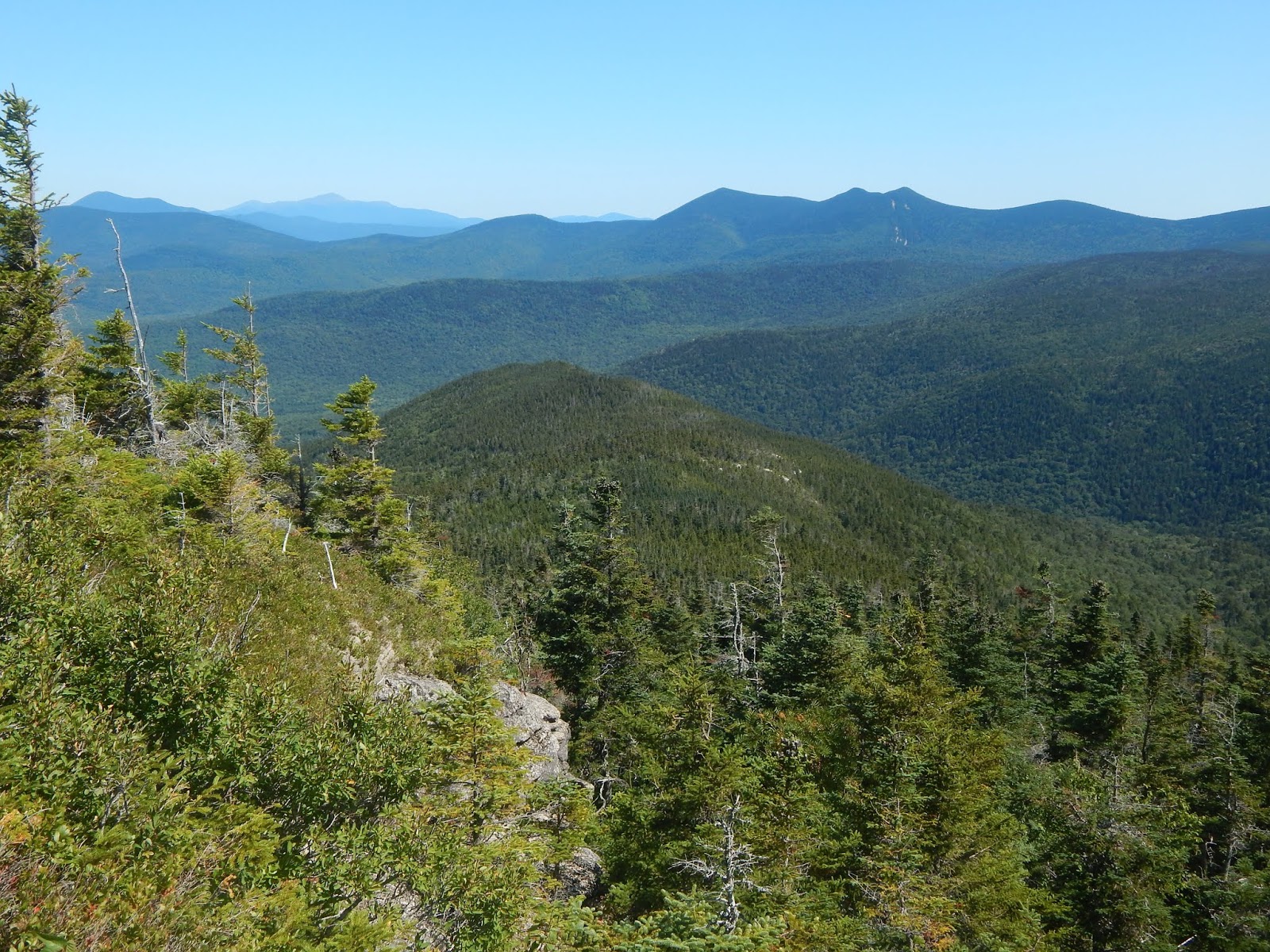 |
| Mt.Carrigain and the Tripyramids visible together yet again, with the Presidential Range in the far distance. |
 |
| Mt.Washington |
 |
| Looking south with Mt.Kearsarge prominently to the left and Mt.Cardigan to the right. |
 |
| Mt.Cardigan to the left, with Mt.Ascutney standing far away to the right. |
 |
| Sandwich Dome from Jennings Peak. |
 |
| The southernmost peaks of the White Mountains (Stinson Mountain, Carr Mountain, Mt.Kineo) as seen from the ledges on Jennings Peak. |
After enjoying the beautiful scenery from the summit, we continued back up to the summit of Sandwich Dome, then down the Bennett Street Trail, which was likely the old fire wardens road, as the trail was wide and flat for most of the way. The path was easy to follow, and made for a good descent. Once we got closer to the bottom of the trail, it got steeper and thinner, until it reached Flat Mountain Pond Trail.
 |
| Time to descend. |
 |
| Higher up on the trail. |
 |
| Bennett Street Trail |
We followed the trail to Flat Mountain Pond, our camping spot for the night.This portion of Flat Mountain Pond Trail is very easy to follow, as it follows an old railroad bed, which had little evidence of being so, until we found a few rails. The path crossed a nice brook, then a flooded bog area known as Beaver Pond. We soon found ourselves at the junction with the trail to the shelter.
 |
| Some of the Flat Mountain Pond Trail. |
 |
| A simple brook crossing. |
 |
| Crossing Beaver Pond. |
 |
| More of the path. Notice the old rail. |
The shelter and other nearby tentsites were set just at the western tip of Flat Mountain Pond. We set up camp here. This pond is situated in a beautiful spot, with amazing views up toward some of the higher peaks in the region. The nearby brook flowed from the water through a very old dam, then down a beautiful brook. The water was calm all night.
 |
| Flat Mountain Pond Shelter |
 |
| On the water. |
 |
| The old dam and Pond Brook. |
 |
| South Tripyramid from Flat Mountain Pond |
 |
| The Sleepers and Mt.Whiteface from the bog on the pond. |
The next morning we continued back to the Bennett Street Trail, then to the Guinea Pond Trail, which is where we ran into some problems. The path stayed on the same railroad bed the entire way, until it suddenly stopped right on the shore of a very flooded plain. There were no blazes or herd paths around this body of water, so we ended up bushwhacking around it's north shore. We crossed the stream then found some faint blazes which we followed back to the trail on the other side of the bog.
 |
| At this point the path disappeared. |
 |
| We bushwhacked until we found this blaze. There is a faint trail at this point. |
The path was much smaller and more overgrown at this point, until we reached the junction with Black Mountain Pond Trail. From this point, we followed the Guinea Pond Trail beneath some power lines and over snowmobile bridges until we found Sandwich Notch Road once again, which we had to follow for about a mile and a half back to the Algonquin Trail.
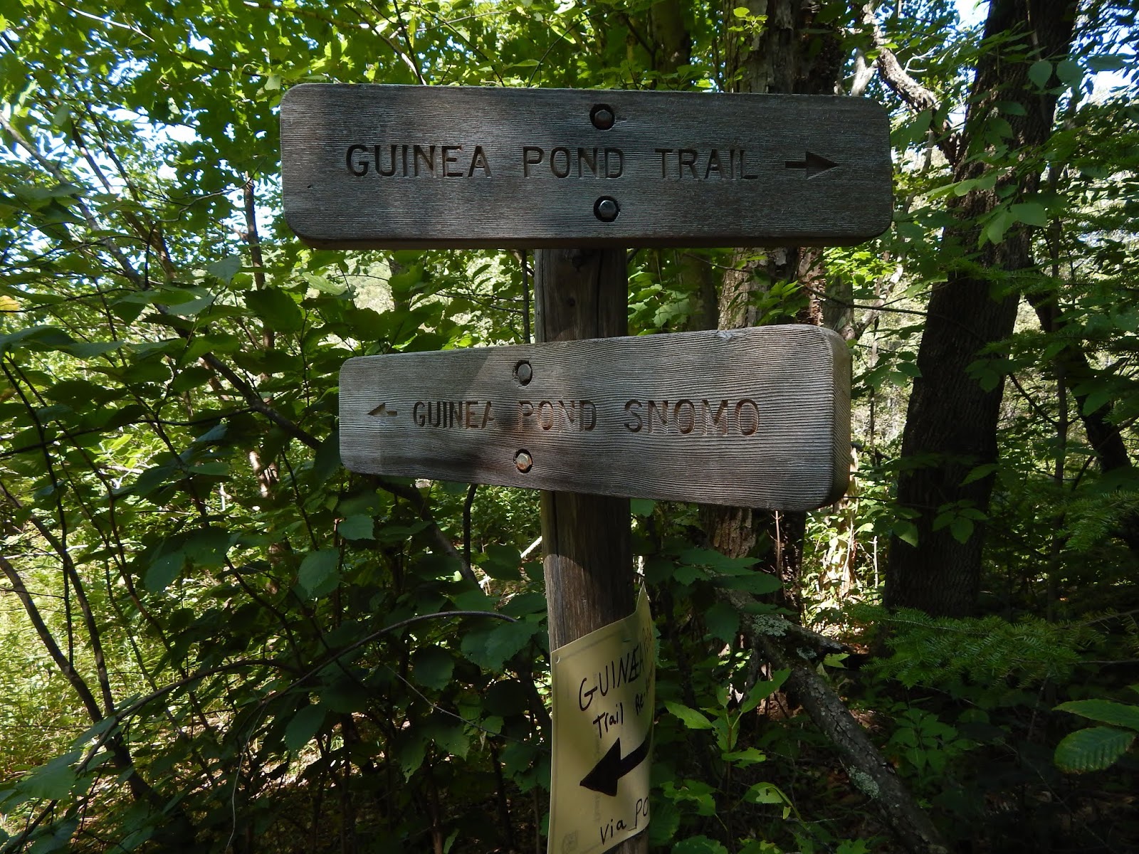 |
| A confusing sign post. |
 |
| The shoulder of Sandwich Dome from a bog. |
 |
| A snowmobile bridge. |
 |
| Passing beneath the power lines. |
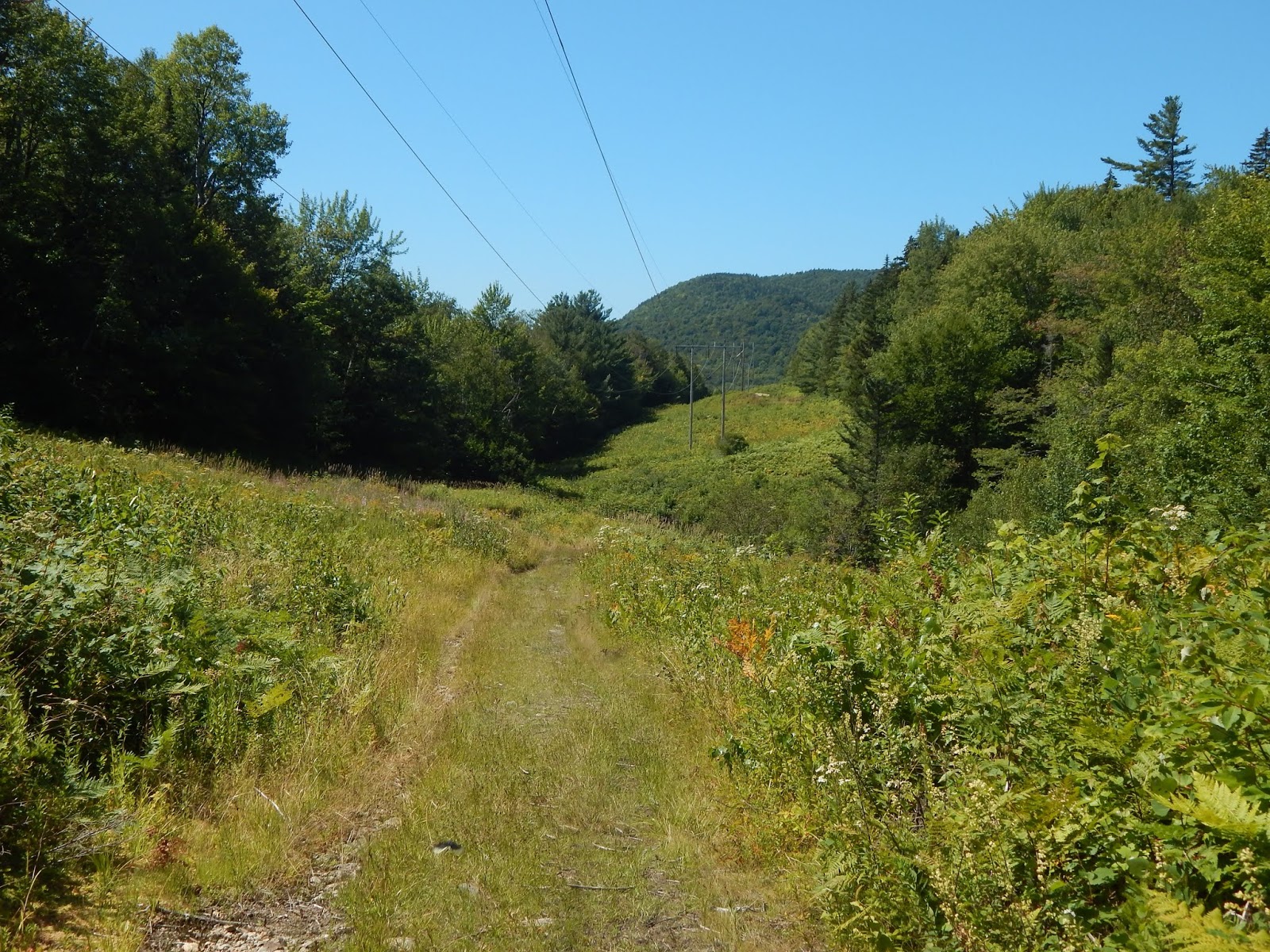 |
| A hill as seen from the power lines. |
Overall, the entire distance was 11-miles each day, but the hike was well worth the weather, We got to bag a couple peaks, and even visit some new places, like Flat Mountain Pond, a place that gets barely any visitors. The Algonquin Trail was also one of the funnest paths I've done in the Sandwich Range. While most people stick to the classic day hikes, I always like to try new routes.