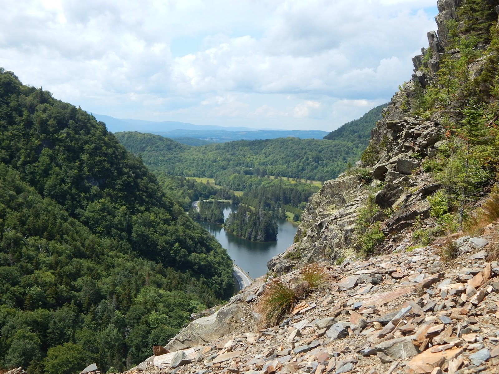
While being in the north country, I immediately knew we needed to check out the highlights in the region. The best, most scenic and unique area is certainly Dixville Notch in northern New Hampshire. From steep, jagged cliffs to roaring gorges and flumes, Dixville Notch has it all. Everything can be seen along the 4-mile loop hike which circles the notch, and even follows portions of the Cohos Trail. Dixville Notch is one of those places you need to see to believe.
 |
| Table Rock as seen from the roadside. |
Just driving through the notch is a beautiful experience, and it helped us get a better look at the place and what to expect. It's recommended to ascend Table Rock first, the most well known part of the loop. With it being only two tenths up to the rock, you think it'd be quick, but in reality, it takes a while, as the trail climbs straight up the sheer walls of the notch. Also, since it rained the night before, the rocks were slick, so care was taken in ascending.
 |
| Bella on the trail. |
 |
| View looking back from the trail. |
The trail suddenly flattens out, with a short side trail to the right leading to Table Rock, a sheer, flat ledge jutting out over the notch. The edges of the rock drop dramatically down to the roadside, and the ledge provides grand views into the notch and over to The Balsams, a huge resort on Lake Gloriette. Some mountains can even be seen in Vermont, standing tall above all the sprawling farmland.
 |
| Looking across Table Rock with the summit of Sanguinary Mountain easily visible. |
 |
| The view east through the notch toward Rice Mountain. |
 |
| The Balsams Resort and Mt.Gloriette from Table Rock. |
 |
| A westward view toward Monadnock Mountain in Vermont. |
 |
| The Three Brothers from Table Rock. |
We followed the path up to the junction with the Cohos Trail, a long distance trail that runs north-south through northern New Hampshire. Dixville Notch is known as one of the highlights of the trail, and I can see why. The path lead into the woods and began to head down, until it reached the Three Brothers Trail, which we followed for a short time until we reached the viewpoint, which offered views over to where we just were.
 |
| The Cohos Trail. |
 |
| Junction with the Three Brothers Trail. |
 |
| Table Rock and Lake Gloriette from the Three Brothers. |
 |
| Sanguinary Ridge and Index Rock seen from the Three Brothers. |
Eventually we found ourselves at Cascade Brook, where we crossed and followed the trail parallel to the stream. The water could be heard constantly roaring down below in the ravine. There were a few viewpoints looking down to Huntington Cascade, and many other falls along the brook. It was a mild descent, but the trail eventually flattened out and followed the brook to a broken bridge and the empty picnic area.
 |
| Huntington Cascade |
 |
| Another portion of the falls. |
 |
| More falls along Cascade Brook. |
 |
| The final set of falls. |
 |
| The twisted bridge. It is still safe to walk across. |
To continue on the loop, we had to walk through the picnic area over to the old Whittemore Cemetery. The trail continues past the graves and crosses the road, but I went over to what appears to be an abandoned barn in the parking area. The buildings empty, but curiously, there's a room on the side of it with walls made of old road signs. I don't know anything about this building, and it appears it's been here a while. After looking around more, we crossed the road to continue on the trail.
 |
| History of Dixville Notch. |
 |
| The small plot of graves. |
 |
| The abandoned barn. |
 |
| Inside the building. |
 |
The strange traffic sign room. I have no clue as
to what this could've been or why it's here. |
Immediately after reentering the forest on the opposite side of the road, the trail arrived at the Baby Flume, which is basically a much smaller version of the Flume Gorge in the White Mountains. There are a few roaring falls visible in the gorge. The path then continued through the forest for a ways, climbing higher and higher up the mountainside. The trail passed a small viewpoint looking into the notch.
 |
| Falls inside Baby Flume. |
 |
| The upper falls. |
 |
The notch as seen from the first viewpoint along
Sanguinary Ridge Trail. |
The trail flattened yet again, this time high above the road. We emerged out to the Rendezvous Outlook, which offered an outstanding view through the notch and over into Maine. It was at this point the trail climbed again, this time it continued for a while. We soon reached the junction where the Cohos Trail heads up to Sanguinary Mountain, which we followed for a hundred feet to see a view over The Balsams.
 |
| Rendezvous Outlook |
 |
| Three Brothers and Table Rock from Rendezvous Outlook. |
 |
An eastward view from the outlook. Old Speck can barely be seen through the haze.
Signal Mountain is prominent, with Mt.Patience visible to the far right. |
 |
| The junction. |
 |
| The view over Lake Gloriette. |
Sanguinary Ridge Trail lead steeply down the mountainside, until it reach a sheer ledge with a great view to The Balsams. It reentered the trees for a hundred feet, then emerged onto another ledge with an iconic view toward the opposing side of the notch, and down below to Index Rock, which the trail passes by after going down some stairs in an open scree field. The views from this point are some of the best in the notch!
 |
| Table Rock and Three Brothers from the ledge. |
 |
| Bella in front of the Three Brothers. |
 |
| The view from the first ledge looking west. |
 |
| Overlooking the trail ahead, and Index Rock. |
 |
| Across the scree field and over to Lake Gloriette. |
 |
| The three rocks as seen all together! |
 |
| The view back towards Rice Mountain and the notch. |
 |
| Index Rock and Three Brothers |
After crossing a slide, we zig-zagged down a steep slope until we reached the now closed road leading over to The Balsams. To get back to the original trailhead, we had to walk the road a bit, which was no trouble. Overall, Dixville Notch is an amazing hiking destination in the region. It's awesome to find a place like it within all the uneventful terrain of northern New Hampshire around. It's a real treasure, a place like no other.