Showing posts with label Cemetery. Show all posts

A Place Like No Other: Dixville Notch

While being in the north country, I immediately knew we needed to check out the highlights in the region. The best, most scenic and unique area is certainly Dixville Notch in northern New Hampshire. From steep, jagged cliffs to roaring gorges and flumes, Dixville Notch has it all. Everything can be seen along the 4-mile loop hike which circles the notch, and even follows portions of the Cohos Trail. Dixville Notch is one of those places you need to see to believe.

Table Rock as seen from the roadside.

Just driving through the notch is a beautiful experience, and it helped us get a better look at the place and what to expect. It's recommended to ascend Table Rock first, the most well known part of the loop. With it being only two tenths up to the rock, you think it'd be quick, but in reality, it takes a while, as the trail climbs straight up the sheer walls of the notch. Also, since it rained the night before, the rocks were slick, so care was taken in ascending.

Bella on the trail.
View looking back from the trail.

The trail suddenly flattens out, with a short side trail to the right leading to Table Rock, a sheer, flat ledge jutting out over the notch. The edges of the rock drop dramatically down to the roadside, and the ledge provides grand views into the notch and over to The Balsams, a huge resort on Lake Gloriette. Some mountains can even be seen in Vermont, standing tall above all the sprawling farmland.

Looking across Table Rock with the summit of Sanguinary Mountain easily visible.
The view east through the notch toward Rice Mountain.
The Balsams Resort and Mt.Gloriette from Table Rock.
A westward view toward Monadnock Mountain in Vermont.
The Three Brothers from Table Rock.

We followed the path up to the junction with the Cohos Trail, a long distance trail that runs north-south through northern New Hampshire. Dixville Notch is known as one of the highlights of the trail, and I can see why. The path lead into the woods and began to head down, until it reached the Three Brothers Trail, which we followed for a short time until we reached the viewpoint, which offered views over to where we just were.

The Cohos Trail.
Junction with the Three Brothers Trail.
Table Rock and Lake Gloriette from the Three Brothers.
Sanguinary Ridge and Index Rock seen from the Three Brothers.

Eventually we found ourselves at Cascade Brook, where we crossed and followed the trail parallel to the stream. The water could be heard constantly roaring down below in the ravine. There were a few viewpoints looking down to Huntington Cascade, and many other falls along the brook. It was a mild descent, but the trail eventually flattened out and followed the brook to a broken bridge and the empty picnic area.

Huntington Cascade
Another portion of the falls.
More falls along Cascade Brook.
The final set of falls.
The twisted bridge. It is still safe to walk across.

To continue on the loop, we had to walk through the picnic area over to the old Whittemore Cemetery. The trail continues past the graves and crosses the road, but I went over to what appears to be an abandoned barn in the parking area. The buildings empty, but curiously, there's a room on the side of it with walls made of old road signs. I don't know anything about this building, and it appears it's been here a while. After looking around more, we crossed the road to continue on the trail.

History of Dixville Notch.
The small plot of graves.
The abandoned barn.
Inside the building.
The strange traffic sign room. I have no clue as
to what this could've been or why it's here.

Immediately after reentering the forest on the opposite side of the road, the trail arrived at the Baby Flume, which is basically a much smaller version of the Flume Gorge in the White Mountains. There are a few roaring falls visible in the gorge. The path then continued through the forest for a ways, climbing higher and higher up the mountainside. The trail passed a small viewpoint looking into the notch.

Falls inside Baby Flume.
The upper falls.
The notch as seen from the first viewpoint along
Sanguinary Ridge Trail.

The trail flattened yet again, this time high above the road. We emerged out to the Rendezvous Outlook, which offered an outstanding view through the notch and over into Maine. It was at this point the trail climbed again, this time it continued for a while. We soon reached the junction where the Cohos Trail heads up to Sanguinary Mountain, which we followed for a hundred feet to see a view over The Balsams.

Rendezvous Outlook
Three Brothers and Table Rock from Rendezvous Outlook.
An eastward view from the outlook. Old Speck can barely be seen through the haze.
Signal Mountain is prominent, with Mt.Patience visible to the far right.
The junction.
The view over Lake Gloriette.

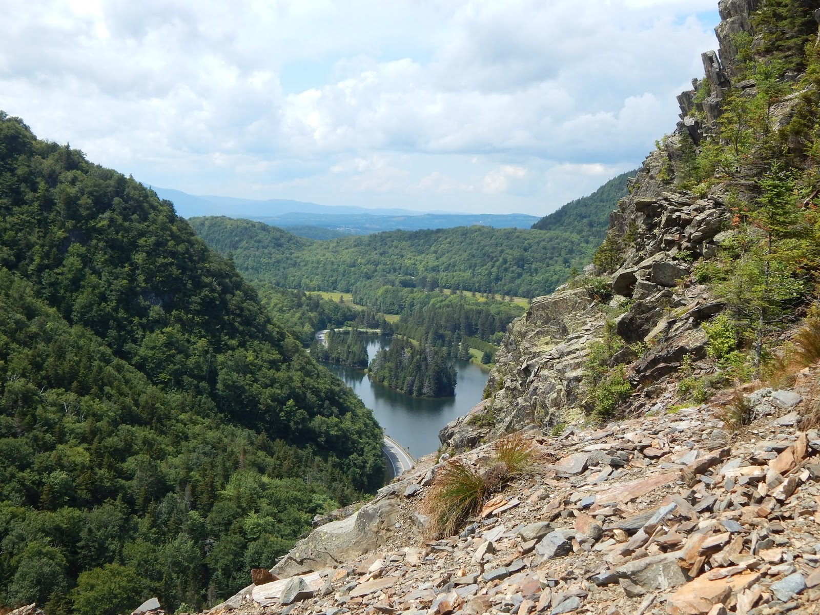
Sanguinary Ridge Trail lead steeply down the mountainside, until it reach a sheer ledge with a great view to The Balsams. It reentered the trees for a hundred feet, then emerged onto another ledge with an iconic view toward the opposing side of the notch, and down below to Index Rock, which the trail passes by after going down some stairs in an open scree field. The views from this point are some of the best in the notch!

Table Rock and Three Brothers from the ledge.
Bella in front of the Three Brothers.
The view from the first ledge looking west.
Overlooking the trail ahead, and Index Rock.
Across the scree field and over to Lake Gloriette.
The three rocks as seen all together!
The view back towards Rice Mountain and the notch.
Index Rock and Three Brothers

After crossing a slide, we zig-zagged down a steep slope until we reached the now closed road leading over to The Balsams. To get back to the original trailhead, we had to walk the road a bit, which was no trouble. Overall, Dixville Notch is an amazing hiking destination in the region. It's awesome to find a place like it within all the uneventful terrain of northern New Hampshire around. It's a real treasure, a place like no other.

A Loop Over West Mountain, The Timp, and Dunderberg Mountain

Happy Halloween everyone! This is the perfect time of year to avoid the crowds in the Hudson Highlands of New York, a place I had never been to before. Both the parkways and trails in the area see a lot of traffic during the summer, as these are some of the closest mountains to New York City. Don't let tourists and busy streets fool you, true beauty can be found here, in more ways than one.


Looking north at Bear Mountain from Bald Mountain.

Our journey started on the Appalachian Trail, on Seven Lakes Drive. We headed up the trail, our first destination being West Mountain. The sky wasn't looking that clear, but we still continued up the trail. It didn't take long for the first viewpoint, but it was cloudy.


One of many foggy views from West Mountain.

West Mountain included a long open ridge with beautiful forests. Once we reached the junction where the Appalachian Trail turns off, the sky opened up, and we continued on the trail to the shelter. The views are amazing.


The view from the Appalachian Trail junction.

It's worth mentioning how beautiful and unique the trail is to the shelter. The trail passes in and out of large, open meadows with great views to peaks such as Bear Mountain, Anthony's Nose, and The Timp.


Bear Mountain from the meadows atop West Mountain.

The shelter looked really comfortable. It was formed by stone and even had two chimneys. While I don't have a picture of the shelter, as a family stayed the night there, I did capture the view from the ledge the shelter is on, and Manhattan is clearly visible.


The view just below the shelter.
A zoomed photo of Manhattan from the shelter.

The trail then maneuvered itself down to the col between West Mountain and The Timp. It passes through a glowing, yellow forest, built with massive trees and large rocks. It was a steep climb, with multiple switchbacks.


A staircase lost in the leaves.

The Timp is well worth the effort, as the view is distinctive, and like nothing else out there. The main ledge looks straight down the Hudson River, into the Tappan Zee, with the Manhattan skyline in the far distance. Cheesecote Mountain and High Tor can also be seen.


The summit of The Timp.
New York City and Newark are clear. The World Trade Center and Empire State Building can be seen.

From here, the trail brought us down a stony descent to the col between The Timp and Dunderberg Mountain ("dunderberg" meaning "thunder mountain" in Dutch). The peak of interest on Dunderberg Mountain is called Bald Mountain. The top of Dunderberg Mountain is flat, and the woods are thin, as there are very few trees, and the forest floor is mostly carpeted by grass.


You would never think that this is the top of a mountain.

The summit of Bald Mountain is a different story, as the trees completely disappear, and all that's left is the grass and views. From here, there is a great view looking directly at Bear Mountain and Anthony's Nose. Other sites that can be seen include Iona Island, The Timp, West Mountain, Bull Hill, and Bear Mountain Bridge, which is where the Appalachian Trail crosses the Hudson River.


The main view from Bald Mountain.

You may think the journey is finished, but once you take the trail down from Dunderberg Mountain, you enter a whole new world. In the valley, the ruins of Doodletown, a logging and mining town, can be found. The town was abandoned in 1965, and the trail is even paved in this area.


The old paved road, with Dunderberg Mountain to the left.

The first ruins while heading down the trail included a strange shed-like structure, along with what appears as an old dam and foundation. Unlike the rest of the town, there were no plaques for the area, so your guess is as good as mine.


Some of the ruins.
Another oddity from the same site.

Once further down, the trail brought us past several old foundations and house sites, all with plaques displaying the house, along with who lived there. While we were touring the area, an actual tour group came through, so keep in mind that you will likely not have this area to yourself.


One of the foundations.

The highlight in the town was June Cemetery, which included both old and new graves. This is one of two cemeteries in the town, but we were running short on time. This area is certainly worth a visit by itself.


Gallery
The beginning of the hike.
Another cloudy view from West Mountain.
The trail atop West Mountain.
Looking toward The Timp from near the shelter.
The only view north from The Timp.
The main view from The Timp. Can you see Manhattan?
My "best" photo of the shelter.
The tower atop Bear Mountain. Look at all the people!
A brook along the way to Dunderberg Mountain.
Anthony's Nose from Bald Mountain. A train can be seen to the left on the tracks.
Some more ruins in Doodletown.
The many graves of June Cemetery.
Happy Halloween!

To conclude, the Hudson Highlands are an incredible location that I will be returning to. The three mountains I wrote about above only scratch the surface of the area, and places like Doodletown also offer a dive into the obscure history of this area. I hope to return soon.

Also:I'm happy that my audience has grown over the past year, and I hope to make my blog better and better. For that goal to be achieved, I would appreciate some more interaction between me and you, so please, feel free to leave a comment below. I also added an "About Me" page to the top of my blog. Thanks for reading!