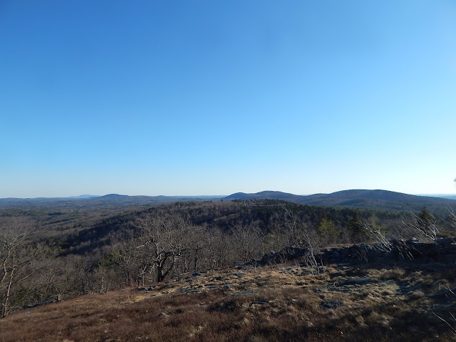
Being a fan of the Wapack Range, I've been wanting to do Kidder Mountain for a while. The mountain, at 1,804 feet, lies just over the border in New Hampshire. The entire mountain was covered in pasture back in the day, but today, the forest is making an attempt to reclaim the fields and ledges that pepper the summit.
 |
| Mt.Monadnock from the field on Kidder Mountain. |
After parking on Chapman Road, we began down the Wapack Trail heading south. The left side of the trail has several "No Trespassing" signs posted on trees. The trail comes out to a line of power lines which we needed to follow for a bit after we left the Wapack Trail. It soon reentered the trees.
 |
| A portion of trail on the power lines. |
The trail was swampy in some places and there were a few patches of snow aside the trail. Through the trees, we could see large ledges with grassy spots. Strangely, the trail came up to a side trail with large metal plant pots. There are many logging roads on the mountain, but there was no good reason for these to be here.
 |
| The pots on the trail make it appear as a grand entrance. |
After taking a rocky trail from the pots, the trail enters the border of a field with a side trail leading to the other side of the field. This spot offered a great view looking over to the northern portion of the Wapack Range. I was able to name Temple Mountain, the Pack Monadnocks and Lyndeborough Mountain.
 |
| The Wapack Range from the first viewpoint. |
This isn't the only viewpoint on the mountain. After rejoining the trail, we followed it up for a hundred more feet and arrived at the main view. This spot is also grassy, but it also has ledges and a stonewall. The stonewall is just a remnant of the times when this summit was covered in farmland.
 |
| A cairn with the stonewall to the right. |
A large cairn marks the summit, and from it we could see the southern Wapack Range and Mt.Wachusett. We could also see the old slopes of an incomplete ski area on the backside of Mt.Watatic (blog here).
 |
| Mt.Wachusett is the one in the background to the left, and Mt.Watatic is in front of it. |
Knowing that you can see the Boston skyline from Mt.Monadnock and Mt.Watatic, I figured we could see it from where we were. I attempted to take some photos of the city.
 |
| A hazy photo of the John Hancock Tower and Prudential Tower. |
After trying to get to the highest point, we found a herd path lead to what was likely a geochache. The last person to find it probably didn't know what it was due to them leaving it open and causing the log to get wet. I sealed it back up and put it back in the right location.
GALLERY
 |
| The trail as it runs through a field. |
 |
| Temple Mountain and the Pack Monadnocks through the trees. |
 |
| Mt.Monadnock through the trees. |
 |
| Looking into Massachusetts. |
 |
| Mt.Wachusett behind Mt.Watatic. |
 |
| Barrett Mountain passed the stonewall. |
 |
| The summit area. |
 |
| Looking towards Boston. |
 |
| The best photo I captured of Boston. |
 |
| The stonewall on the summit with Mt.Watatic on the other side. |
Kidder Mountain is not too different from Mt.Watatic. Both have the same terrain and history surrounding them. I would recommend both hikes. If you want to get away from crowds that gather atop Mt.Watatic, I would choose Kidder Mountain. The biggest bonus about Kidder Mountain, is that it has the same views as Mt.Watatic, but also views looking north at Mt.Monadnock. Both are great, so head out there and get hiking!


No comments:
Post a Comment