Percival and Morgan

Mt.Percival and Mt.Morgan are both well known for the great views that can be had from the summit, and the technical trails that ascend them. Both the upper portions of the Mt.Percival Trail and Mt.Morgan Trail are part of the Terrifying 25 list (a list of 25 trails in the White Mountains that are technical/exciting), and there is good reason for this. They both may be short mountains, but the climb and views are like no other in the state!


Mt.Morgan seen from Mt.Percival.

We decided to use the Mt.Morgan Trail for our ascent. The trail is flat, with a slight incline for most of the way up. It gets steep right before you reach the Crawford-Ridgepole Trail. From here, the trail runs flat to the base of the cliffs on Mt.Morgan. Once we arrived here, we could tell why this trail is on the Terrifying 25 list.


The three ladders add up to a total of 20 feet.

Yeah, three ladders! A bypass trail does go around them, but we wanted a real thrill! My dad, the hero that he is, guided me up the ladders, as the top one was a little bit technical for me to reach. Once we reached the top of the ladders, the trail actually climbs through a boulder cave. This trail is quite unique!


The boulder cave atop the ladders.

After that, the trail climbs up the ledges to the summit. The summit itself has no views, but a large ledge above the cliffs offers a grand view overlooking the lakes. Mountains that can be seen include Mt.Belknap, Red Hill, Mt.Kearsarge, Mt.Prospect, Mt.Webster and Mt.Shaw.


The Ossipee Range can be seen to the left, with Red Hill and the Rattlesnakes in the middle. The Belknap Range is all the way to the right.
Mt.Webster is in the foreground, with Mt.Kearsarge in the far back, right to the right of it.

It was time to leave the summit, and the trail in between Mt.Percival and Mt.Morgan was pleasant. It passes over many enclosed ledges. Some of these ledges offered a nice view looking over to Sandwich Dome and Jennings Peak in the Sandwich Range.


Sandwich Dome from the Crawford-Ridgepole Trail.

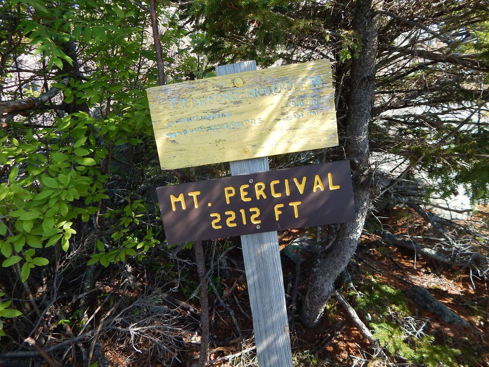
Once we arrived at the summit of Mt.Percival, we found a summit sign and cairn, something that the summit of Mt.Morgan lacks. From here, the view is much grander, and some of the peaks that can be seen include Sandwich Dome, Mt.Whiteface, Mt.Paugus, Mt.Chocorua, Mt.Shaw, Mt.Roberts, Mt.Belknap, The Rattlesnakes, and Mt.Morgan.


Sandwich Dome is to the left, with Mt.Whiteface to the right of it. Mt.Chocorua can be seen behind  tree, and Mt.Israel is poking out from behind Mt.Squam to the far right.
The Ossipee range and Red Hill from Mt.Percival.

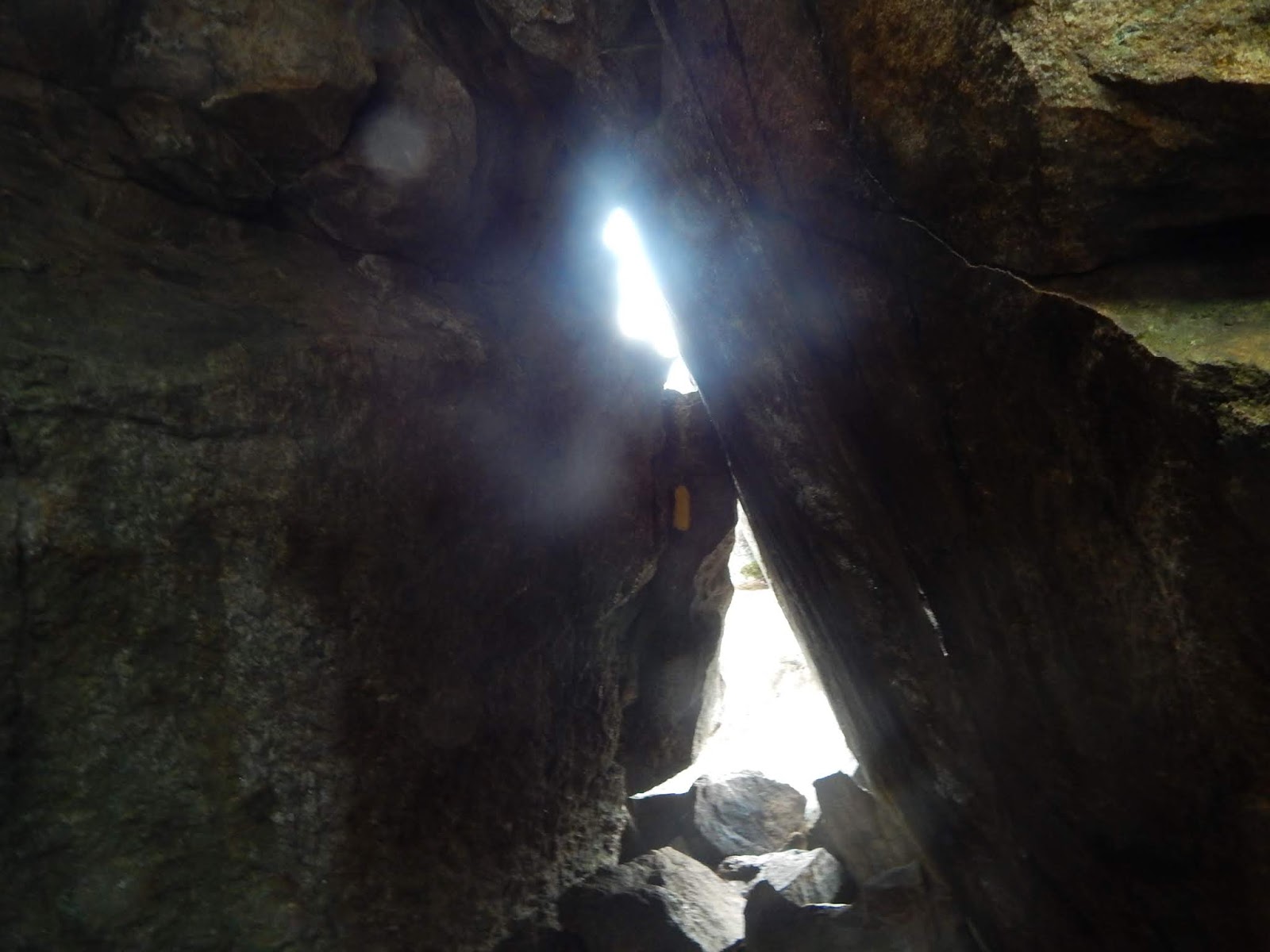
From here, both the bypass and technical trail leave the summit. From the cairn, you want to take the trail to the right if you want to go through the caves. Yup, this section includes some intense boulder caves! The trail crawls down the rocks of Mt.Percival into a ravine, then into an extremely large boulder cave.


This is where the trail enters the boulder cave.

This cave is quite impressive, and it was formed by some pretty large rocks that broke off from above. To get the Terrifying 25 credit, you must take the ladder route and cave route of both of these trails, and I say, it's worth it!


And this is where the trail leaves the boulder cave.

Descending the Mt.Percival trail involves much more descent then the Mt.Morgan Trail would. The trail meets many brooks along the way down. Instead of walking the road, we hooked onto the Morse Trail, which connects the lower portion of both the trails. Its a nice, gentle walk, and it passes through a few stonewalls and over a bridge.


GALLERY
This is where you rise out of the cave on Mt.Morgan.
Mt.Prospect with Mt.Cardigan to the right of it.
Squam Lake from Mt.Morgan.
This marks the summit of Mt.Percival.
Looking down the cave route.
Mt.Whiteface, Mt.Paugus, Mt.Chocorua, Mt.Israel, and Mt.Squam from the summit.
Mt.Whiteface with Flat Mountain in the front. East Sleeper can be seen to the far left.
One of the crawlspaces in the cave.
The Rattlesnakes and Red Hill from the trail.

Mt.Percival and Mt.Morgan are peaks like no other, as the views from them are so, so unique. The two mountains lie in the center of New Hampshire, and the view of the lakes, both Squam Lake and Lake Winnipesaukee, are nice. The trails are also quite the experience, as nobody could expect such a technical trail on such short mountains. I might want to do a traverse of the Crawford-Ridgepole Trail one day too.

Sunrise from Mt.Parker

A year ago, I brought my dad on a trip he would never forget. If you've read my recap blog of all the hikes I did in 2017, then you probably already know about our first climb up Kearsarge North. On that trip, we arrived at the summit for sunrise, and we got a beautiful undercast view. According to my dad, this trip was even better then Kearsarge North, and the mountain we climbed happened to be Mt.Parker, and lets just say, we got a grand view of the changing sky.


The sun, as it rises above Sable Mountain and South Baldface.

I would like to give detail of the ascent, but we began the hike at 2:30 in the morning, when it was pitch black. We did walk right past the Cave Mountain Path without knowing. The ascent was gentle the entire way up, and it was easy to follow, even with just a headlamp. We made very good timing, as we arrived on the summit at 4:00. The summit area was dim, and the nearby peaks, like Mt.Resolution, appeared ominous in the dark sky.


Looking out to the distant horizon.

Clouds were hovering around the peaks in Jackson and North Conway. The summit area is peppered with large patches of flowers and ledge. It was a view like no other, as the clouds appeared like an ocean surrounding peaks such as the Doubleheads and Kearsarge North. We could see the Carters and Wildcats, but Mt.Washington was in the clouds. The pictures don't give the views justice.


Kearsarge North can be seen to the right with Iron Mountain in the center.

Once it began to brighten up, we thought we wouldn't be able to see the sun, as the clouds seemed to be obstructing it. Luckily, for a quick ten minute period, the sun poked out in between the layers of clouds.


The sun above the Baldfaces and Sable Mountain.

Now that the sky was lit up, we could see more peaks, including Mt.Crawford, Mt.Resolution, Iron Mountain, and Black Cap. Mt.Parker is quite the beautiful peak, and I'm surprised it doesn't get a lot of attention compared to other peaks on the 52 With a View list.


GALLERY
Mt.Resolution, Mt.Crawford, and Crawford Dome from Mt.Parker.
Kearsarge North, the site of our first sunrise hike.
Another picture of the sun.
The sun and the Wildcats and Carters.
Another shot of the Carters and Wildcats.
I couldn't take enough photos of the sunrise.
If you want an experience like no other, then climb a mountain for sunrise!

I would've liked to stay on the summit of Mt.Parker all day, but we had other things to do. I just can't get over how underappreciated the mountain is. I've heard whispers of a ledge on Mt.Parker that faces to the west, but I didn't exactly know how to get over there. If anyone has any info on how to get there, please comment below. I will 100% be returning to Mt.Parker, and hopefully one day, revisiting the sunrise (or the sunset from the western ledge)!

Mt.Nancy, and the Nancy Pond Trail

Sitting high above the rest of the Nancy Pond Range, Mt.Nancy is a popular bushwhack on the New England 100 Highest list. The peak, at 3,926 feet, is accessible from the Nancy Pond Trail at Norcross Pond. In this blog, I would like to describe the Nancy Pond Trail, and how to access the summit of Mt.Nancy.


Mt.Nancy from Norcross Pond. It may not look that steep, but it is!

The Nancy Pond Trail begins flat, and stays that way for a while. It crosses over Halfway Brook and Nancy Brook in the beginning, and follows the old fire warden road that ascended Mt.Bemis. The trail turns off of it, and we came across the ruins of what might have been a cabin, right on the trail.


A blurry image of the ruins. It was a bit dark for a clear photo.

The trail left the road, and my dad theorized that it was due to a washout, as the road kept following Nancy Brook. This rerouted section ascends and descends the steep side of the brook, but it soon lowers back down to the brook and crosses it. Ahead, my dad and I could see Nancy Cascade. The trail winded up to the lower section of the falls, which is 45 feet tall. The upper section can also be seen, and it's around 80 feet tall.


The lower portion of the cascade.
The upper portion of the cascade.

From here, the trail begins a steeper ascent up to the plateau area. This plateau area is quite scenic, as many narrow brooks flow quietly as they zigzag through the forest. We thought for certain we would see a moose, but we didn't. As a warning, a few of the larger bog bridges are broken. We soon came to Nancy Pond.


Mist rising from Nancy Pond.

This area is very scenic and tranquil. We only saw two other people on our entire trip up there. Sure it was a bit cloudy, but that didn't take away from it. We passed some makeshift tent sites on Nancy Pond. The trail soon came across the larger Norcross Pond, where we saw Mt.Anderson rising above us.


An ominous photo of Norcross Pond. Mt.Anderson can be seen on a clear day to the left.

To find the herd path that ascends Mt.Nancy, follow these instructions: The Nancy Pond Trail crosses Norcross Brook, but right before the crossing, there are a few tent sites. When the trail first comes to this area, a wide flat path leads to the right (northeast) to a clearing with two herd paths. The one on the right leads to a campsite with a large fireplace, and the other path is the trail. From here, the herd path ascends very steeply up the side of the peak, and I would not recommend doing it on a wet day like we did. The trail flattens out on the summit and we came across the viewpoint and sign.


The summit sign.
This was our view when we first arrived.

The view was cloudy in the beginning, but we soon were able to see Mt.Bemis and a bit of the Twin Range. On a clear day, you can see Mt.Washington and the Mt.Crawford area. This is a very impressive viewpoint, and I'm surprised an official trail doesn't exist.


Mt.Bemis from Mt.Nancy.

The descent was especially slippery, as many branches were hiding the slick roots and rocks on the trail. Once we got back to the trail, we visited the Norcross Brook ledges, which offer a grand view into the Pemigewasset Wilderness and the Bonds. We could also see Mt.Nancy and Mt.Anderson above the pond.


The cloud-capped Bonds from the Norcross Brook ledges.

There are many things in the area that share the name of "Nancy" and there is actually a story behind it. Nancy Barton was one of Colonel Joseph Whipple's many servants on his large estate in Jefferson. Nancy happened to fall in love with Jim Swindell, another servant on the estate. When Colonel Whipple found out about the love, he had Jim transferred to Portsmouth. Nancy found out, and pursued his transport carriage. So in December, 1778, Nancy ran all the way out to Nancy Brook  and froze to death, crying. It is said you can still hear her cries in the brook.


GALLERY
One of many tributarys to Nancy Brook.
The falls and ledges of Norcross Brook.
Notice how the ledges appear to drop into oblivion.
Mt.Bond obstructed by rain and clouds.
Mt.Anderson, Vose Spur, and Mt.Hancock all seen from the herd path.

If you're looking for a quiet, tranquil hike with very unique views, I would highly recommend this hike above all others. On a clear day, you can achieve some great views and visit some scenic ponds, along with the waterfall. This is one of the three New England 100 Highest I've bushwhacked so far (others being Mt.Fort and Big Jay), and there are many still to come! Also, if anyone has information on the easiest way to access Border Peak or Elephant Mountain, feel free to comment below.

Clouds on Black Mountain

After finding ourselves in the area on a clouded day, we decided to hike Black Mountain via the Chippewa Trail. Hearing that it was surrounded by clouds, you may think it was socked in, but we still got some great views, along with a small side trip to the old abandoned lime kilns.

The cloud-capped Kinsman Range to the east.

We began the trail, and soon came to a snowmobile trail that leads over to some lime kilns. This is where they would put limestone and burn it to produce lime. Lime was taken out of nearby mountains such as Sugarloaf Mountains. We actually met a caretaker while we were there, who told us about the history of them. This specific kiln is 20 feet tall.

The tallest of the lime kilns.
Yet another lime kiln.

From here, the trail winds into the Kingsbury-Chippewa Trail Forest. As a side note, many lady's slippers pepper the forest floor.  Before the trail reaches the main ledges, we took some side trails that lead to smaller ledges, where we could see Sugarloaf Mountain.

Sugarloaf Mountain on Jeffers Mountain.

The trail got steeper, but not too bad. We first came to a large ledge looking west into Vermont, and this is where the clouds can be seen. Early in the day, I thought that we shouldn't even go for a hike, but once we reached the first views, I realized we were on the only mountain that wasn't engulfed in clouds!

Looking west from Black Mountain.

The trail weaved in and out of the trees on the ledges for a while. We soon opened up to the large ledges below the summit. Black Mountain, like any other mountain with the same name, is named for it's dark appearance due to the pine trees, but the rocks are awfully white.

The summit of Black Mountain above the ledges.

The trail briefly ducks into the trees then meets with the Black Mountain Trail below the summit. The view from the summit, and all the ledges from here, offered a great view of the cloud-capped Kinsman Range, which appeared ominous beneath the clouds.

The Kinsman Range includes Mt.Moosilauke, The Kinsmans, and Cannon Mountain.

We took herd paths to some enormous ledges on the eastern end of the ridge. I will definitely be returning to this peak on a clear day. It's no wonder it's on the 52 With a View list!

GALLERY
Knights Hill from Black Mountain.
Looking at Jeffers Mountain, with Mt.Clough to the left.
Mt.Moosilauke behind Mt.Clough.
A glacial erratic on the eastern end of the summit.
The lower ledges from the summit.

The descent was gentle and scenic. We sure did get some pretty unique views! It was a good hike, but I'm sure it still would've been a better climb if there were no clouds. The lime kilns were also a great side trip! Overall, I will be returning to Black Mountain at some point, on a better day!