Exactly five years ago, I summited North Brother and Mt.Fort, which are both along the same ridge as South Brother and Mt.Coe. This means that on this ridge alone, four peaks on the New England 100 Highest list can be found. Since we had the time, we decided to finish up the peaks in Baxter State Park, and also throw in an extra summit.
 |
| Mt.Coe from Mt.OJI. |
The Marston Trail is the easiest way of access, so we took that to the first junction with the Mt.Coe Trail, and then followed that. The trail follows a brook for most of the way up. This brook is unique, as the trail follows the large, exposed banks of the brook which have likely succumbed to slides. They do allow descent views.
 |
| The Mt.Coe Trail on the banks of the brook. |
The trail then came out to the enormous slide on the southwest side of Mt.Coe. From here, we decided to head over to Mt.OJI, which is 3,434 feet. Mt.OJI actually gets it's name from the three slides on it's southern face, which spell out the letters O-J-I. On the way up the mountain, we passed the old Mt.OJI Trail junction, and soon came to the first views.
 |
| Katahdin can be seen behind Barren Mountain from Mt.OJI. |
The trail followed the ridge of Mt.OJI, and then dumped us onto a large, scenic rock outcropping, known as "Old Jay Eye Rocks" which has no relation to the name of the mountain. From here, Baxter Peak, Hamlin Peak, the 100 Mile Wilderness, Doubletop Mountain, and Mt.Coe can be seen, along with a few more peaks.
 |
| Doubletop Mountain, with the Spencers in the background from Old Jay Eye Rocks. |
We descended from the rocks, back down to the Mt.Coe Trail. The next step in our trip was to ascend the giant slide of Mt.Coe. It features large ledges, gravelly slopes, and loose rocks. The slide is steep, and the wet spots are slippery.
 |
| Mt.OJI from the side of the slide. |
The top of the slide is the steepest, and most difficult. A lot of the upper portion is wet as well. The slide does offer good views back to Doubletop Mountain, Mt.OJI, and Old Jay Eye Rocks. Looking back down the slide also revealed how much we covered.
 |
| The slide. Old Jay Eye Rocks can be seen to the right. |
We found ourselves in the trees once again. It was still pretty steep, but no where near as bad as the slide. The trail climbs around the mountain, then comes out to the open summit. There is a summit sign, but the height should be 3,795 feet instead of what's listed.
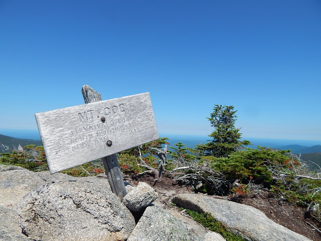 |
| The summit sign lists 3,764, which would take it off the 100 Highest list. |
This peak offers amazing views, as it is in the middle of the ridge. Baxter Peak, Hamlin Peak, The Brothers, Mt.OJI, Barren Mountain, The Owl, The Traveler, Doubletop Mountain, and all the distant peaks to the south can be seen, which includes the 100 Mile Wilderness and the mountains near Moosehead Lake. This is definitely one of the better 100 Highest.
 |
| The Brothers from Mt.Coe. |
 |
| Katahdin, with Hamlin Peak in the center. |
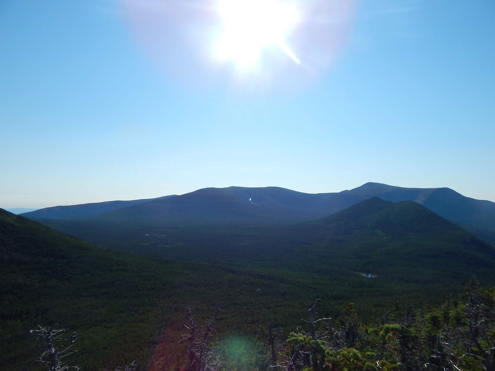
After spending time up there, enjoying the views, we descended Mt.Coe and continued north. We came to the spur trail that ascends South Brother, our final peak. The short trail leads quickly to the open and scenic summit, which is covered in scrub and rocks. Views can be had in every direction.
 |
| Mt.Coe and Doubletop Mountain from South Brother. |
The summit is great! A plethora of mountains could be seen. We could see the entirety of Katahdin, The Klondike, Barren Mountain, Mt.Coe, Doubletop Mountain, North Brother, The Traveler, and a ton of other distant mountains. We could also see Old Jay Eye Rocks.
 |
| Katahdin from South Brother. |
We spent a lot of time up there, but we soon decided to head back down. We came across the junction with the Marston Trail soon after. On the way down,we descended a ridge, with minor views over to Old Jay Eye Rocks and Teardrop Pond. The trail also passed by the pond once it dropped from the ridge.
 |
| Teardrop Pond and Mt.Coe from the Marston Trail. |
Once we passed by the pond, we found ourselves at the junction we began our day at. We got back down and went swimming in Ledge Falls, which is a very nice, yet crowded, swimming spot with natural water slides.
GALLERY
 |
| Old Jay Eye Rocks from the Mt.Coe Trail. |
 |
| The first view from Mt.OJI. |
 |
| Old Jay Eye Rocks and the distant peaks, with Nesowadnehunk Lake in the middle. |
 |
| Doubletop Mountain from the rocks. |
 |
| Mt.Coe and the wet slide, with Mt.OJI's summit to the right. Katahdin is in the middle. |
 |
| The 100 Mile Wilderness from the rocks. |
 |
| Looking up the slide. |
 |
| Looking towards Millinocket and Baxter Peak from Mt.Coe. |
 |
| Knifes Edge, Pamola Peak, Chimney Peak, and Baxter Peak from Mt.Coe. |
 |
| North Brother from South Brother. |
 |
| North Brother and Northwest Basin from South Brother. Mt.Chase is in the center. |
 |
| Looking northwest from South Brother. |
 |
| Teardrop Pond, with the ridge in the background. |
It's good to knock off two more 100 Highest, and all of them in Baxter State Park. The last time I was in the park to bag a peak was when I summited Hamlin Peak to complete the New England 67. Now that I've done South Brother and Mt.Coe, I only have one more 100 Highest in Maine with a trail. All three of these peaks can be found on my 42 With A View list, which is a work in progress.


No comments:
Post a Comment