Showing posts with label Views of Maine. Show all posts

A Hike Up South Turner

When you hear of Roaring Brook Campground, you likely think of the multiple trails that ascend Katahdin, such as Helon-Taylor, Dudley, Cathedral, and maybe even Saddle Trail. When it comes to the campground, Katahdin isn't the only accessible peak. South Turner Mountain is an often forgotten peak that can be reached from Sandy Stream Pond. It's a steep climb, but the view is well worth the effort.


The primary view of Pamola Peak.

To get to the trail, you must first walk along Sandy Stream Pond, which has a few side trails leading to views of Pamola Peak and South Turner. The sky was a bit cloudy this early in the morning, but, later in the day, they did clear up. It's also worth mentioning that South Turner is named after Charles Turner Jr, who, along with Zackery Adley, were the first white men to climb Katahdin in 1804.


South Turner from Sandy Stream Pond.

After reaching the trail to South Turner and following it, the trail climbs over a few boulders and begans a steep ascent over hundreds of stairs. The maintenance and work that went into this trail is impressive. Once it passed a side trail to a spring, the trail began to flatten, and the trees were getting thinner. Then, the trail emerged onto the slide.


Looking up the slide.

The view is incredible, but there is still a climb ahead. The slide is covered in gravel, but it's not as bad as the slide on Mt.Coe or the ones on the Tripyramids. It's not that difficult, and the steepest section includes a small rocky spot immediately before the summit. Once up there, the view is even better, even though Katahdin was cloudy.


Looking back down the slide, with Katahdin and Pamola Peak in the clouds.

From here, North Turner, Deasey Mountain, Mt.Chase, Lunksoos Mountain, Pamola Peak, Katahdin, South Branch Mountain, and Mt.Fort can be seen. There is also a good view of Sandy Stream Pond, the Whidden Ponds, Katahdin Lake, Millinocket Lake, and the Togue Ponds. Only one other person came up to the summit, on Labor Day!


GALLERY

A bridge on Sandy Stream Pond.
Katahdin from the bottom of the slide.
Katahdin Lake from the summit.
Looking into Baxter State Park from the summit.
The summit area.
North Turner (right) also has an exposed summit.
Barnard Mountain and Deasey Mountain can be seen in the background.
One last picture from the slide. Mullen Mountain is popping up over the ridge.

Overall, South Turner is definitely worth the trek up. Sandy Stream Pond is quite scenic and peaceful. I would also like to mention, that it is my one year anniversary after completing the New England 67. I finished last year on Hamlin Peak when I was 14 years old. Baxter State Park is an important place for me, and there's still much more to do (like Black Cat Mtn)!

Big Moose Mountain, on Moosehead Lake

This mountain marks the first time I've been to Moosehead Lake, and the first time I've climbed a mountain north of Route 201, outside of Baxter State Park of course. We were in the area on our drive up to Millinocket, so I figured it would be a good hike. I would also like to mention that this peak is on my Views of Maine list, which now has a website (here).


One of the several vistas from the summit.

Our approach included the Big Moose Trail, the only one that ascends the mountain. Most of it utilized the old fire tower road, with a few sets of stairs and brook crossings. Bridges cross all the brooks, and the trail passes by the abandoned fire wardens cabin.

The cabin is a little over halfway up the mountain.

Once on the ridge, a side trail leads to a large rock outcropping, with great views of Greenville and the summit of Big Moose Mountain. Another rock has minor views over to Coburn Mountain, Granny Cap, and Heald Mountain.

The first lookout, looking toward Little Moose and the 100 Mile Wilderness.

The trail continues moderately up the summit ridge, until it reaches the bald summit. A radio repeater is on the summit, along with old footings, and views towards the 100 Mile Wilderness and Coburn Mountain. Peaks that can be seen include Baker Mountain, Whitecap Mountain, Elephant Mountain, Borestone Mountain and the Barren-Chairback Range. On a clearer day, Katahdin and Mt.OJI can be seen.

Looking toward Moosehead Lake, Baker, White Cap, Elephant, and more.

The views don't stop there! After talking to a nice couple on the summit, we continued down the trail to the next antennae. After passing the building, the trail winds into a large ledge with a helipad, which offers an even better view of the 100 Mile Wilderness.

The same view, but from the helipad ledge.

We stopped there for a bit, then continued a tiny bit farther to the final ledge, which overlooks Mirror Pond and Mountain View Pond. Almost all of Moosehead Lake can be seen from this ledge, as well as Big Spencer, Little Spencer, Boundary Bald Mountain, and the enormous cliff on Mt.Kineo. Eagle Rock can also be seen.

GALLERY
Looking up at the summit from the first view.
The view over to Coburn Mountain.
The summit of Big Moose Mountain.
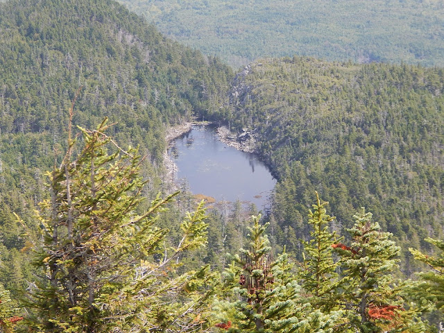
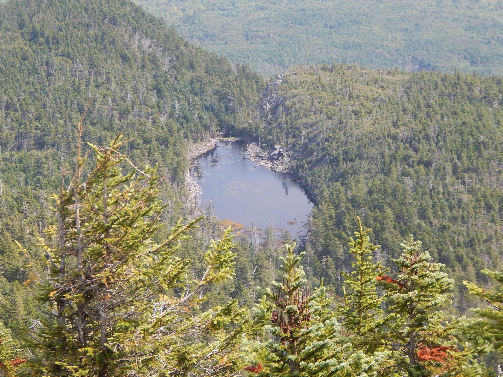
The view down to Mirror Pond.
The Spencers and Lobster Mountain across Moosehead Lake.
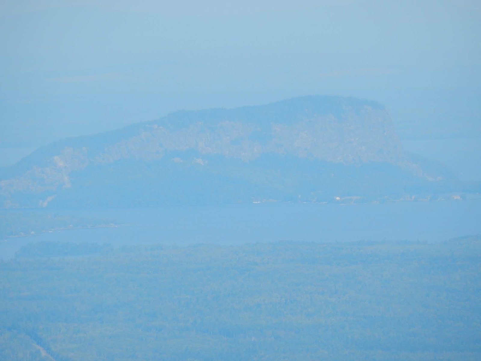
Mt.Kineo through the haze.

The mountain is gorgeous, and it sits in quite a unique area. I'll definitely be returning to the Moosehead Lake area to do The Spencers, Eagle Rock, and maybe Mt.Kineo. Hopefully, Greenville is far less crowded on a normal day. Remember to check out my new website on the Views of Maine, for a more in depth description of this peak and more.

Caribou Mountain, In Evans Notch

Before Caribou Mountain, the closest I've ever gotten to the White Mountains of Maine and Evans Notch was The Baldfaces and Shelburne Moriah, which were both amazing hikes. I don't see many blogs on Caribou Mountain, a peak that sits northeast of Evans Notch, and one of the major peaks of the Caribou-Speckled Wilderness. The mountain, along with Kees Falls, are sights that deserve some respect.


Looking south from Caribou Mountain.

Caribou Mountain may be short, at 2,850 feet, but it's views and scenery are far better than many 4,000 footers in New England. The mountain can be done in a loop, and I would recommend going up Mud Brook Trail and down Caribou Trail. Doing this, we got to experience more views. The first views can be found at a series of ledges looking southeast.


The first of many views.

The trail emerges onto lower ledges that look up to the summit. It then winds up to the summit, through scattered ledges. The best spot on the south peak can be found by going over the summit and down through a meadow to a large square ledge. From here, Albany Mountain, Red Rock Mountain, Pleasant Mountain, Speckled Mountain, The Baldfaces, The Royces, and the Carter-Moriah Range can be seen when looking south.


Looking directly west, towards the Carter-Moriah Range and The Royces.

When looking east, Mt.Abram, Mt.Zircon, Spruce Mountain, Buck and Lapham Ledge, and Speckled Mountain (in Peru) can be seen. The Presidentials can be seen to the west as well, but on this day, only Mt.Madison was visible, with some of Mt.Adams and Boott Spur.


Looking northeast from the south summit, towards Mt.Zircon and Spruce Mountain.

Continuing past the south summit, the trail drops and rides atop a very large, flat ledge with views to Mt.Success and North Bald Cap. The north summit had amazing views, in nearly every direction. This summit also includes a large ledge, but there was a few more people than the other peak, as it's common for people to only hike to this summit.


Looking towards the south summit and the Carter-Moriah Range.

The Mahoosuc Range is visible, with views of Mt.Hayes, Cascade Mountain, Bald Cap, North Bald Cap, Mt.Success, Mt.Ingalls, Mt.Carlo, Goose Eye Mountain, Fulling Mill Mountain, Mahoosuc Arm, Old Speck, Baldpate Mountain, and Elephant Mountain. The same peaks to the south can be seen.


The Mahoosuc Range, from North Bald Cap to distant Elephant Mountain.

Directly west, Mt.Waumbek, Black Crescent Mountain, The Weeks, Terrace Mountain, Mt.Cabot, The Bulge, and The Horn can be seen, to name a few. Limited views to the northwest can be found on both peaks, and Saddleback Wind Mountain and Mt.Blue are the only major peaks that can be seen that way.


Looking toward Gorham and the Pilot-Pliny Range in the distance.

We continued down the Mud Brook Trail, past Caribou Springs (which did have water) and to the junction. The Caribou Trail is easy, and water is plentiful. There are several small cascades, but the biggest one is Kees Falls. The trail passes just above the falls, and a steep herd path leads down to the bottom. The rest of the trail was gentle.


GALLERY
Mt.Abram and others from the first few ledges.
Bella posing, with Red Rock and Butters Mountains in the background.
Bella on a ledge. Why not?
Now that I look back, there are a lot of photos of her. This one has Albany Mountain in the background.
Speckled Mountain, Kearsarge North, Eastman Mountain, The Baldfaces, The Royces, and more.
A path to Speckled Mountain?
The north summit, and other peaks of Maine.
The Mahoosucs from the completely open col.
Mt.Moriah, Middle Moriah, Shelburne Moriah, Mt.Waumbek, The Weeks, and more can all be seen.
Looking south from the north summit. This summit had the benchmark.
A closer look at the Mahoosuc Range and Bear and Elephant Mountains.
The big attraction, Kees Falls! Definitely deep enough to swim.
Another unnamed waterfall. I'll nickname it "Mossy Shelf Falls".

Caribou Mountain is a great peak, with amazing views of many notable peaks. This peak is on my 42 With A View list, which has been renamed to Views Of Maine for now, as a few more peaks where added to the list. I will soon have a new page out for the list, that is fully up to date. So far, Caribou Mountain is the best mountain on the list in the White Mountains.

The Traveler and Little Knife's Edge

The Traveler sits high in the northeast corner of Baxter State Park, and it is one of the best mountains I've ever climbed. The mountain is like a small Katahdin, as it has several peaks, and an extensive alpine area. The mountain is also home to Peak of the Ridges, which is also known as Center Ridge. On this peak, sits Little Knife's Edge.


Summit of The Traveler, and Little Knife's Edge to the left.

We stayed a night at South Branch Pond Campground, and it's definitely one of the better campgrounds in the whole park. We stayed right on the shore of Lower South Branch Pond, and from here, there was a good view of the slope of South Branch Mountain and the ledges of North Traveler and Peak of the Ridges.


The Traveler from Lower South Branch Pond.

At the trailhead, they recommend going up the Center Ridge Trail first, so we did. We began the hike by walking along the shore of Lower South Branch Pond. The South Branch of Trout Brook flows from these ponds, and then drains into Grand Lake Matagamon, which then becomes the East Branch of the Penobscot River. You can rent canoes for the ponds, and the trail comes out to a nice shore area for boats.


Lower South Branch Pond from the shore.

The trail started to go up the mountain with limited views to South Branch Mountain. We hooked onto the Center Ridge Trail, and it became somewhat steep and rocky. All the rock on the mountain looks like traprock, much like Mt.Tom in Massachusetts. The Traveler may actually be the largest volcanic mountain on the east coast. The trail came out to a talus field, with good views towards the ponds and to Katahdin.


South Branch Mountain and Black Cat Mountain from the first viewpoint.

The trail goes in and out of exposed rocky spines and talus slopes. With the morning sky illuminating all the distant peaks, and the silence, it made for an amazing experience. From here, we could see Katahdin and Knife's Edge, the South Branch Ponds, South Branch Mountain, and the distant northern peaks of Maine.


Looking south, with Peak of the Ridges to the left, and Katahdin in the distance.

We soon entered the open alpine meadows just below the summit. As the trail climbed over more and more rocks and ledges, we realized how many false peaks there really were. The summit was in sight, and we made the last climb to the summit of Peak of the Ridges.


Peak of the Ridges, and Katahdin.

From here, there was a very good view of the peaks of Baxter State Park, such as Katahdin, Knife's Edge, Hamlin Peak, North Brother, Mt.Fort, Doubletop Mountain, South Branch Mountain, The Pogys, and the rest of The Traveler. Mt.Mooseleuk and Round Mountain could also be seen to the far north.


North Turner, Katahdin, and North Brother from Peak of the Ridges.

Looking towards The Traveler, we could see our next destination, Little Knife's Edge. Much like Knife's Edge on Katahdin, this is a thin spine of sharp rock that stretches down the ridge towards The Traveler. This one isn't as high up or as thin as the one on Katahdin. The entire way on the edge, there is a good view to North Traveler and Katahdin.


Little Knife's Edge, with North Brother and Mt.Fort in the background.

There are several sharp knobs to Little Knife's Edge, and the trail doesn't always follow the top of the ridge, and it usually follows just above the cliff, looking south. The trail then dropped down into the col, and then climbed up to open, rocky slopes of The Traveler, with views back to Little Knife's Edge and Katahdin.


Little Knife's Edge from the slope of The Traveler.

We found ourselves on the completely bare summit of The Traveler, which is 3,540 feet tall. From here there was an amazing view, in every direction. We could see North Traveler, Little Knife's Edge, North Brother, Mt.Fort, The Klondike, Katahdin, and North Turner.


Looking at North Traveler and Traveler Ridge.

Unlike Peak of the Ridges, no mountain was blocking the views to the east, so we could see Mt.Chase, Sugarloaf Mountain, Deasey Mountain, Lunksoos Mountain, Grand Lake Matagamon, and the Fowler Ponds area, to the north. There was also a clearer view of Knife's Edge and Russell Pond.


The peaks of southern Baxter State Park, including Katahdin.

After enjoying lunch, we headed down the summit, and our next destination was the peak between The Traveler and North Traveler, called Traveler Ridge. The trail brought us down the east slope of The Traveler, and the entire thing was bald and open, with views over to Mt.Chase. There were so many meadows and ledges, and it made the hike so beautiful.


Mt.Chase and Sugarloaf Mountain from The Traveler.

We were brought down to the wooded col, then back up to the bald summit of Traveler Ridge. From the ridge, we could see Mt.Chase, North Traveler, Bald Mountain, Billfish Mountain, Trout Brook Mountain, and Horse Mountain. South Branch Mountain and Peak of the Ridges came back into view.


Looking up Traveler Ridge after emerging from the col.

The trail once again dropped into the wooded col, and we began our final ascent to North Traveler. This peak was much different compared to the other peaks, as the summit area was covered with alpine vegetation and a ton of talus. The entire summit was doused with small pieces of rocks, and views could be had looking east, south, and to the west.


The Traveler and Peak of the Ridges from North Traveler.

From the summit, the trail works it's way down meadows and over ledges, with views over the South Branch Ponds. Most people only hike to these ledges for views, but they don't know what's waiting on the rest of the loop.


GALLERY
Lower South Branch Pond from Center Ridge.
North Traveler from Center Ridge.
The summit of Peak of the Ridges.
Looking over Little Knife's Edge.
A closeup of Katahdin from Little Knife's Edge.
A knob of Little Knife's Edge.
Looking back to Peak of the Ridges.
Little Knife's Edge
On Little Knife's Edge.
From inside the col of Peak of the Ridges and The Traveler.
The bald summit of The Traveler, with Deasey Mountain poking out in the distance.
The summit, with North Traveler in the background.
Deasey Mountain and Lunksoos Mountain from The Traveler.
Sugarloaf Mountain, and taller Mt.Chase.
The Traveler from Traveler Ridge.
The summit of Traveler Ridge.
Bald Mountain and Billfish Mountain, with Trout Brook Mountain in the back.
The barren summit of North Traveler.
Looking back up North Traveler.
The slopes of North Traveler, with the hills and ponds of northern Maine in the back.
A lower ledge and a cairn on North Traveler.
Another low ledge, looking back at The Traveler.
Katahdin and Upper South Branch Pond from the ridge.

I think The Traveler is one of the best mountains in New England, and it's definitely the second best in Baxter State Park behind Katahdin. If your wondering about how The Traveler got it's name, it was named by loggers who traveled the East Branch of the Penobscot River, and witnessed the mountain appearing to move. This mountain is also on my 42 With A View list, which is atop my blog.